- All Categories (24)
- Data (3)
- News (3)
- Missions (2)
- Documents (16)
Data - Sample Data (Open)
GEOSAT-1 sample data
Download free GEOSAT-1 sample datasets to preview products available for this mission.
News - General News
GEOSAT collaborates with ESA to boost understanding of the planet
Researchers around the world are exploring innovative scientific applications of high quality satellite data from commercial provider GEOSAT, thanks to a successful collaboration between the firm and ESA’s Third Party Missions (TPM) programme.
News - Success Stories
New cross-calibration readies PROBA-1 data for climate research
While PROBA-1 has already exceeded expectations by suppling over 21 years of Earth observation hyperspectral data, recent cross-calibration activities are aiming to ensure the data will robustly serve long time-series research, even when the satellite ends operations.
News - Infographics

PROBA-1 - From technology demonstration to long-term Earth observation
Learn about ESA's PROBA-1 (Project for On-Board Autonomy) mission in our new infographic.
Data - Data Description
TropForest - ALOS, GEOSAT-1 & KOMPSAT-2 optical coverages over tropical forests
The objective of the ESA TropForest project was to create a harmonised geo-database of ready-to-use satellite imagery to support 2010 global forest assessment performed by the Joint Research Centre (JRC) of the European Commission and by the Food and Agriculture Organization (FAO). Assessments for year 2010 were essential for building realistic deforestation benchmark rates at global to regional levels. To reach this objective, the project aimed to create a harmonised ortho-rectified/pre-processed imagery geo-database based on satellite data acquisitions (ALOS AVNIR-2, GEOSAT-1 SLIM6, KOMPSAT-2 MSC) performed during year 2009 and 2010, for the Tropical Latin America (excluding Mexico) and for the Tropical South and Southeast Asia (excluding China), resulting in 1971 sites located at 1° x 1° geographical lat/long intersections. The project finally delivered 1866 sites (94.7% of target) due to cloud coverages too high for missing sites. Spatial coverage: Check the spatial coverage of the collection on a map available on the Third Party Missions Dissemination Service.
Data - Fast Registration with approval (Restrained)
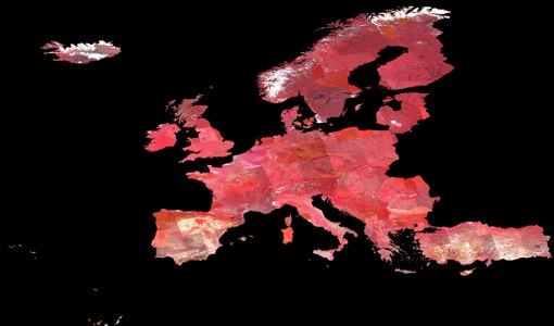
Image 2007 European coverage
The Image 2007 collection is composed by products acquired by Disaster Monitoring Constellation 1st generation (DMC-1) satellites over European countries (plus Turkey) in 2007. The data provided in this collection are 32m multispectral images captured by the DMC SLIM-6 imager sensor, with two processing levels: L1R Band registered product derived from the L0R product L1T Orthorectified product derived from the L1R product using manually collected GCPs from Landsat ETM+ data and SRTM DEM V31 data Data disseminated come from the following satellites belonging to DMC-1 constellation: UK-DMC-1 Bejing-1 NigeriaSat-1 Spatial coverage: Check the spatial coverage of the collection on a map available on the Third Party Missions Dissemination Service.
Mission - Third Party Missions

PROBA-1
PROBA-1 is a technology demonstration satellite that later became an operational Earth observation mission.
Mission - Heritage Missions
DMC First Generation
The Disaster Monitoring Constellation (DMC) is a constellation of microsatellites formerly coordinated by DMCii to provide frequent observations of the Earth for monitoring natural disasters.
Document - Proceedings

Hyperspectral Workshop 2010
Proceedings of the Hyperspectral Workshop 2010 held on 17-18 March 2010 in ESA-ESRIN, Frascati, Italy. This workshop was organised by the European Space Agency (ESA), the German Aerospace Center (DLR)/the German Research Center for Geosciences (GFZ) and the Italian Space Agency (ASI).
Document - General Reference

Overview of an Intelligent Sensorweb for Integrated Earth Sensing Project
Document - Product Readme Note

Retrieving-Canopy-Structure-from-Hyperspectral-Multi-Angular-Satellite-Data.pdf
This article was presented at the 5th EARSeL SIG IS workshop Imaging Spectroscopy : Innovation in Environmental Research held on 23-25 April 2007 in Bruges, Belgium, ed. By I. Reusen and J. Cools. EARSEL, 2007. 7 p.
Document - User Guide

Third Party Missions, Cat-1 Data Availability
This brochure gives a quick overview on the availability of the Third Party Missions IRS-P3, JERS-1, NIMBUS, Proba, Landsat, KOMPSAT-1, SCISAT-1, Terra/Aqua, NOAA, QSCAT, OrbView, SPOT-1,-2,-3,-4, ALOS.
Document - General Reference
Earth-from-Space-Russia-and-Ukraine.pdf
This brochure is a collection of KOMPSAT EOC; ERS-2 SAR; Envisat ASAR, MERIS and Proba CHRIS, HRC mosaics.
Document - General Reference
Earth-from-Space-South-America.pdf
This brochure is a collection of Envisat MERIS, Envisat ASAR and PROBA CHRIS mosaics of South America. The attached CD-rom contains the same images in electronic version.
Document - Proceedings
3rd-CHRIS-Proba-Workshop.pdf
Proceedings of the 3rd CHRIS/Proba Workshop, held from 21-23 March 2005 at ESA-ESRIN in Frascati, Italy.
Document - General Reference
Correction-of-systematic-spatial-noise-in-push-broom-hyperspectral-sensors.pdf
We present a new technique that faces the problem of removing the spatiallycoherent noise known as vertical striping, usually found in images acquired by push-broom sensors.
Document - General Reference
BIOMASS-Report-for-Mission-Selection-An-Earth-Explorer-to-observe-forest-biomass.pdf
The objective of the BIOMASS Mission is to determine the global distribution of forest biomass by reducing the uncertainty in the calculation of carbon stock and fluxes associated with the terrestrial biosphere.
Document - General Reference
Autonomy-in-action-Ten-years-of-Proba-1.pdf
This is an article extracted from the ESA Bulletin Nr.148.
Document - General Reference
Big-year-for-small-satellite-ESAs-second-in-orbit-technology-demonstration-mission-Proba-2.pdf
This is an article extracted from the ESA Bulletin Nr.144.