- All Categories (1317)
- Data (7)
- News (14)
- Missions (1)
- Events (8)
- Tools (2)
- Activities (2)
- Campaigns (2)
- Documents (1281)
Document - Product Cal/Val Plan/Report
Validation Report following the 3rd MERIS data reprocessing
This document prepared by the MERIS Quality Working Group (QWG) corresponds to the Validation Report following the 3rd MERIS data reprocessing. It aims at qualifying and quantifying the accuracy of the MERIS L2 products generated with the version 8.0 of MERIS Ground Segment prototype (MEGS), delivered to the whole community through the ODESA software (http://earth.eo.esa.int/odesa/). It is equivalent to version 6.0 of the Instrument Processing Facilities (IPF) at ESRIN.
News - Thematic area articles
Transforming space data into climate action
ESA’s Earth observation activities are playing a key role in the revitalised global drive to combat climate change.
News - Thematic area articles
Tracking the world’s forests from space
As human activities continue to threaten the planet’s forests, data delivered by satellites are boosting global efforts to conserve these crucial natural resources.
Document - Technical Note
The RA-2 On-Board Tracker and its Autonomous Adaptable Resolution
This technical note describes the complete functionality of the RA-2 on-board Tracker and how its Resolution Selection Logic (RSL) works. It gives a detailed analysis of the algorithm and its configuration parameters.
Document - General Reference
The Envisat Radar Altimeter System (RA-2)
This article was published in the ESA Bulletin Nr. 98 and givesdetails on RA-2 and on its role in the ENVISAT mission.
Document - General Reference
Taking-the-Measure-of-Earth-Fifteen-Years-of-Progress-in-Radar-Altimetry.pdf
This article is extracted from ESA Bulletin Nr. 128.
Campaign
SPARC
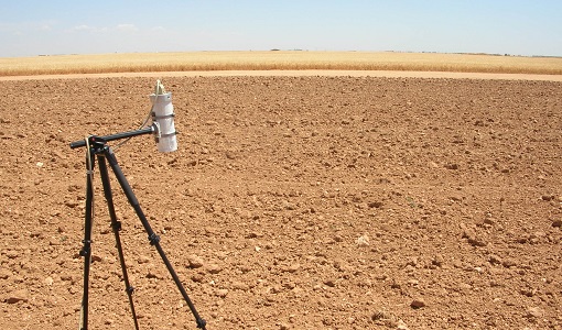
ESA's SPectra bARrax Campaign (SPARC) activity was part of the preparatory study for a proposed ESA Earth Explorer mission called SPECTRA. The objective was to collect a CHRIS/PROBA reference dataset for SPECTRA-related studies.
Data - Campaigns (Open)
SPARC
ESA's SPectra bARrax Campaign (SPARC) activity was part of the preparatory study for a proposed ESA Earth Explorer mission called SPECTRA. The objective was to collect a CHRIS/PROBA reference dataset for SPECTRA-related studies.
News - Thematic area articles
Space data support Earth’s ecosystems
ESA’s Earth observation (EO) missions are making a critical contribution to monitoring transformations in our planet’s ecosystems, helping track changes in the vegetation, soil, and ocean that affect these systems.
Activity - Quality
SEOM CAWA
The Advanced Clouds, Aerosols and WAter vapour products for Sentinel-3/OLCI project aims to develop and improve the advanced atmospheric retrieval algorithms developed for MERIS and OLCI instruments.
Campaign
SEN3EXP
The main objective of Sen3Exp (Sentinel-3 Experimental Campaign) was to provide a comprehensive dataset that covers all Sentinel-3 OLCI and SLSTR bands that is to be used for the algorithm prototype and ground segment processor development.
Data - Campaigns (Open)
SEN3EXP
The main objective of Sen3Exp (Sentinel-3 Experimental Campaign) was to provide a comprehensive dataset that covers all Sentinel-3 OLCI and SLSTR bands that is to be used for the algorithm prototype and ground segment processor development.
Document - Conference Presentation - Poster
Remaining-East-West-bias-explained.pdf
This presentation shows the results obtained from a scientific assessment on the use of GDR-D improved orbit standard and of the consequent improvement in the Sea Surface Height and Sea Level Anomaly Data of altimeter GDR data (A. Ollivier, OSTST 2011).
Document - Publication - Paper
RA-2-S-Band-anomaly-detection-and-waveforms-reconstruction.pdf
This paper describes the algorithm developed for the L1b processor that allows to set a flag identifying the data affected by the S-Band anomaly and reconstruct normal echo waveforms.
Document - Product Cal/Val Plan/Report
RA-2-In-Flight-Instrument-Calibration-and-Level-1b-Verification-Plan.pdf
This document describes the plan for the RA-2 In-flight Instrument Calibration and Level lb Verification procedures.
Document - Product Cal/Val Plan/Report
Passive Calibration of the Backscattering Coefficient of the Envisat RA-2
Passive Calibration of Backscattering Coefficient of Envisat RA-2: final report


