- All Categories (26)
- Data (7)
- News (14)
- Missions (1)
- Events (3)
- Campaigns (1)
News - Data Release news

2015 CryoSat Ice Baseline D reprocessed data now available
The reprocessed CryoSat Ice Baseline D data for all of 2015 has now been published on the Science Server.
News - Data Release news

2016 CryoSat Ice Baseline D reprocessed data now available
The reprocessed CryoSat Ice Baseline D data for 2016 has now been published on the Science Server.
Event - Workshop

3rd APVE: Arctic and high-latitude product Validation and Evolution Workshop
3rd APVE: Arctic and high-latitude product Validation and Evolution Workshop
Data - Announcement of Opportunity (Restrained)

Announcement of Opportunity for NoR
ESA invites submissions for the Network of Resources (NoR) call, which aims to support research, development and pre-commercial users to innovate their working practices, moving from a data download paradigm towards a 'bring the user to the data' paradigm.
News - Data Release news

Back-processed data from 2010 now available for CryoTEMPO-EOLIS Baseline 2
Following on from the release of new Baseline 2 point and gridded products for CryoTEMPO-EOLIS, the data for several regions have now been back-processed to 2010 and are available from the CryoSat Science Server.
Event - Conference

CryoSat 10th Anniversary Science Conference
The conference focussed on the latest scientific results from the mission, it was also a celebration of the remarkable contribution CryoSat has made to our understanding of the cryosphere.
News - Data Release news

CryoSat Ice Baseline-E Reprocessed Data - Update
Previously, quality checks of the Ice Baseline-E reprocessing products observed a discrepancy in the metadata of products with incremented version numbers (E002, E003).
News - Data Release news

CryoSat Ice Baseline-E Reprocessed Data - Update
Quality checks of the Ice Baseline-E reprocessing products have observed a discrepancy in the metadata of products with incremented version numbers.
News - Success Stories
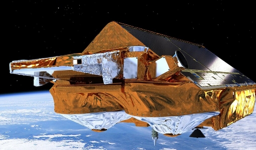
CryoSat still cool at 10
Today marks 10 years since a Dnepr rocket blasted off from an underground silo in the remote desert steppe of Kazakhstan
News - Operational News

Delay in the availability of CryoSat Products
A technical issue occurred at the CryoSat Payload Data Ground Segment (PDGS).
Data - EO Sign In Authentication (Open)
Envisat MERIS Full Resolution - Level 1 [MER_FRS_1P/ME_1_FRG]
The MERIS Level 1 Full Resolution (FR) product contains the Top of Atmosphere (TOA) upwelling spectral radiance measurements. The in-band reference irradiances for the 15 MERIS bands are computed by averaging the in-band solar irradiance of each pixel. The in-band solar irradiance of each pixel is computed by integrating the reference solar spectrum with the band-pass of each pixel. The MERIS FR Level 1 product has Sentinel 3-like format starting from the 4th reprocessing data released to users in July 2020. Each measurement and annotation data file is in NetCDF 4. The Level 1 product is composed of 22 data files: 15 files containing radiances at each band (one band per file), accompanied by the associated error estimates, and 7 annotation data files. The 15 sun spectral flux values provided in the instrument data file of the Level 1 products are the in-band reference irradiances adjusted for the Earth-sun distance at the time of measurement. The band-pass of each pixel is derived from on-ground and in-flight characterisation via an instrument model. The values "Band wavelength" and "Bandwidth" provided in the Manifest file of the Level 1b products are the averaged band-pass of each pixel over the instrument field of view. Auxiliary data are also listed in the Manifest file associated to each product. The Level 1 FR product covers the complete instrument swath. The product duration is not fixed and it can span up to the time interval of the input Level 0 (for a maximum of 20 minutes). Thus the estimated size of the Level 1 FR is dependent on the start/stop time of the acquired segment. During the Envisat mission, acquisition of MERIS Full Resolution data was subject to dedicated planning based on on-demand ordering and coverage of specific areas according to operational recommendations and considerations. See yearly and global density maps to get a better overview of the MERIS FR coverage.
Data - EO Sign In Authentication (Open)
Envisat MERIS Full Resolution - Level 2 [MER_FRS_2P/ME_2_FRG]
MERIS FR Level 2 is a Full-Resolution Geophysical product for Ocean, Land and Atmosphere. Each MERIS Level 2 geophysical product is derived from a MERIS Level 1 product and auxiliary parameter files specific to the MERIS Level 2 processing. The MERIS FR Level 2 product has Sentinel 3-like format starting from the 4th reprocessing data released to users in July 2020. The data package is composed of NetCDF 4 files containing instrumental and scientific measurements, and a Manifest file which contains metadata information related to the description of the product. A Level 2 product is composed of 64 measurement files containing: 13 files containing Water-leaving reflectance, 13 files containing Land surface reflectance and 13 files containing the TOA reflectance (for all bands except those dedicated to measurement of atmospheric gas - M11 and M15), and several files containing additional measurements on Ocean, Land and Atmospheric parameters and annotation. The Auxiliary data used are listed in the Manifest file associated to each product. The Level 2 FR product covers the complete instrument swath. The product duration is not fixed and it can span up to the time interval of the input Level 0/Level 1. Thus the estimated size of the Level 2 FR is dependent on the start/stop time of the acquired segment. During the Envisat mission, acquisition of MERIS Full Resolution data was subject to dedicated planning based on on-demand ordering and coverage of specific areas according to operational recommendations and considerations. See yearly and global density maps to get a better overview of the MERIS FR coverage.
Data - Fast Registration with approval (Restrained)
ERS-1/2 ATSR Averaged Surface Temperature [AT1/AT2_AR__2P]
The Averaged Surface Temperature Product (AST) contains averaged geophysical data at two different resolutions, and with respect to two different averaging schemes: measurement data sets at resolutions of 0.5 by 0.5 degrees and 10 by 10 arcmin with respect to a latitude/longitude grid; other data sets contain data averaged over equal area cells of 50 by 50 km and 17 by 17 km aligned with the satellite ground track. Both top-of-atmosphere and surface data sets are provided. The surface temperature data sets provide, for sea cells, nadir and dual view sea surface temperatures, and for land cells, land surface temperature (currently 11 micron BT) and NDVI. Cloud data is also included. No ADS are included in the AST product; auxiliary data is contained within the MDS. The data sets of the AST product are arranged by surface type and resolution. The 3rd reprocessing of ATSR data was performed in 2013; the processing updates that have been put in place and the scientific improvements are outlined in full in the User Summary Note for the Third ERS ATSR Reprocessing.
Data - Fast Registration with approval (Restrained)
ERS-1/2 ATSR Gridded Brightness Temperature/Reflectance [AT1/AT2_TOA_1P]
The Gridded Brightness Temperature/Reflectance (GBTR) product contains top of atmosphere (TOA) brightness temperature (BT) values for the infra-red channels and reflectance values for the visible channels. Values for each channel and for the nadir and forward views occupy separate measurement data sets. Additional MDS contain cloud and land/sea flags and confidence flags for each image pixel. The 3rd reprocessing of ATSR data was performed in 2013; the processing updates that have been put in place and the scientific improvements are outlined in full in the User Summary Note for the Third ERS ATSR Reprocessing.
Data - Fast Registration with approval (Restrained)
ERS-1/2 ATSR Gridded Surface Temperature [AT1/AT2_NR__2P]
The Gridded Surface Temperature (GST) Product is the Level 2 full resolution geophysical product. The product contains gridded sea-surface temperature images using both nadir and dual view retrieval algorithms. The product includes pixel latitude/longitude positions, X/Y offset and the results of the cloud-clearing/land-flagging. It contains a single measurement data set the content of which is switchable, that is to say, the content of each pixel field will depend on the surface type. Specifically, the contents of the data fields will depend on the setting of the forward and nadir cloud flags and the land flag. The 3rd reprocessing of ATSR data was performed in 2013; the processing updates that have been put in place and the scientific improvements are outlined in full in the User Summary Note for the Third ERS ATSR Reprocessing.
News - Success Stories

Gravity Field Models from Swarm data
In addition to its geomagnetic objectives, GPS receivers onboard Swarm can and have already been exploited to measure temporal variations in Earth's global gravity field.
News - Infographics

Key facts about SMOS Level-1 and Level-2 science data
Learn about data products from the SMOS mission in our latest infographic.
News - Data Release news
Near-Real Time Full Bit Rate (FBR) CryoSat products now available
We’re pleased to announce that as of 15 March 2023, the CryoSat Full Bit Rate (FBR) products are disseminated in Near-Real Time (NRT).
News - Success Stories
New CryoSat data to boost understanding of the oceans
A new CryoSat sea level anomaly product designed to enable ocean science and the development of operational marine applications has been released.
News - Data Release news
New CryoSat Ice Baseline-E 2014 and 2015 reprocessed data – Available now!
The reprocessed CryoSat Ice Baseline-E data for all of 2014 and 2015 has now been published on the Science Server.