- All Categories (42731)
- Data (132)
- News (234)
- Missions (44)
- Events (82)
- Tools (18)
- Activities (15)
- Campaigns (50)
- Documents (42156)
MISSIONS
Explore the European Space Agency's Earth Observation satellite missions. Learn all about ESA's dedicated Earth Explorers or collaborations with other agencies through the Third Party Missions programme.
Mission - Earth Explorers

Swarm
Swarm is dedicated to creating a highly detailed survey of Earth’s geomagnetic field and its temporal evolution as well as the electric field in the atmosphere using a constellation of three identical satellites.
Mission - Earth Explorers

CryoSat
CryoSat determines variations in the thickness of continental ice sheets and marine ice cover. Europe's first ice mission is an advanced radar altimeter specifically designed to monitor the most dynamic sections of Earth's cryosphere.
Mission - Earth Explorers

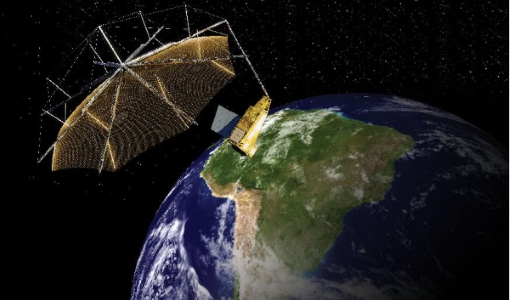
SMOS
The Soil Moisture and Ocean Salinity (SMOS) mission is dedicated to making global observations of soil moisture over land and salinity over oceans.
Mission - Earth Explorers
Biomass
The objective of the Biomass mission is to determine the global distribution of forest biomass.
Mission - Earth Explorers

FLEX
The FLEX mission will provide global maps of vegetation fluorescence, which can be converted into an indicator of photosynthetic activity.
Mission - Earth Watch

PROBA-V
The PROBA-V mission provides multispectral images to study the evolution of the vegetation cover on a daily and global basis.
Mission - Third Party Missions

PROBA-1
PROBA-1 is a technology demonstration satellite that later became an operational Earth observation mission.
Mission - Earth Explorers

GOCE
ESA's Gravity field and Ocean Circulation Explorer (GOCE) mission mapped Earth's geoid very accurately, opening a window into Earth's interior structure as well as the currents circulating within the depths of its oceans.
Mission - Heritage Missions

Envisat
Envisat was ESA's successor to ERS. Envisat carried ten instruments aboard for a wide range of Earth observing fields. The mission was operational from 2002 to 2012.
Mission - Heritage Missions

ERS
The ERS programme was composed of two missions, ERS-1 and ERS-2, which together observed the Earth for 20 years, from 1991 to 2011.
Mission - Heritage Missions
MOS-1/1B
MOS-1 and 1B, Japan’s first marine observation satellites, were designed to monitor ocean currents, sea surface temperature, atmospheric water vapour, ocean chlorophyll levels, precipitation, and land vegetation.
Mission - Third Party Missions
FSSCat
The FSSCat mission was an innovative concept that consisted of two federated 6-Unit Cubesats, called ³Cat-5/A and ³Cat-5/B, which operated in support of the Copernicus Land and Marine Environment services.
Mission - Earth Explorers

Swarm Product Data Handbook
The Swarm Product Data Handbook provides a detailed description of Level 1b and Level 2 products derived from Swarm data.
Mission - Third Party Missions
Pléiades Neo
Pléiades Neo is a very high resolution optical constellation of two identical satellites phased at 180° from each other.
Mission - Copernicus Sentinels

Copernicus Sentinel-3
Copernicus Sentinel-3 is an European Earth Observation satellite mission developed to support Copernicus ocean, land, atmospheric, emergency, security and cryospheric applications.
Mission - Copernicus Sentinels

Copernicus Sentinel-1
The Copernicus Sentinel-1 mission comprises a constellation of two polar-orbiting satellites, operating day and night performing C-band synthetic aperture radar imaging, enabling them to acquire imagery regardless of the weather.
Mission - Third Party Missions

WorldView-4
WorldView-4 was an imaging and environment-monitoring satellite from Maxar of the United States, which offered very high resolution imagery.
Mission - Third Party Missions

WorldView-1
WorldView-1 helped meet the growing commercial demand for multi-spectral geospatial imagery.
Mission - Third Party Missions

WorldView Series
The WorldView constellation are environment-monitoring satellites that have been supplying imagery since 2007.
Mission - Third Party Missions

TerraSAR-X and TanDEM-X
The TerraSAR-X and TanDEM-X satellites feature a unique geometric accuracy that is unmatched by any other spaceborne sensor.