- All Categories (221)
- Data (51)
- News (85)
- Missions (6)
- Events (30)
- Tools (2)
- Activities (8)
- Campaigns (19)
- Documents (20)
News - Events and Proceedings
Featuring the power of Earth observation data at EGU
The European Geosciences Union General Assembly 2024 brings together geoscientists from all over the world, aiming to provide a forum where scientists and early career researchers can present their work and discuss their ideas with experts, in all fields of geoscience.
News - General News

ESA's improved Earth system data records: what is in store for the future?
Fundamental Data Records (FDRs) are instrumental in advancing our understanding of Earth systems and for addressing societal challenges effectively. These long-term records contain uncertainty-quantified, calibrated and geo-located multi-instrument/multi-platform satellite sensor data spanning several decades to support climate-related applications.
News - Operational News
Transition from FTP to FTPS for SMOS, Aeolus and Campaign data dissemination systems
As of 15 April 2024 access to the SMOS, Aeolus and Campaign data will be changed from simple FTP to FTPS.
News - Data Release news
FDR4ALT - ESA unveils new cutting-edge ERS/Envisat Altimeter and Microwave Radiometer Datasets
The European Space Agency (ESA) has developed a comprehensive suite of innovative Earth system data records as part of the Fundamental Data Records for Altimetry project - FDR4ALT.
News - Operational News

Temporary interruption to Envisat AATSR dissemination service
A planned downtime will affect the access to the ftp dissemination server for the Envisat AATSR data during the period 13-15 February 2024.
News - Success Stories
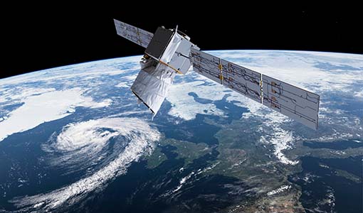
Trailblazing ERS-2 mission enables climate change applications
As ESA’s ERS-2 satellite approaches Earth’s atmosphere for reentry, it’s time to reflect on the mission’s great achievements in powering climate-related applications.
Document - Product Handbook

SAR Tropical Atmospheric Phenomena Handbook
ERS SAR Tropical Atmospheric Phenomena Handbook.
News - General News
Aeolus wind data boosts innovative new global wind comparison tool
A new system for comparing wind data from multiple observing platforms, including ESA’s Aeolus wind satellite, puts global wind data - and the tools needed to analyse them - all in one place.
News - Events and Proceedings
EarthCARE pre-launch science workshop a success
Held between 13 and 17 November 2023, in ESA’s Earth Observation facility in Frascati, Italy, the ESA-JAXA pre-launch EarthCARE science and validation workshop brought together nearly 250 participants, representing a vibrant worldwide scientific community that is eagerly awaiting the mission’s launch.
News - Events and Proceedings
ESA Earth observation event supports quality of New Space data
In the context of a rapidly growing New Space economy, ESA’s traditional position as an Earth Observation (EO) data provider is interchanged with new additional roles, such as customer, partner or enabler, as set out at the VH-RODA workshop.
News - Operational News

Update for the SMOS Near Real Time Sea Surface Wind Speed Processor configuration
An updated configuration of the SMOS Near Real Time Sea Surface Wind Speed Processor was deployed at the IFREMER and ESA operational ground segment on 4th December 2023.
News - Data Release news
MOS-1/1B MESSR and VTIR data products now available
MOS-1/1B MESSR (Multi-spectral Electronic Self-Scanning Radiometer) and VTIR (Visible and Thermal Infrared Radiometer) level 1 data products are now available via the ESA Heritage Missions Dissemination System.
Data - EO Sign In Authentication (Open)
MOS-1/1B ESA Orthorectified Map-oriented Products [MES_GEC_1P]
The ESA Orthorectified Map-oriented (Level 1) Products collection is composed of MOS-1/1B MESSR (Multi-spectral Electronic Self-Scanning Radiometer) data products generated as part of the MOS Bulk Processing Campaign using the MOS Processor v3.02. The products are available in GeoTIFF format and disseminated within EO-SIP packaging. Please refer to the MOS Product Format Specification for further details. The collection consists of data products of the following type: MES_GEC_1P: Geocoded Ellipsoid GCP Corrected Level 1 MOS-1/1B MESSR products which are the default products generated by the MOS MESSR processor in all cases (where possible), with usage of the latest set of Landsat improved GCP (Ground Control Points). These are orthorectified map-oriented products, corresponding to the old MOS-1/1B MES_ORT_1P products with geolocation improvements. MESSR Instrument Characteristics Band Wavelength Range (nm) Spatial Resolution (m) Swath Width (km) 1 (VIS) 510 – 690 50 100 2 (VIS) 610 – 690 50 100 3 (NIR) 720 – 800 50 100 4 (NIR) 800 – 1100 50 100
Data - EO Sign In Authentication (Open)
MOS-1/1B ESA System Corrected Map-oriented Products [MES_GES_1P]
The ESA System Corrected Map-oriented (Level 1) Products collection is composed of MOS-1/1B MESSR (Multi-spectral Electronic Self-Scanning Radiometer) data products generated as part of the MOS Bulk Processing Campaign using the MOS Processor v3.02. The products are available in GeoTIFF format and disseminated within EO-SIP packaging. Please refer to the MOS Product Format Specification for further details. The collection consists of data products of the following type: MES_GES_1P: Geocoded Ellipsoid System Corrected Level 1 MOS-1/1B MESSR products as generated by the MOS MESSR processor where the generation of MES_GEC_1P products is not possible. These replace the old MES_SYC_1P products. MESSR Instrument Characteristics Band Wavelength Range (nm) Spatial Resolution (m) Swath Width (km) 1 (VIS) 510 – 690 50 100 2 (VIS) 610 – 690 50 100 3 (NIR) 720 – 800 50 100 4 (NIR) 800 – 1100 50 100
Data - EO Sign In Authentication (Open)
MOS-1/1B ESA System Corrected VTIR Products [VTI_SYC_1P]
The ESA System Corrected (Level 1) MOS-1/1B VTIR Products collection is composed of MOS-1/1B VTIR (Visible and Thermal Infrared Radiometer) data products generated as part of the MOS Bulk Processing Campaign using the MOS Processor v3.02. The products are available in GeoTIFF format and disseminated within EO-SIP packaging. Please refer to the MOS Product Format Specification for further details. The collection consists of data products of the following type: VTI_SYC_1P: System corrected Level 1 MOS-1/1B VTIR products in EO-SIP format. VTIR Instrument Characteristics Band Wavelength Range (µm) Spatial Resolution (km) Swath Width (km) 1 (VIS) 0.5 – 0.7 0.9 1500 2 (TIR) 6.0 – 7.0 2.7 1500 3 (TIR) 10.5 – 11.5 2.7 1500 4 (TIR) 11.5 – 12.5 2.7 1500
News - General News
Aeolus data and lessons learned: what happens next for ESA’s wind mission?
The Aeolus satellite returned to Earth on 28 July 2023, in an assisted reentry that marked the end of nearly five years in space. For scientists working with Aeolus data, however, the mission lives on.
News - Infographics
Overview of Aeolus Level-2b scientific wind data
Learn more about the Aeolus Level-2b scientific wind product in our latest infographic.
News - Spotlight on EO community
An overview of the EarthCARE mission
In this video, meet Björn Frommknecht, Mission Manager of ESA's upcoming EarthCARE satellite.
News - Spotlight on EO community
Introducing the EarthCARE Mission Manager
In this video, Björn Frommknecht describes his role as Mission Manager of EarthCARE, and what he enjoys most about his involvement with this upcoming Earth Explorer.
News - Success Stories
Rome supersite helps validate atmospheric space data
In the sprawling, urban area of Rome, where atmospheric composition is impacted by complex coastal weather and pollution, ESA supports a powerful observatory spread across several locations.