- All Categories (42479)
- Data (99)
- News (208)
- Missions (30)
- Events (65)
- Tools (16)
- Activities (15)
- Campaigns (34)
- Documents (42012)
ACTIVITIES
Find the activities you need.
Activity - General activities
EO Summer Schools
ESA's series of summer schools, on Monitoring of the Earth System, aims to promote the exploitation of Earth observation (EO) data.
Activity - Projects

Contribution of Swarm data to the prompt detection of Tsunamis and other natural hazards
The main objective of COSTO (Contribution of Swarm data to the prompt detection of Tsunamis and other natural hazards) project is to better characterise, understand and discover coupling processes and interactions.
Activity - Projects
Dragon Cooperation Programme
The Dragon Programme focussed on science and applications development in China using mainly data from the ERS and Envisat missions. The Prgramme was a cooperation between ESA and the National Remote Sensing Centre of China.
Activity - Projects
Dragon 2 Cooperation Programme
The Dragon 2 Programme focussed on the exploitation of ESA, ESA's Third Party Missions and Chinese Earth observation data for science and applications development in land, ocean and atmospheric applications.
Activity - General activities

EO Science for Society
ESA's Earth Observation Science for Society programme aims to promote scientific exploitation of satellite data, forges new scientific discoveries and pioneers new services, stimulating downstream industrial and economic growth.
Activity - Fiducial Reference Measurements
FRM4STS: Fiducial Reference Measurements for validation of Surface Temperatures
FRM4STS is an ESA funded project, to establish and maintain SI traceability of global Fiducial Reference Measurements (FRM) for satellite derived surface temperature product validation.
Activity - Fiducial Reference Measurements
FRM-BOUSSOLE: Buoy for the acquisition of long-term optical time series
The purpose of the BOUSSOLE project is to establish a time series of optical properties in oceanic waters, in support to bio-optics research.
Activity - Fiducial Reference Measurements
FRM4ALT: Fiducial Reference Measurements for Altimetry
The aim of the FRM4ALT Project. precise measurements of the surface topography of the ocean, and of continental waters are made through satellite altimetry missions all over the globe.
Activity - Fiducial Reference Measurements
FRM4SOC: Fiducial Reference Measurements for Satellite Ocean Colour
The FRM4SOC project, with funding from ESA, has been structured to provide support for evaluating and improving the state of the art in ocean colour validation .
Activity - Quality

EDAP
The ESA Earthnet Data Assessment Pilot (EDAP) project will perform assessments for various missions to ensure the delivered data is fit for purpose.
Activity - Quality
SCIRoCCo
The SCIRoCCo project is an interdisciplinary cooperation of scatterometry experts aimed at promoting the continuing exploitation of ESA's unique 20 years' worth of ERS Scatterometer data.
Activity - Quality
SLAP
The SLAP (Systematic Landsat Archive Processing) project covers the MSS, TM and ETM+ products from Landsat missions 1 – 7, and is the first systematic reprocessing of the ESA Landsat archive.
Activity - Quality
SEOM CAWA
The Advanced Clouds, Aerosols and WAter vapour products for Sentinel-3/OLCI project aims to develop and improve the advanced atmospheric retrieval algorithms developed for MERIS and OLCI instruments.
Activity - Quality
REAPER
The REAPER (REprocessing of Altimeter Products for ERS) project covers both the ERS-1 and the ERS-2 altimetry missions. The project aims to support and maintain data quality.
Activity - Projects
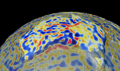
Magnetic oceans and electric Earth
The Magnetic Tidal Signals and Their Use in Mapping the Electrical Conductivity of the Lithosphere and Upper Mantle project aimed to use the magnetic fields produced from ocean tides to probe the conductivity of Earth's lithosphere and upper mantle.