earth online
  • Explore Missions
    • Earth Explorers
    • Heritage Missions
    • Third Party Missions
  • Explore Data
    • All Data
    • Open Data
    • Announcement of Opportunity
    • Project Proposal
    • Sample Data
    • Dashboard
  • Explore Tools
    • Analysis Tools
    • Processing Tools
    • Visualisation Tools
    • Catalogues
    • Apps
  • Explore News & Events
    • All News
    • Data Release News
    • Maintenance News
    • Operational News
    • All Events
    • Events Updates
    • Workshop
    • Conference
  • Explore Learn & Discover
    • Data Application Articles
    • Spotlight on EO Community
    • Gallery
    • FAQ
    • Success Stories
    • Infographics
    • Quality Reports Advanced Search
  • SEE ALL
  • Transforming space data into climate action
  • Transforming space data into climate action
  • ERS-2
  • Artist’s impression of Envisat
  • Antarctica’s ice loss
  • Introducing SMOS
  • GHGSat
  • Transforming space data into climate action
  • ERS-2
  • Artist’s impression of Envisat
  • Antarctica’s ice loss
  • Introducing SMOS
  • GHGSat
More
    • Learn & Discover
    • Transforming space data into climate action
    • GHGSat

    GHGSat

    30 Jun 2022

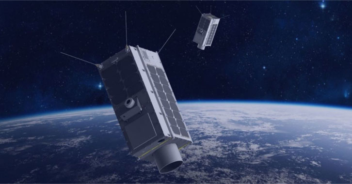
    GHGSat


    Title: GHGSat

    Description: Canadian remote sensing constellation GHGSat – which became a TPM during the Living Planet Symposium – can detect and quantify emissions of planet-warming emissions from point sources as small as individual oil and gas wells. This has the potential to increase understanding of how emissions from industrial facilities contribute to climate change, as well as helping industry act to reduce these emissions.

    Copyright: GHGSat

    Tweet
    Share

    Featured

    • Scheduled Maintenance – ESA MAAP Catalog on 20 October 2026
      Scheduled Maintenance – ESA MAAP Catalog on 20 October 2026
    • Maintenance on ESA MAAP Explorer on 20 October 2026
    • Maintenance on ESA MAAP PAL on 20 October 2026
    • ESA EOIAM Maintenance on 20 October 2026
    • Additional Swarm Langmuir probe Ion Drift, density and effective Mass dataset available

    Search with keywords

    • AATSR
    • Active Remote Sensing
    • Agriculture
    • Altimeters
    • AMI/SAR
    • AMI/Scatterometer
    • ASAR
    • Atmosphere
    • ATSR-1
    • ATSR-2
    • Climate
    • CryoSat
    • Cryosphere
    • Envisat
    • ERS
    • ERS-1
    • ERS-2
    • GHGSat
    • GOME
    • GOMOS
    • Groundwater
    • Imaging Radars
    • Imaging Spectrometers/Radiometers
    • Interferometers
    • Interferometric Radiometers
    • Land Surface
    • MIPAS
    • MIRAS
    • Oceans
    • Passive Remote Sensing
    • Profilers/Sounders
    • RA
    • RA-2
    • Radar Altimeters
    • Salinity and Density
    • Scatterometers
    • SCIAMACHY
    • Sea Ice
    • SIRAL
    • SMOS
    • Soil Moisture
    • Soils
    • Spectrometers
    • Spectrometers/Radiometers
    • Terrestrial Hydrosphere
    European Space Agency
    Terms and conditionsCookie NoticePrivacy NoticeContact UsFAQComplaintsLeave feedback