- RADARSAT
- Mission
- RADARSAT Overview
RADARSAT Overview
Mission Background
With global environmental monitoring and protection being a worldwide concern, RADARSAT-1 was developed as Canada's flagship to pursue this priority.
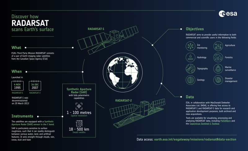
Hence RADARSAT-1 satellite became Canada's first commercial Earth observation satellite developed to monitor the planet's natural resources and environmental changes. It was equipped with a state-of-the-art synthetic aperture radar (SAR) instrument that could be steered to collect data over a 1175 km wide area using seven beam modes.
RADARSAT-2 is filling a wide variety of applications, including sea ice mapping and ship routing, iceberg detection, agricultural crop monitoring, marine surveillance for ship and pollution detection, terrestrial defence surveillance and target identification, geological mapping, mine monitoring, land use mapping, wetlands mapping and topographic mapping.
RADARSAT-2 is jointly funded by the Canadian Space Agency and Maxar Technologies Ltd. [former MDA (MacDonald, Dettwiler and Associates Ltd.)], representing a Canadian government/industry partnership in a commercial venture.
RADARSAT Infographic
Learn more about the RADARSAT mission in this infographic:
Satellite Design
| RADARSAT-1 | RADARSAT-2 | |
| Mass | 3200 kg | 2200 kg |
| Dimensions | 1.2 m cube; 1.5 m x 15 m antenna | 3.7 m x 1.36 m |
| Design lifetime | 5 years | 7 years |
Related Links
Learn more about the RADARSAT missions from these websites:
*The information provided is sourced and updated by external entities. For further details, please consult our Terms and Conditions page.