- MetOp
- Mission
- MetOp Objectives
MetOp Objectives
The Meteorological Operational satellite programme (MetOp) is a European undertaking providing weather data services to monitor the climate and improve weather forecasts, including:
- Ensuring continuity and availability for operational purposes of polar meteorological observations from the "morning" orbit to the global user community.
- Providing enhanced monitoring capabilities (complimentary to Envisat) to fulfil the requirements to study the Earth climate system as expressed in a number of international cooperative programs such as: GCOS (Global Climate Observing System), IGBP (International Geosphere and Biosphere Programme), and WCRP (World Climate Research Programme). The aim is to provide continuous, long-term data sets.
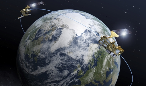
The MetOp satellites are designed to work in conjunction with the NOAA satellite system, flying in complementary orbits. MetOp's polar orbit is Sun synchronous, so that the satellite track along the Earth is always at the same local time, in this case in the mid-morning. NOAA still continues to operate its mid-afternoon orbit satellite service as part of the Polar Orbit Environmental Satellites (POES) system.
Polar orbiting satellites orbit at a lower altitude – typically 800 km compared with 36,000 km for a geostationary satellite – and can observe Earth in closer detail. This global observing system provides valuable meteorological data from polar orbit to users within two hours and 15 minutes of the measurements being taken, with regional users being able to receive data in realtime.
With a sophisticated array of instrumentation, the MetOp satellites provide data of unprecedented accuracy and resolution on a host of different variables such as temperature and humidity, ocean surface wind speed and direction, and concentrations of ozone and other trace gases – thus marking a major advance in global weather forecasting and climate monitoring capabilities.
In addition, these new weather satellites provide imagery of land and ocean surfaces as well as search and rescue equipment to aid ships and aircraft in distress. There is a data relay system on board, linking up to buoys and other data collection devices.
Launching a new satellite every five to six years guarantees a continuous delivery of high-quality data for medium- and long-term weather forecasting and climate monitoring until at least 2020.