- Activities
- GSCB and LTDP
- GSCB Represented Missions
Overview
Cosmo-SkyMed - Italy
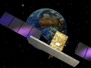
COSMO-SkyMed is funded by ASI and the Italian Ministry of Defence. The system consists of a constellation of four low Earth orbit mid-sized satellites, each carrying a multi-mode high-resolution X-band Synthetic Aperture Radar (SAR), and a global ground segment. The launch of the first COSMO spacecraft took place on 8 June 2007, the second on 9 December 2007, the third on 25 October 2008, and the fourth on 6 November 2010.
The primary mission is to provide services for land monitoring, territory strategic surveillance, management of environmental resources, maritime and shoreline control and law enforcement, topography and scientific applications.
Pleiades - France
The Pleiades optical system consists of two small satellites (1 tonne each) offering resolutions of 70 cm panchromatic and 2.8 m multispectral with a field of view of 20 km, better than its Spot predecessors. In addition, the system can acquire near-instantaneous stereoscopic doubles (or even triples) of 20 x 300 km, and provide highly accurate pinpointing of the images (< 1 m with ground control points) for optimal use of the data in geographical information systems. Pleiades-1A launched December 2011 and was followed by the launch of Pleiades-1B in December 2012.
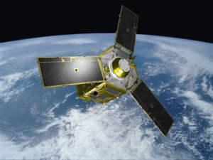
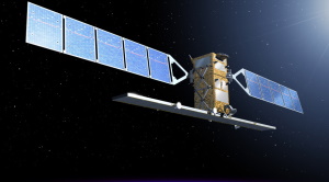
TerraSAR-X - Germany

Based on their experience with SAR technology from various national (SIR-C, SRTM) and ESA missions (ERS, Envisat), DLR and Astrium signed a public-private partnership agreement in March 2002, under which DLR is procuring from Astrium the innovative TerraSAR-X satellite. The 1023 kg satellite delivers X-band SAR data in various modes.
The Spot-Light mode yields the finest resolution data, with 1 m pixels for a 10 x 10 km image. The ScanSAR mode delivers 16 m resolution in a 100 km-wide swath. A special 'split antenna' mode allows experimental in-track interferometry, such as the mapping of moving objects. The satellite was launched on 15 June 2007 from Baikonur and flies in a 514 km-high dawn-dusk orbit.
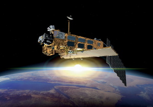
TanDEM-X - Germany
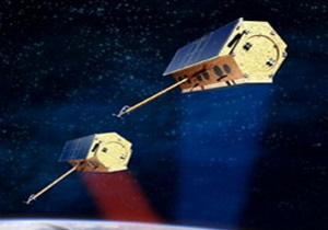
In 2003, DLR issued a call for proposals for a national follow-on to TerraSAR-X. One of the two accepted proposals was TanDEM-X, which consisted of a near identical satellite flying in a close tandem configuration with TerraSAR-X by 2009. This allowed interferometric digital elevation models to be generated globally to the highest precision ('DTED-3' quality, with 10 m footprint and 2 m vertical accuracy).
enMAP - Germany
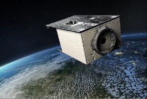
The second national German mission that launched around 2012, is the hyperspectral EnMAP (Environmental Mapping and Analysis Programme). EnMAP covers the spectral range 420–2450 nm with more than 200 bands of 5–10 nm spacing. The 30 m pixels cover a swath of 30 km; off-nadir viewing enables 5-day repeat coverage. EnMAP helps the study of ecosystems and the monitoring of natural resources.
RadarSat-1 / 2 - Canada
The Radarsat-2, follow-up to Radarsat-1, launched in 1995, it is a collaboration between government (CSA) and industry (MacDonald, Dettwiler and Associates Ltd). It was designed to provide C-band SAR data similar to those from Radarsat-1 for continuity. Significant technical improvements were made, including a 3 m high-resolution mode, a full range of signal polarisation modes to improve discrimination between various surface types, superior data storage and more precise measurements of satellite position and attitude. Radarsat-2, launched on 14 December 2007, operates in a Sun synchronous orbit identical to that of Radarsat-1 but with an offset.
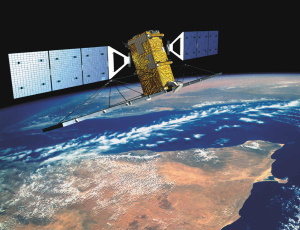
Envisat - ESA
Envisat was launched on 1 March 2002 and operated with a 35-day repeat cycle, 30 minutes ahead of ERS-2. The instruments addressed four major areas: radar imaging; optical imaging over oceans, coastal zones and land; observation of the atmosphere; altimetry. About two-thirds of the data were transmitted to the ground via ESA's Artemis relay satellite, providing Europe with data acquisition for any location worldwide. A total of 78 product types were generated, amounting to 250 GBytes per day. Most of these products are available on the internet in near realtime.
The Envisat data are used in many fields of Earth science, including atmospheric pollution, fire extent, sea ice motion, ocean currents and vegetation change, as well as for operational activities such as mapping land subsidence, monitoring oil slicks and watching for illegal fisheries.
Copernicus Sentinels - ESA / EU
Drawing on the preliminary work of the definition studies (Phases-A/B1), the key aspects of the individual Sentinel missions are described below.
Sentinel-1
Sentinel-1 provides continuity of ERS and Envisat SAR data, but at higher ground resolution and data-take per orbit. It carries a SAR in a precisely controlled dawn-dusk Sun synchronous orbit, at about 700 km altitude with an exact repeat cycle of 12 days and a swath of about 240 km. The first Sentinel-1 satellite was launched on a Soyuz rocket from Europe's Spaceport in French Guiana on 3 April 2014.
Sentinel-2
Sentinel-2 provides improved continuity for the Spot multispectral optical data, carrying a push-broom imager operating in the visible/near-IR and shortwave IR in a Sun synchronous orbit at about 800 km altitude. The resolution in the visible and near-IR channels is 10 m. The swath width of the multispectral imager is about 280 km, ensuring systematic coverage of all land surfaces every 10 days. Sentinel-2A was launched on 23 June 2015.
Sentinel-3
Sentinel-3, was launched on 16 February 2016, monitors oceans and land/ atmosphere at a global scale. It carries, in a Sun synchronous orbit of around 800 km altitude: a microwave altimeter, with a microwave radiometer for atmospheric correction and a satnav receiver for precise orbit determination; a 15-channel super-spectral imager for ocean/land colour observations; a visible/IR imaging dual-view radiometer for sea/land surface temperature observations. The land imaging mission provides continuity for Spot's Vegetation instrument, providing global coverage every four days. All Sentinels fly in a two-satellite constellation to satisfy the coverage requirements. All have design lifetimes of seven years and, depending on their mass, are compatible either with the Soyuz (Sentinel-1: 2.5 tonnes) or the Vega launchers (Sentinel-2: 800 kg; Sentinel-3: 1.3 tonnes).