- Activities
- SCIRoCCo
SCIRoCCo
Overview
![]()
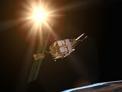
The Scatterometer Instrument Competence Centre (SCIRoCCo) project was established by ESA in support of the activities of the Sensor Performance and Product Assessment and Algorithm section (EOP-GMQ) for the ERS-2 Scatterometer mission Phase-F.
The project started on 24 June 2014 for a duration of two years. The final project review was held in ESRIN on 31 January 2017.
SCIRoCCo is an interdisciplinary cooperation of international scatterometry experts, aimed at promoting the continuing exploitation of ESA's unique 20 years' worth of ERS Scatterometer data (ESCAT) at medium (25 km, 50 km) spatial resolution, and improving the quality of available and future scatterometry data.
The SCIRoCCo project aims are to consolidate current methodologies for scatterometer data processing and calibration. SCIRoCCo provides ERS-1/-2 sensors inter-calibration, sensor characterisation and data validation. Data analysis and processing software, academic and technical publications in support of calibration and many diverse applications and research in Land (e.g. Soil Moisture), Oceanography (Ocean Winds, Sea, Ice), Climatology are also provided through the web portal. The web portal also serves as the entry point to SCIRoCCo's educational network, funded through grants and aimed at fostering the next-generation scatterometry experts. SCIRoCCo thus targets the needs of meteorological agencies, meteorological operations centres and the broader research and user communities for consistent and high quality Scatterometer data processing.
SCIRoCCo is a (Multi-)Sensor Timeseries project. ESA has been collecting and processing Earth observation data from ESA missions (for example Envisat, ERS-1 and -2), and ESA Third Party Missions (for example AVHRR, Landsat, ALOS) for nearly three decades. To facilitate the various end-user and science applications, there is a need for the agency to support and maintain the quality aspects across missions with similar sensors. The SPPA (Sensor Performance, Products and Algorithms) team multi-sensor activities focus primarily on the sensor Fundamental Data Records (FDR), i.e. the level 1 data, on the instrument's core products, as outlined in the Mission Requirements Documents of each mission, and on some select additional geophysical parameters that facilitate the improvements of the sensor FDR.
Download information about SCIRoCCo project activities and first achievements
Contact Information
If you have any questions about this project, contact:
Dr Raffaele Crapolicchio
Email: raffaele.crapolicchio@esa.int
Address: Serco SpA, Via Sciadonna 24-26, 00044 Frascati, Italy
Organisation: Serco
Dr Philippe Goryl
Email: philippe.goryl@esa.int
Address: ESA-ESRIN, Largo Galileo Galilei 1, 00044 Frascati, Italy
Organisation: ESA/ESRIN
Related Mission
find out more
Data
ERS Wind and Soil Moisture Scatterometer data is provided through the ESA Earth Online Portal, via the Fast Registration procedure.
ERS Wind Scatterometer Level 2.0 Data
ERS Wind Scatterometer Level 2.0 data are available as:
- High resolution (25 km) ASPS and NetCDF format
- Nominal resolution (50 km) ASPS and NetCDF format
- Nominal resolution (50 km) UWI format (to maintain compatibility with previous data formats, see the table below).
Detailed tables reporting the total number of missing Level 2 Orbits for each ERS-2 cycle are available through the Quality Control Report pages for the Wind Scatterometer.
A useful resource regarding data availability and quality are the Quality Readme files for the ERS-1/2 Wind Scatterometer Products and the ERS-2 Soil Moisture Products.
| Description | ERS-2 Data Availability | ERS-1 Data Availability |
|---|---|---|
| SCATTEROMETER High Resolution Ocean Wind field and Sea Ice probability (ERS.ASPS20.H) | Reprocessed Data: ERS-2 data are available from March 1996 to July 2011 | Reprocessed Data: ERS-1 data are available from August 1991 to June 1996 |
SCATTEROMETER Nominal Resolution Ocean Wind field and Sea Ice probability (ERS.ASPS20.N) | ||
ERS.UWI: Scatterometer Nominal Resolution back-scattering measurements, Ocean Wind field |
ERS-2 Soil Moisture Data
Surface soil moisture records are derived from the backscatter coefficient σ0 measured by the Scatterometer on-board the European Remote Sensing satellite (ERS-2) using the Technische Universität (TU) Wien soil moisture retrieval algorithm called WARP (WAter Retrieval Package).
| Name | Processor | Temporal Coverage | Spatial Coverage |
|---|---|---|---|
ERS-2 SCAT 25 km and 50 km Soil Moisture Time Series (ERS.SSM.H.TS, ERS.SSM.N.TS) | WARP 5.6 | 26 March 1996 to 4 July 2011 | Global coverage until 2001, from 2003 onwards regional coverage |
ERS-2 SCAT 25 km and 50 km Soil Moisture Orbit Product (ERS.SSM.H, ERS.SSM.N) |
Scatterometer Surface Soil moisture WARP 5.6 Technical Documents:
Activity Consortium
The SCIRoCCo project is a collaborative effort of the following institutions with ESA:
- The Royal Military Academy of Belgium (RMA),
- The Koninklijk Nederlands Meteorologisch Instituut (KNMI)
- The Technische Universität Wien (TU Wien)
- The European Centre for Medium Weather Forecast (ECMWF)
SERCO Sp.A is the prime industrial contractor and is responsible for the overall project management and coordination.
Serco
ECMWF
TU Wien
KNMI
RMA