- All Categories (46)
- News (3)
- Missions (6)
- Events (1)
- Tools (2)
- Documents (34)
Document - Proceedings

4th-International-GOCE-User-Workshop.pdf
Proceedings of the 4th International GOCE User Workshop held on 31 March - 1 April 2011 at the Technische Universitat Munich, Germany
Document - Proceedings
Abstracts-of-2nd-International-GOCE-User-Workshop.pdf
This volume collects the abstracts of the papers presented at the GOCE User Workshop, held on 8-10 March 2004 at ESA ESRIN, Frascati Italy.
Document - Software Verification Plan/Report

An-investigation-of-the-error-characteristics-of-the-GOCE-geoid-models.pdf
This report presents an initial investigation into the error characteristics of the GOCE gravity field models as they are realised in the calculated geoid anomalies.
Document - General Reference

Earth-Explorers-Satellites-to-understand-our-changing-Earth.pdf
This eight-page brochure provides an overview of the Earth Explorers currently in orbit and those under development.
Document - General Reference
Earth-Explorers.pdf
This flyer gives a quick overview of the 6 Earth Explorers missions.
Mission - Earth Explorers
EGG
This opened a window into Earth's interior structure, as well as the currents circulating within the depths of its oceans
Event - Training

EO Summer School 6
Keynote lectures on global change issues are also given to discuss the current state of the science of global change and
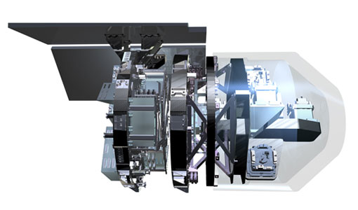
Mission - Earth Explorers

GOCE
Explorer (GOCE) mission mapped Earth's geoid very accurately, opening a window into Earth's interior structure as well as the currents
Document - Product Cal/Val Plan/Report

GOCE Calibration & Validation Plan for L1b Data Products
The purpose of this document is to provide a framework for theactivities planned in connection with the calibration andvalidation of Level 1b data products from the GOCE mission. Itcontains information on the overall context for GOCE-relatedcalibration and validation, together with a summary of each of theplanned activities, including information about their goals,methodology and their outputs, as well as a list of participants.The objective of documenting each specific effort is to identifyeach expected contribution to either calibration or validation ofLevel 1b products, in order to fully appreciate what areas arecovered by existing plans, and whether further attention to detailmay be required.
News - Data Release news

GOCE EGG L1b reprocessed data published
The GOCE L2 data, including the gravity field models, are currently being regenerated and will be available in Q2 2019.
Document - Quality Report

GOCE EGG Monthly Report 01 Jul 2011
Figure 1 Current trace PSD (right), compared with previous days (left).
Document - Quality Report
GOCE EGG Monthly Report 01 Sep 2012
Figure 5 Current CM PSDs (right) and during the previous reference period (left) 3.4 Instrument calibration Special Spacecraft
Document - Product Document

GOCE Level 2 Product Report
This technical note summarises the status of the GOCE Level 2 products obtained at the end of the nominal operational phase of GOCE.
Mission - Earth Explorers
GOCE Objectives
Thanks to this current, the coastal waters of Europe are 4°C warmer than waters at equivalent latitudes in the north Pacific
Mission - Earth Explorers
GOCE Overview
height mapped by altimeters and the knowledge of the precise ocean geoid that has improved our understanding of surface currents
Mission - Heritage Missions
GOCE re-entry dataset
with further dynamical and environmental information such as on-board magnetometer measurements of Earth's magnetic field, currents
Tools - Analysis

GOCE User Toolbox
Data output formats The current data formats that GUT can provide in output are: netCDF (Climate and Forecast Metadata Convention