- All Categories (13314)
- News (32)
- Missions (17)
- Events (2)
- Activities (1)
- Campaigns (1)
- Documents (13261)
News - Success Stories
CRYO2ICE over Antarctica: revealing further insight on changing ice
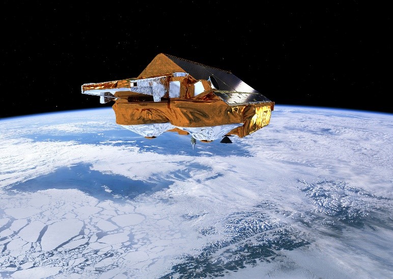
The CryoSat-2 satellite is currently being aligned with ICESat-2 over Antarctica, unlocking fresh possibilities in the wealth
News - Success Stories
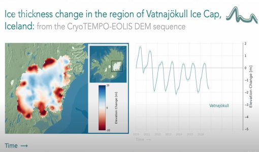
CryoTEMPO-EOLIS Products Now Available for Iceland, Svalbard, and the Canadian Arctic
Land-ice monitoring via Earth Observation methods in general, and altimetry in particular, are essential for tracking the current
Activity - Quality
SCIRoCCo
Author: The SCIRoCCo Team Abstract: The ERS Scatterometers in the Global Climate Observing System report describes the current
News - Operational News

Delay in the availability of CryoSat Products
There is currently an ongoing technical issue at the CryoSat Payload Data Ground Segment (PDGS).
News - General News
ESA's excellent Earth Explorer missions extended to 2025
Acting like the spinning conductor in a bicycle dynamo, it generates electrical currents and thus the continuously changing
Mission - Earth Explorers
Geographical Mode Mask
The current operational Geographical Mode Mask v5.0 The current version of the geographical mode mask v5.0 has been in operation
Document - General Reference

Taking-the-Measure-of-Earth-Fifteen-Years-of-Progress-in-Radar-Altimetry.pdf
This article is extracted from ESA Bulletin Nr. 128.
Event - Training

EO Summer School 3
In line with observations it shows anti-cyclonically rotating surface currents and cyclonically rotating bottom currents.
News - Data Release news
New CryoSat BUFR products for the meteorological community
The current CryoSat Ocean Processor is able to generate Near-real-time Ocean Products (NOP) with a latency of 2-3 hours after
Document - General Reference
CryoSat-Polar-Ice-Fields-are-they-melting.pdf
This article was published in the Earth Observation Quarterly Nr. 71 and is about CryoSat applications in experimental measurements in the Arctic.
Document - General Reference
Introduction-CryoSat-2-ICESat-2-Resonant-Orbits.pdf
This presentation describes the CRYO2ICE campaign.
News - General News
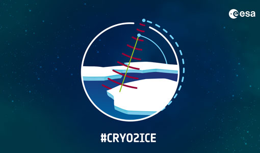
CRYO2ICE is now on Earth Online
The resulting data will have applications in the fields of sea ice, land ice, polar ocean currents, inland water and atmosphere
Mission - Earth Explorers
Special Datasets Overview
CryoSat Antarctic Digital Elevation Model - Download the current CryoSat product Antarctic DEM.
Mission - Heritage Missions

RA (ERS)
the RA provided information on significant wave height; surface wind speed; sea surface elevation, which relates to ocean currents
Document - Technical Note

Guidelines-for-the-SAR-Delay-Doppler-L1b-Processing.pdf
The purpose of this document is to present the major theoretical guidelines for a standard SAR (aka Delay Doppler) Processing from low-level data (FBR, aka L1a) to multi-looked waveforms (L1b) in case of the Closed-Burst instrument transmission mode (CryoSat-2 and Sentinel-3 case).
Document - General Reference
CryoSat-ESAs-Ice-Mission.pdf
This brochure describes the science behind the CRYOSAT mission and how the satellite works.
News - Data Release news

Back-processed data from 2010 now available for CryoTEMPO-EOLIS Baseline 2
Arctic Canada North High Mountain Asia (Central/South East/South West Asia) Russian Arctic Svalbard Iceland Regions that are currently
News - Operational News
CryoSat - Geographical Mode Mask 4.0 released
SAR Interferometric (SARIn) (purple) mode is used over steeply sloping ice-sheet margins, over some geostrophic ocean currents
News - Data Release news

New reprocessing of datasets celebrates 30 years of ERS
For each surface, the experts will use our current knowledge acquired over 30 years of experience, to improve the ERS altimetric