- All Categories (34)
- Data (3)
- News (11)
- Missions (2)
- Events (1)
- Tools (5)
- Activities (1)
- Documents (11)
News - How to guides
HEDAVI Discover: a step-by-step guide
The Heritage Data Visualisation tool (HEDAVI) is a platform developed by the French Science Consulting for Earth Observation group, VisioTerra, which allows users to freely access over 40 years of ESA Earth Observation Heritage data, Third Party Missions and some Copernicus data.
News - Success Stories
Discover Earth like never before: the HEDAVI tool
The Heritage Data Visualisation tool, or HEDAVI, enables the analysis of global spatio-temporal dynamics of natural and artificial environments, covering over 40 years of ESA Earth Observation Heritage data, Third Party Missions and some Copernicus data.
News - Thematic area articles
Cloud-free collections key for land monitoring
Satellite imagery is a crucially important tool for monitoring the land, but cloud cover can often block parts of Earth’s surface from view, limiting subsequent analyses.
News - Success Stories
Commercial and international data for fire monitoring
As climate change sparks a surge in the frequency and intensity of wildfires, satellite data disseminated through ESA’s Third Party Missions (TPM) programme are helping scientists to track and investigate these potentially damaging natural events.
Data - Data Description
Landsat 7 ETM+ European and Mediterranean Countries Cloud Free Collection
This dataset contains the cloud-free products from Landsat 7 Enhanced Thematic Mapper collection acquired over Europe, North Africa and the Middle East; for each scene only one product is selected, with the minimal cloud coverage. The Landsat 7 ETM+ scenes typically cover 185 x 170 km. A standard full scene is nominally centred on the intersection between a Path and Row (the actual image centre can vary by up to 100 m). The data are system corrected.
Tools - Catalogues

FedEO
FedEO is a data catalogue that provides a unique entry point to a number of scientific catalogues and services for, but not limited to, European and Canadian missions.
Tools - Catalogues

ESA PDGS DataCube
ESA's DataCube is a data catalogue that enables multi-temporal and pixel-based access to a subset of data available from ESA
Tools - Catalogues

EO CAT
EO CAT is a data catalogue, offering a Next Generation Earth Observation system designed to manage end-user Earth Observation services.
News - Data Release news

Full European Landsat data collection now available under the same catalogue
The Full European Landsat data collection, from Landsat-1 to Landsat-8, is now available under the same catalogue
News - Data Release news
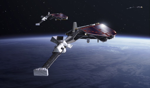
GRACE-FO magnetometer data now available to support Swarm Sciences
We are pleased to announce the new release of magnetic field data recorded by Fluxgate magnetometers operating on-board the two Gravity Recovery and Climate Experiment Follow-On (GRACE-FO) satellites.
News - Data Release news

GRACE magnetometer data now available to support Swarm Sciences
We are pleased to announce the new release of magnetic field data recorded by Fluxgate magnetometers operating onboard the two GRACE satellites.
News - Events and Proceedings

National missions in the spotlight at the Living Planet Symposium
In the framework of ESA’s Third Party Missions (TPM) programme, the agency offers access to the full data archives of almost 50 satellite missions, which are owned by organisations around the world.
Data - EO Sign In Authentication (Open)
Landsat ETM+ ESA archive
This dataset contains all the Landsat-7 Enhanced Thematic Mapper high-quality ortho-rectified L1T products (or L1Gt where not enough GCPs are available) over Kiruna, Maspalomas, Matera and Neustrelitz visibility masks. The Landsat-7 ETM+ scenes typically covers 185 x 170 km. A standard full scene is nominally centred on the intersection between a Path and Row (the actual image centre can vary by up to 100 m). Each band requires 50 MB (uncompressed), and Band 8 requires 200 MB (panchromatic band with resolution of 15 m opposed to 30 m). Kiruna, Maspalomas and Matera Landsat-7 ETM density maps
News - Data Release news

New reprocessed Landsat data on a new dissemination server
The full ESA Landsat archive has been reprocessed with the latest version of the processor to provide a homogenous dataset covering MSS, TM and ETM+ data.
Document - Product Specifications

Landsat-TM-ETM-CEOS-ESA-Products
This document describes the standards used by ESA for the distribution of the TM and ETM+ (Thematic Mapper and Enhanced Thematic Mapper) optical sensor products.
Document - Technical Note

Landsat 7 ETM Image Assessment System Radiometric Algorithm Theoretical Basis Document
Document - Technical Note
Landsat 7 ETM Image Assessment System Geometric Algorithm Theoretical Basis Document
Tools - Visualisation
EVDC Orbit Prediction Tool
The EVDC Orbit Prediction and Overpass Tool generates and visualises satellite's overpasses.
Data - Data Description
GRACE-A and GRACE-B Level 1B, Level 1B combined and Level 2 Data Products
Level-1A Data Products are the result of a non-destructive processing applied to the Level-0 data at NASA/JPL. The sensor calibration factors are applied in order to convert the binary encoded measurements to engineering units. Where necessary, time tag integer second ambiguity is resolved and data are time tagged to the respective satellite receiver clock time. Editing and quality control flags are added, and the data is reformatted for further processing. The Level-1A data are reversible to Level-0, except for the bad data packets. This level also includes the ancillary data products needed for processing to the next data level. The Level-1B Data Products are the result of a possibly destructive, or irreversible, processing applied to both the Level-1A and Level-0 data at NASA/JPL. The data are correctly time-tagged, and data sample rate is reduced from the higher rates of the previous levels. Collectively, the processing from Level-0 to Level-1B is called the Level-1 Processing. This level also includes the ancillary data products generated during this processing, and the additional data needed for further processing. The Level-2 data products include the static and time-variable (monthly) gravity field and related data products derived from the application of Level-2 processing at GFZ, UTCSR and JPL to the previous level data products. This level also includes the ancillary data products such as GFZ's Level-1B short-term atmosphere and ocean de-aliasing product (AOD1B) generated during this processing. GRACE-A and GRACE-B Level-1B Data Product: Satellite clock solution [GA-OG-1B-CLKDAT, GB-OG-1B-CLKDAT, GRACE CLKDAT]: Offset of the satellite receiver clock relative to GPS time, obtained by linear fit to raw on-board clock offset estimates GPS flight data [GA-OG-1B-GPSDAT, GB-OG-1B-GPSDAT, GRACE GPSDAT]: Preprocessed and calibrated GPS code and phase tracking data edited and decimated from instrument high-rate (10 s (code) or 1 s (phase)) to low-rate (10 s) samples for science use (1 file per day, level-1 format) Accelerometer Housekeeping data [GA-OG-1B-ACCHKP, GB-OG-1B-ACCHKP, GRACE ACCHKP]: Accelerometer proof-mass bias voltages, capacitive sensor outputs, instrument control unit (ICU) and sensor unit (SU) temperatures, reference voltages, primary and secondary power supply voltages (1 file per day, level-1 format) Accelerometer data [GA-OG-1B-ACCDAT, GB-OG-1B-ACCDAT, GRACE ACCDAT]: Preprocessed and calibrated Level-1B accelerometer data edited and decimated from instrument high-rate (0.1 s) to low-rate (1s) samples for science use (1 file per day, level-1 format) Intermediate clock solution [GA-OG-1B-INTCLK, GB-OG-1B-INTCLK, GRACE INTCLK]: derived with GIPSY POD software (300 s sample rate) (1 file per day, GIPSY format) Instrument processing unit (IPU) Housekeeping data [GA-OG-1B-IPUHKP, GB-OG-1B-IPUHKP, GRACE IPUHKP]: edited and decimated from high-rate (TBD s) to low-rate (TBD s) samples for science use (1 file per day, level-1 format) Spacecraft Mass Housekeeping data [GA-OG-1B-MASDAT, GB-OG-1B-MASDAT, GRACE MASDAT]: Level 1B Data as a function of time GPS navigation solution data [GA-OG-1B-NAVSOL, GB-OG-1B-NAVSOL, GRACE NAVSOL]: edited and decimated from instrument high-rate (60 s) to low-rate (30 s) samples for science use (1 file per day, level-1 format) OBDH time mapping to GPS time Housekeeping data [GA-OG-1B-OBDHTM, GB-OG-1B-OBDHTM, GRACE OBDHTM]: On-board data handling (OBDH) time mapping data (OBDH time to receiver time Star camera data [GA-OG-1B-SCAATT, GB-OG-1B-SCAATT, GRACE SCAATT]: Preprocessed and calibrated star camera quaternion data edited and decimated from instrument high-rate (1 s) to low-rate (5 s) samples for science use (1 file per day, level-1 format) Thruster activation Housekeeping data [GA-OG-1B-THRDAT, GB-OG-1B-THRDAT, GRACE THRDAT]: GN2 thruster data used for attitude (10 mN) and orbit (40 mN) control GN2 tank temperature and pressure Housekeeping data [GA-OG-1B-TNKDAT, GB-OG-1B-TNKDAT, GRACE TNKDAT]: GN2 tank temperature and pressure data Oscillator frequency data [GA-OG-1B-USODAT, GB-OG-1B-USODAT, GRACE USODAT]: derived from POD product GRACE-A and GRACE-B Combined Level-1B Data Product Preprocessed and calibrated k-band ranging data [GA-OG-1B-KBRDAT, GB-OG-1B-KBRDAT, GRACE KBRDAT]: range, range-rate and range-acceleration data edited and decimated from instrument high-rate (0.1 s) to low-rate (5 s) samples for science use (1 file per day, level-1 format) Atmosphere and Ocean De-aliasing Product [GA-OG-1B-ATMOCN, GB-OG-1B-ATMOCN, GRACE ATMOCN]: GRACE Atmosphere and Ocean De-aliasing Product. GRACE Level-2 Data Product: GAC [GA-OG-_2-GAC, GB-OG-_2-GAC, GRACE GAC]: Combination of non-tidal atmosphere and ocean spherical harmonic coefficients provided as average over certain time span (same as corresponding GSM product) based on level-1 AOD1B product (1file per time span, level-2 format) GCM [GA-OG-_2-GCM, GB-OG-_2-GCM, GRACE GCM]: Spherical harmonic coefficients and standard deviations of the long-term static gravity field estimated by combination of GRACE satellite instrument data and other information for a dedicated time span (multiple years) and spatial resolution (1 file per time span, level-2 format) GAB [GA-OG-_2-GAB, GB-OG-_2-GAB, GRACE GAB]: Non-tidal ocean spherical harmonic coefficients provided as average over certain time span (same as corresponding GSM product) based on level-1 AOD1B product (1file per time span, level-2 format) GAD [GA-OG-_2-GAD, GB-OG-_2-GAD, GRACE GAD]: bottom pressure product - combination of surface pressure and ocean (over the oceans, and zero over land). Spherical harmonic coefficients provided as average over certain time span (same as corresponding GSM product) based on level-1 AOD1B product (1file per time span, level-2 format) GSM [GA-OG-_2-GSM, GB-OG-_2-GSM, GRACE GSM]: Spherical harmonic coefficients and standard deviations of the static gravity field estimated from GRACE satellite instrument data only for a dedicated time span (e.g. weekly, monthly, multiple years) and spatial resolution (1 file per time span, level-2 format).
Mission - Heritage Missions

Landsat Series
The Landsat Series is the world's longest running system of satellites for moderate-resolution optical remote sensing for land, coastal areas and shallow waters.