- All Categories (57)
- Data (4)
- News (6)
- Missions (3)
- Events (4)
- Tools (3)
- Activities (3)
- Documents (34)
Document - User Guide
Third Party Missions, Cat-1 Data Availability
This brochure gives a quick overview on the availability of the Third Party Missions IRS-P3, JERS-1, NIMBUS, Proba, Landsat, KOMPSAT-1, SCISAT-1, Terra/Aqua, NOAA, QSCAT, OrbView, SPOT-1,-2,-3,-4, ALOS.
Document - General Reference
The Earth Observation Handbook, 2010 Update - Key Tables
This is the 2010 update of the CEOS Earth Observation Handbook. You can browse the live database at http://database.eohandbook.com/ or download the printable PDF of key tables based on the 2010 database contents for a handy reference.
Mission - Heritage Missions
JERS-1
The overall objectives of JERS-1 (Japanese Earth Resources Satellite) were the generation of global data sets with SAR and OPS sensors aimed at surveying resources, establishing an integrated Earth observation system
Mission - Third Party Missions
Landsat-8
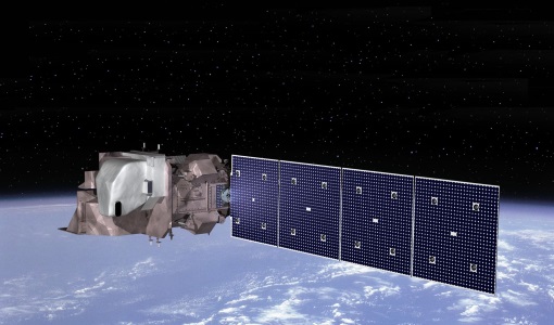
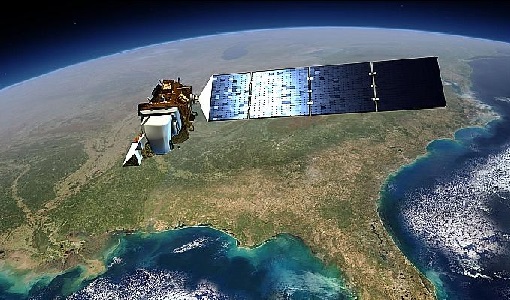
Landsat-8 is an Earth-imaging satellite from USGS and NASA which launched in 2013. The Landsat programme provides a global archive of satellite imagery.
Event - Meeting
VH-RODA and CEOS SAR workshop
The workshop provided an open forum for the presentation and discussion of current status and future developments related to the calibration and validation of space borne very high-resolution SAR and optical sensors and data products.
Event - Workshop
IDEAS+ Cal/Val Workshop 7
The 7th IDEAS+ Cal/Val Workshop took place on 4 and 5 June 2019 and it was hosted at the Wageningen University and Research (WUR) in The Netherlands.
Activity - Cal/Val activities
MBASSS
Mer Bleue Arctic Surrogate Simulation Site (MBASSS) Sentinel-2 and Landsat 8 Validation Project objectives are to develop capability to validate Landsat 8 Operational Land Imager land data products.
Activity - Cal/Val activities
S2L8VegStruc
The Retrieval of vegetation structural variables from Sentinel-2/Landsat 8 time series study's objective is to test and validate the capabilities for the retrieval of structural variables.
Activity - Quality
EDAP
The ESA Earthnet Data Assessment Pilot (EDAP) project will perform assessments for various missions to ensure the delivered data is fit for purpose.
Mission - Heritage Missions
Landsat Series
The Landsat Series is the world's longest running system of satellites for moderate-resolution optical remote sensing for land, coastal areas and shallow waters.
Data - EO Sign In Authentication (Open)
JERS-1 SAR Level 1 Precision Image
The JSA_PRI_1P product is comparable to the ESA PRI/IMP images generated for Envisat ASAR and ERS SAR instruments. It is a ground range projected detected image in zero-Doppler SAR coordinates, with a 12.5 metre pixel spacing. It has four overlapping looks in Doppler covering a total bandwidth of 1000Hz, with each look covering a 300Hz bandwidth. Sidelobe reduction is applied to achieve a nominal PSLR of less than -21dB. The image is not geocoded, and terrain distortion (foreshortening and layover) has not been removed. Data acquired by ESA ground stations. Spatial coverage: Check the spatial coverage of the collection on a map available on the Third Party Missions Dissemination Service.
Data - EO Sign In Authentication (Open)
JERS-1 SAR Level 1 Single Look Complex Image
The JSA_SLC_1P product is comparable to the ESA SLC/IMS images generated for Envisat ASAR and ERS SAR instruments. It is a slant-range projected complex image in zero-Doppler SAR coordinates. The data is sampled in natural units of time in range and along track, with the range pixel spacing corresponding to the reciprocal of the platform ADC rate and the along track spacing to the reciprocal of the PRF. Data is processed to an unweighted Doppler bandwidth of 1000Hz, without sidelobe reduction. The product is suitable for interferometric, calibration and quality analysis applications. Data acquired by ESA ground stations. Spatial coverage: Check the spatial coverage of the collection on a map available on the Third Party Missions Dissemination Service.
Data - EO Sign In Authentication (Open)
JERS-1 OPS (Optical Sensor) Very Near Infrared Radiometer (VNIR) System Corrected Products level 1
The JERS-1 Optical System (OPS) is composed of a Very Near Infrared Radiometer (VNIR) and a Short Wave Infrared Radiometer (SWIR). The instrument has 8 observable spectral bands from visible to short wave infrared. Data acquired by ESA ground stations The JERS-1 OPS products are available in GeoTIFF format. These products are available only for the VNIR sensor. All four bands are corrected. The correction consists in a vertical and horizontal destriping, the radiometry values are expanded from the range [0.63] to the range [0.255]. No geometrical correction is applied on level 1. The pixel size of approximately 18 x 24.2 metres for raw data is newly dimensioned to 18 x 18 metres for System Corrected data using a cubic convolution algorithm. Disclaimer: Cloud coverage for JERS OPS products has not been computed using an algorithm. The cloud cover assignment was performed manually by operators at the acquisition stations. Due to missing attitude information, the Nadir looking band (band 3) and the corresponding forward looking band (band 4) are not well coregistered, resulting in some accuracy limitations. The quality control was not performed systematically for each frame. A subset of the entire JERS Optical dataset was selected and manually checked. As a result of this, users may occasionally encounter issues with some of the individual products. Spatial coverage: Check the spatial coverage of the collection on a map available on the Third Party Missions Dissemination Service.
Event - Workshop
CEOS-WGCV ACIX II CMIX Atmospheric Correction Inter-comparison Exercise Cloud Masking Inter-comparison Exercise 2nd workshop
The CEOS-WGCV ACIX II 2nd workshop took place at Esrin, Rome in Italy from 3 December - 5 December 2019.
Tools - Other
Forestry TEP
The Forestry Thematic Exploitation Platform (TEP) enables users in the forestry sector to access satellite data based processing services and tools for generating value-added forest information products.
Tools - Other
Hydrology TEP
The Hydrology Thematic Exploitation Platform (TEP) enables access, processing, uploading, visualisation, manipulation and comparison of hydrological data.
Tools - Other
Urban TEP
The Urban Thematic Exploitation Platform enables access, processing, uploading, visualisation, manipulation and comparison of data over urban areas.
Document - Quality Report
Landsat-8 OLI/TIRS Monthly Report 01 Sep 2017
Landsat-8 OLI/TIRS Monthly Report
Document - Quality Report
Landsat-8 OLI/TIRS Monthly Report 01 Oct 2016
Landsat-8 OLI/TIRS Monthly Report
Document - Quality Report
Landsat-8 OLI/TIRS Monthly Report 01 Oct 2015
Landsat-8 OLI/TIRS Monthly Report


