- All Categories (39)
- Data (3)
- News (11)
- Missions (3)
- Events (2)
- Tools (4)
- Activities (2)
- Documents (14)
Document - Product Specifications
JERS-SeaSat-SAR-Products-CEOS-Format-Specifications.pdf
This document defines the format of the SAR RAW, PRI, IMM and SLC products generated from JERS-1 and SeaSat SAR data by the ESA JERS and SeaSat SAR Instrument Processing Facilities.
Document - Product Specifications
JERS-SeaSat-SAR-Level-1-products-format-specifications.pdf
This document defines the Envisat and GEOTIFF/TIFF format of the L1 products generated from JERS/SeaSat SAR sensor data by the ESA JERS SAR Instrument Processing Facility.
Document - Product Document
LANDSAT_Products_Description_Document.pdf
This document acts as a User Guide to the Landsat MSS, TM and ETM+ archives, focussing more specifically on the Landsat TM and ETM+ products from the Kiruna, Maspalomas and Matera archives (including from the Matera, Fucino, Neustralitz, O’Higgins, Malindi, Libreville and Bishkek ground stations) that have been generated as part of the ESA archive bulk-reprocessing project.
Document - Technical Note
SeaSat-SAR-IPF-Data-and-Processing-Issues.pdf
This document describes the rehabilitation and reprocessing of ESA’s historic SeaSat raw data archive.
Document - General Reference
The Earth Observation Handbook, 2010 Update - Key Tables
This is the 2010 update of the CEOS Earth Observation Handbook. You can browse the live database at http://database.eohandbook.com/ or download the printable PDF of key tables based on the 2010 database contents for a handy reference.
Event - Conference
15 Years of Progress in Radar Altimetry Symposium
A Symposium on "15 Years of Progress in Radar Altimetry" and the annual meeting of the Ocean Surface Topography Science Team, the International Doris Service Workshop and the ARGO Workshop.
Mission - Heritage Missions
Seasat
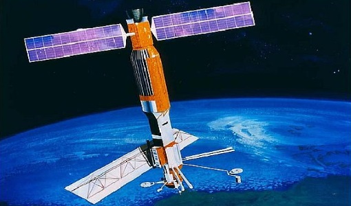
On board Seasat was the first-ever space-borne synthetic aperture radar (SAR) system for science applications.
News - General News
Satellite Radar Altimetry: past and future
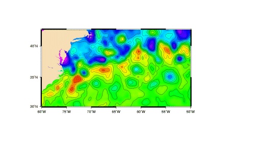
Satellite radar altimetry measurements yield a wealth of information that can be used for a wide range of applications.
Document - Technical Note
The SeaSat-A Synthetic Aperture Radar System
The SeaSat-A synthetic aperture radar imaging radar system (SAR) was the first imaging radar system used as a scientific instrument from Earth orbit. The system generated continuous radar imagery with a 100 km swath at a resolution of 25 m from an 800 km altitude orbit. The imagery is a pictorial representation of the radar backscatter of the Earth's surface in a map-like representation.
Activity - Quality
SLAP
The SLAP (Systematic Landsat Archive Processing) project covers the MSS, TM and ETM+ products from Landsat missions 1 – 7, and is the first systematic reprocessing of the ESA Landsat archive.
Activity - Quality
EDAP
The ESA Earthnet Data Assessment Pilot (EDAP) project will perform assessments for various missions to ensure the delivered data is fit for purpose.
Mission - Heritage Missions
Landsat-1 to Landsat-3
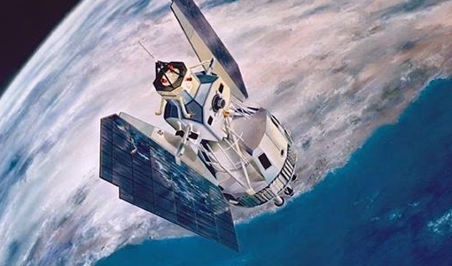
The Landsat-1 to 3 satellites were the first in the United States' Landsat programme, dedicated to monitoring the Earth's land mass.
Mission - Heritage Missions
Landsat Series
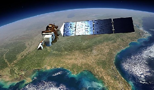
The Landsat Series is the world's longest running system of satellites for moderate-resolution optical remote sensing for land, coastal areas and shallow waters.
Data - EO Sign In Authentication (Open)
SeaSat ESA archive
This collection gives access to the complete SEASAT dataset acquired by ESA and mainly covers Europe. The dataset comprises some of the first ever SAR data recorded for scientific purposes, reprocessed with the most recent processor. The Level-1 products are available as: SAR Precision Image [SEA_PRI_1P] SAR Single Look Complex Image [SEA_SLC_1P] SAR Ellipsoid Geocoded Precision Image [SEA_GEC_1P] Spatial coverage: Check the spatial coverage of the collection on a map available on the Third Party Missions Dissemination Service.
News - Success Stories
New life for Landsat historical data
45 years of data, more than 1.8 million images, these are the numbers of an adventure started 48 years ago with the launch of the first Landsat satellite.
Document - User Guide
TPM-L-OADS-dissemination-service-User-Manual.pdf
This guide describes the Third Party Missions Dissemination System.
News - General News
ESA’s Earth Observation Catalogue and its services
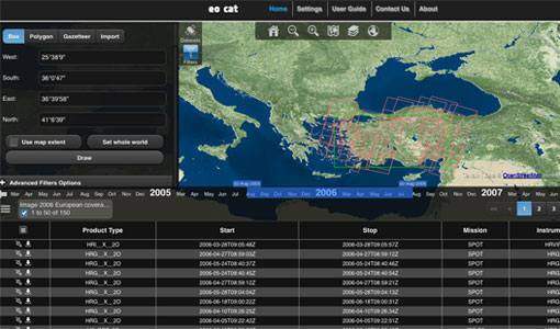
EO-CAT is the EO Catalogue tool allowing users to search ESA and Third Party Mission collections.
