- All Categories (25234)
- Data (34)
- News (112)
- Missions (9)
- Events (18)
- Tools (9)
- Activities (16)
- Campaigns (9)
- Documents (25027)
News - Infographics

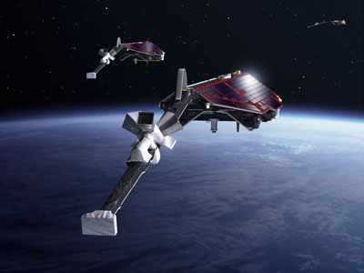
What is CRYO2ICE?
Learn about CRYO2ICE, an innovative campaign producing near simultaneous acquisitions over Antarctica from the CryoSat and ICESAT-2 missions, in this new infographic.
Data - EO Sign In Authentication (Open)

VT GOCE Data
This collection contains the VT GOCE software and associated data set needed to run the software that is used for GOCE data visualisation.
News - Success Stories

Using Satellite Data to Predict Floods and Droughts
Scientists are turning to remote sensing to fill the in-situ data gap in hydrological data models in some parts of the world.
Event - Workshop
URBIS24
URBan Insights from Space (URBIS24) Workshop will offer an insightful exploration of urban challenges and innovative EO-integrated solutions.
News - Data Release news

Updated Precise Orbit data (POD) for the full ERS-1 and ERS-2 mission available
The Precise Orbit files (ERS.ORB.POD) for the entire ERS-1 and ERS-2 mission periods have been reprocessed with up-to-date standards.
News - Data Release news

Updated CryoSat magnetometer data now available with new baseline 0201
An improved version of the CryoSat magnetic field data is now available on the Swarm Dissemination Server with new baseline 0201.
News - Data Release news

Updated CryoSat magnetometer data now available
An improved version of the CryoSat magnetic field data (version 0102) is now available in the "#CryoSat-2" folder of the ESA FTP server.
News - Data Release news

Updated CryoSat magnetometer data now available
An improved version of the CryoSat magnetic field data (version 0103) is now available.
News - Operational News

Update on Swarm Field-Aligned Current Dual (FAC_AC) data missing from 7 November 2021
As a follow-up of the news published on 23 November 2021, we want to update Swarm users about the missing Field-Aligned Current Dual (FAC_TMS_2F) data since 7 November 2021.
Document - General Reference

Understanding our Planet - the Earth Observation Envelope Program
This brochure describes the Earth Observation Envelope Programme.
Document - General Reference
Two Years of ERS-1 Data Exploitation
This bulletin reports on the first two years of the ERS-1 satellite.
News - Thematic area articles

Transforming space data into climate action
ESA’s Earth observation activities are playing a key role in the revitalised global drive to combat climate change.
Activity - Projects
TIRO
Topside Ionosphere Radio Observations from multiple LEO-missions (TIRO) project will provide two measurements from onboard instruments of LEO satellite missions: TEC (Total Electron Content) derived from GNSS signals, and electron density derived from KBR (K-Band Ranging) system observations.
Document - Product Cal/Val Plan/Report

The-Calibration-of-the-ERS-1-Radar-Altimeter.pdf
This report describes the calibration of ERS-1's Radar Altimeter during the commissioning phase, which used Venice as a basis for calibration.
Document - Technical Note

Technical-Note-on-Data-Flows-and-Volumes-between-ISS-and-Other-Entities-of-the-ERS-1-Ground-Segment.pdf
This document lists all the messages exchanged between the Interface Subset (ISS) and the other entities of the ERS-1 Ground Segment.
Document - General Reference
Taking-the-Measure-of-Earth-Fifteen-Years-of-Progress-in-Radar-Altimetry.pdf
This article is extracted from ESA Bulletin Nr. 128.
News - Data Release news

Systematic swath elevation and monthly DEMs over the Greenland Ice Sheet margin from CryoSat
The CryoTEMPO-EOLIS (Elevation Over Land Ice from Swath), the first of the CryoTEMPO products, is now available.
News - Data Release news

Systematic swath elevation and monthly DEMs over the Antarctica Ice Sheet margin from CryoSat 2
Land-ice is declining globally, raising sea levels worldwide and impacting glacial risks and access to fresh-water in high-mountain glaciers regions.