- All Categories (8)
- Data (1)
- News (3)
- Missions (1)
- Events (1)
- Documents (2)
News - Thematic area articles
Global understanding of Earth's land surfaces greatly boosted by satellite data
ESA perform land surface monitoring with a range of instruments onboard satellites acquiring optical and radar data. Collections of data from these missions are freely available for research purposes.
Event - Conference
Living Planet Symposium 2022
Learn about the 2022 edition of ESA's Living Planet Symposium.
News - Infographics
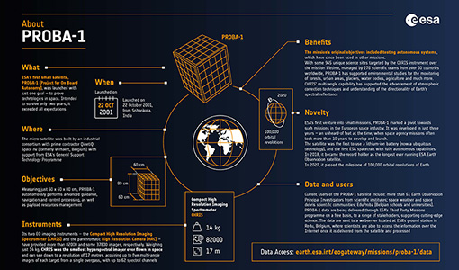
PROBA-1 - From technology demonstration to long-term Earth observation
Learn about ESA's PROBA-1 (Project for On-Board Autonomy) mission in our new infographic.
News - Success Stories
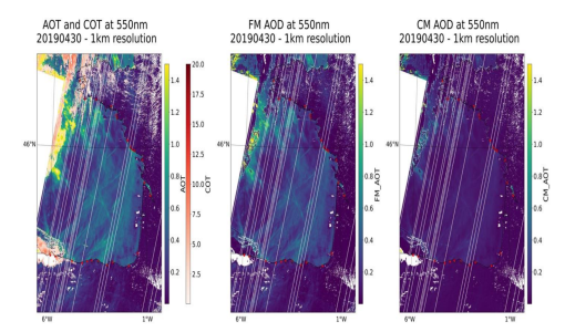
Ship trails in the Bay of Biscay observed using PROBA-V imagery
Ship trails have been perceived as convincing evidence of aerosol-cloud interaction. Ship emissions have been proven to contribute by about 1.9% and 2.9% to the increase in the global total and fine-mode aerosol optical thickness (AOT) respectively over a five year period (Peters et al. 20212).
Data - EO Sign In Authentication (Open)
PROBA-1 HRC
The HRC Level 1A product is an image with a pixel resolution of 8m. The data are grey scale images, an image contains 1026 x 1026 pixels and covers an area of 25 km2. HRC data is supplied in BMP format. All PROBA-1 passes are systematically acquired according to the current acquisition plan, HRC data are processed every day to Level 1A and made available to ESA users. Spatial coverage: Check the spatial coverage of the collection on a map available on the Third Party Missions Dissemination Service.
Mission - Third Party Missions
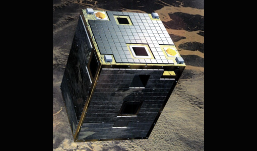
PROBA-1
PROBA-1 is a technology demonstration satellite that later became an operational Earth observation mission.
Document - General Reference
Earth-from-Space-Middle-East.pdf
This brochure is a collection of ENVISAT ASAR and MERIS, PROBA, ERS-2, Landsat mosaics.
Document - General Reference
Earth-from-Space-North-America.pdf
This brochure is a collection of Envisat MERIS, Envisat ASAR, Envisat AATSR, ERS, Proba and SPOT mosaics of North America.


