- All Categories (1015)
- Data (1)
- News (6)
- Missions (3)
- Tools (2)
- Activities (2)
- Documents (1001)
News - Data Release news
FDR4ALT - ESA unveils new cutting-edge ERS/Envisat Altimeter and Microwave Radiometer Datasets
The European Space Agency (ESA) has developed a comprehensive suite of innovative Earth system data records as part of the Fundamental Data Records for Altimetry project - FDR4ALT.
News - Events and Proceedings

Data preservation takes centre stage at Living Planet Symposium
Against the backdrop of the famed Rhine River, world-class scientists and Earth observation data-users are gathered this week in the historical city of Bonn, at the Living Planet Symposium (LPS).
News - Spotlight on EO community

Introducing Mirko Albani
In this short introduction, ESA's Heritage Missions Programme Manager describes what he likes most about ESA's long term archive of satellite mission data and his role in the programme.
News - Success Stories

How Envisat helped to shape global understanding of Earth’s systems
Twenty years have passed since a ground-breaking European spacecraft designed to deliver unprecedented insight into the planet’s changing environment was lofted into orbit.
Activity - Projects
Dragon 2 Cooperation Programme
The Dragon 2 Programme focussed on the exploitation of ESA, ESA's Third Party Missions and Chinese Earth observation data for science and applications development in land, ocean and atmospheric applications.
News - Success Stories

ERS Heritage Data allow for 30 years of science
At their time of launch thirty years ago, the two ERS satellites were the most sophisticated Earth observation spacecraft ever developed and launched by Europe.
News - Infographics

ERS - ESA’s first Earth observation satellites
To mark the 30th anniversary of ERS, we've released a new infographic summarising the mission.
Tools - Apps

Heritage Missions app for iOS
Download the Heritage Missions application to discover what the missions were about, how it worked and what the elements of the space and ground segment that make these missions unique.
Tools - Apps

Heritage Missions app for Android
Download the Heritage Missions application to discover what the missions were about, how it worked and what the elements of the space and ground segment that make these missions unique.
Data - Fast Registration with approval (Restrained)
Image 2007 European coverage
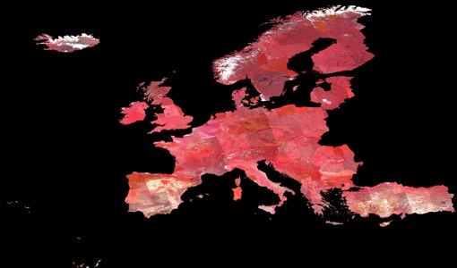
The Image 2007 collection is composed by products acquired by Disaster Monitoring Constellation 1st generation (DMC-1) satellites over European countries (plus Turkey) in 2007. The data provided in this collection are 32m multispectral images captured by the DMC SLIM-6 imager sensor, with two processing levels: L1R Band registered product derived from the L0R product L1T Orthorectified product derived from the L1R product using manually collected GCPs from Landsat ETM+ data and SRTM DEM V31 data Data disseminated come from the following satellites belonging to DMC-1 constellation: UK-DMC-1 Bejing-1 NigeriaSat-1 Spatial coverage: Check the spatial coverage of the collection on a map available on the Third Party Missions Dissemination Service.
Mission - Heritage Missions

Envisat
Envisat was ESA's successor to ERS. Envisat carried ten instruments aboard for a wide range of Earth observing fields. The mission was operational from 2002 to 2012.
Mission - Heritage Missions

ERS
The ERS programme was composed of two missions, ERS-1 and ERS-2, which together observed the Earth for 20 years, from 1991 to 2011.
Mission - Heritage Missions
DMC First Generation
The Disaster Monitoring Constellation (DMC) is a constellation of microsatellites formerly coordinated by DMCii to provide frequent observations of the Earth for monitoring natural disasters.
Activity - Quality
SCIRoCCo
The SCIRoCCo project is an interdisciplinary cooperation of scatterometry experts aimed at promoting the continuing exploitation of ESA's unique 20 years' worth of ERS Scatterometer data.
Document - Quality Report

Envisat RA-2 MWR Cyclic L2 Report 07 Jul 2003
Envisat RA-2 MWR Cyclic L2 Report
Document - Quality Report
Envisat RA-2 MWR Cyclic L2 Report 11 Aug 2003
Envisat RA-2 MWR Cyclic L2 Report
Document - Quality Report
Envisat RA-2 MWR Cyclic L2 Report 15 Sep 2003
Envisat RA-2 MWR Cyclic L2 Report
Document - Quality Report
Envisat RA-2 MWR Cyclic L2 Report 20 Oct 2003
Envisat RA-2 MWR Cyclic L2 Report
Document - Quality Report
Envisat RA-2 MWR Cyclic L2 Report 28 Apr 2003
Envisat RA-2 MWR Cyclic L2 Report
Document - Quality Report
Envisat RA-2 MWR Cyclic L2 Report 29 Dec 2003
Envisat RA-2 MWR Cyclic L2 Report