- All Categories (551)
- Data (12)
- News (6)
- Missions (1)
- Events (5)
- Tools (2)
- Activities (3)
- Documents (522)
Data - Fast Registration with approval (Restrained)
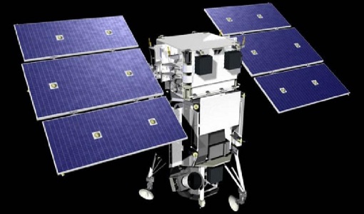
WorldView-1 full archive and tasking
WorldView-1 high resolution optical products are available as part of the Maxar Standard Satellite Imagery products from the QuickBird, WorldView-1/-2/-3/-4, and GeoEye-1 satellites. All details about the data provision, data access conditions and quota assignment procedure are described into the Terms of Applicability available in Resources section. In particular, WorldView-1 offers archive and tasking panchromatic products up to 0.50 m GSD resolution. Band Combination Data Processing Level Resolution Panchromatic Standard(2A)/View Ready STANDARD (OR2A) 50 cm, 30 cm HD View Ready Stereo 50 cm Map-Ready (Ortho) 1:12.000 Orthorectified 50 cm, 30 cm HD Native 50 cm resolution products are processed with MAXAR HD Technology to generate the 30 cm HD products: the initial special resolution (GSD) is unchanged but the HD technique increases the number of pixels and improves the visual clarity achieving aesthetically refined imagery with precise edges and well reconstructed details. As per ESA policy, very high-resolution imagery of conflict areas cannot be provided.
Data - Fast Registration with approval (Restrained)
WorldView ESA archive
The WorldView ESA archive is composed of products acquired by WorldView-1, -2, -3 and -4 satellites and requested by ESA supported projects over their areas of interest around the world Panchromatic, 4-Bands, 8-Bands and SWIR products are part of the offer, with the resolution at Nadir depicted in the table. Band Combination Mission GSD Resolution at Nadir GSD Resolution (20° off nadir) Panchromatic WV-1 50 cm 55 cm WV-2 46 cm 52 cm WV-3 31 cm 34 cm WV-4 31 cm 34 cm 4-Bands WV-2 1.84 m 2.4 m WV-3 1.24 m 1.38 m WV-4 1.24 m 1.38 m 8-Bands WV-2 1.84 m 2.4 m WV-3 1.24 m 1.38 m SWIR WV-3 3.70 m 4.10 m The 4-Bands includes various options such as Multispectral (separate channel for Blue, Green, Red, NIR1), Pan-sharpened (Blue, Green, Red, NIR1), Bundle (separate bands for PAN, Blue, Green, Red, NIR1), Natural Colour (pan-sharpened Blue, Green, Red), Coloured Infrared (pan-sharpened Green, Red, NIR). The 8-Bands being an option from Multispectral (COASTAL, Blue, Green, Yellow, Red, Red EDGE, NIR1, NIR2) and Bundle (PAN, COASTAL, Blue, Green, Yellow, Red, Red EDGE, NIR1, NIR2). The processing levels are: Standard (2A): normalised for topographic relief View Ready Standard: ready for orthorectification (RPB files embedded) View Ready Stereo: collected in-track for stereo viewing and manipulation (not available for SWIR) Map Scale (Ortho) 1:12,000 Orthorectified: additional processing unnecessary Spatial coverage: Check the spatial coverage of the collection on a map available on the Third Party Missions Dissemination Service. The following table summarises the offered product types EO-SIP Product Type Band Combination Processing Level Missions WV6_PAN_2A Panchromatic (PAN) Standard/View Ready Standard WorldView-1 and 4 WV6_PAN_OR Panchromatic (PAN) View Ready Stereo WorldView-1 and 4 WV6_PAN_MP Panchromatic (PAN) Map Scale Ortho WorldView-1 and 4 WV1_PAN__2A Panchromatic (PAN) Standard/View Ready Standard WorldView-2 and 3 WV1_PAN__OR Panchromatic (PAN) View Ready Stereo WorldView-2 and 3 WV1_PAN__MP Panchromatic (PAN) Map Scale Ortho WorldView-2 and 3 WV1_4B__2A 4-Band (4B) Standard/View Ready Standard WorldView-2, 3 and 4 WV1_4B__OR 4-Band (4B) View Ready Stereo WorldView-2, 3 and 4 WV1_4B__MP 4-Band (4B) Map Scale Ortho WorldView-2, 3 and 4 WV1_8B_2A 8-Band (8B) Standard/View Ready Standard WorldView-2 and 3 WV1_8B_OR 8-Band (8B) View Ready Stereo WorldView-2 and 3 WV1_8B_MP 8-Band (8B) Map Scale Ortho WorldView-2 and 3 WV1_S8B__2A SWIR Standard/View Ready Standard WorldView-3 WV1_S8B__MP SWIR Map Scale Ortho WorldView-3 As per ESA policy, very high-resolution imagery of conflict areas cannot be provided.
Document - Publication - Paper
Uniqueness of the ERS Scatterometer for nowcasting and typhoon forecasting
Paper presented to IGARSS-2005: Uniqueness of the ERS Scatterometer for nowcasting and typhoon forecasting
Document - General Reference
Two Years of ERS-1 Data Exploitation
This bulletin reports on the first two years of the ERS-1 satellite.
News - Thematic area articles
Transforming space data into climate action
ESA’s Earth observation activities are playing a key role in the revitalised global drive to combat climate change.
Document - Publication - Paper
Tracking of tropical cyclones with the ERS Scatterometer
Presented at IGARSS 1999: Tracking of tropical cyclones with the ERS Scatterometer
Document - Product Cal/Val Plan/Report
The-Calibration-of-the-ERS-1-Radar-Altimeter.pdf
This report describes the calibration of ERS-1's Radar Altimeter during the commissioning phase, which used Venice as a basis for calibration.
Document - General Reference
The Nine Candidate Earth Explorer Missions - Topography Mission
This report for assessment addresses the Topography mission when it was selected with other nine Earth Explorer missions as a potential candidate for Phase A study.
Document - Publication - Paper
THE ERS-2 SCATTEROMETER- INSTRUMENT AND DATA PERFORMANCES ASSESSMENT SINCE THE BEGINNING OF THE MISSION
Scatterometer performances presented to ERS-ENVISAT Symposium Montreux 2007 (paper): ERS-2 Scatterometer - Instrument and data performances assessment since the beginning of the mission
Document - Publication - Paper
The Advanced Scatterometer Processing System for ERS Data- Thirteen Years of Ocean Winds from Space
Document - Technical Note
Technical-Note-on-Data-Flows-and-Volumes-between-ISS-and-Other-Entities-of-the-ERS-1-Ground-Segment.pdf
This document lists all the messages exchanged between the Interface Subset (ISS) and the other entities of the ERS-1 Ground Segment.
Document - Publication - Paper
Stability of Amazon Backscatter at C-band- ERS1-2 and RADARSAT-1
Stability of Amazon Backscatter at C-band: Spaceborne Results from ERS-1/2 and RADARSAT-1
Document - General Reference
SMOS-ESAs-Water-Mission-Fact-sheet.pdf
This document provided a series of information on the SMOS mission.
Document - General Reference
Sentinel-1-The-Radar-Mission-for-GMES-Land-and-Sea-Services.pdf
This article is extracted from ESA Bulletin Nr. 131.
Activity - Quality
SCIRoCCo
The SCIRoCCo project is an interdisciplinary cooperation of scatterometry experts aimed at promoting the continuing exploitation of ESA's unique 20 years' worth of ERS Scatterometer data.
Document - Publication - Paper
Scatterometer Ground Processing Review for Gyro-Less Operations
Remote Sensing of the Ocean and Sea Ice: Scatterometer Ground Processing Review for Gyro-Less Operations

