- All Categories (17)
- Data (5)
- News (4)
- Missions (2)
- Events (2)
- Tools (3)
- Campaigns (1)
Tools - Catalogues

EO CAT
EO CAT is a data catalogue, offering a Next Generation Earth Observation system designed to manage end-user Earth Observation services.
Event - Workshop
EO for Agriculture Under Pressure 2024
EO for Agriculture Under Pressure 2024 Workshop follows up from previous events, bringing together the large community working on EO-based science and solutions for agriculture.
Tools - Catalogues

ESA PDGS DataCube
ESA's DataCube is a data catalogue that enables multi-temporal and pixel-based access to a subset of data available from ESA
Tools - Catalogues

FedEO
FedEO is a data catalogue that provides a unique entry point to a number of scientific catalogues and services for, but not limited to, European and Canadian missions.
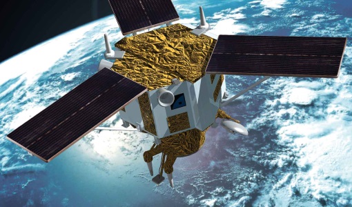
Mission - Earth Explorers

FLEX
The FLEX mission will provide global maps of vegetation fluorescence, which can be converted into an indicator of photosynthetic activity.
Campaign
FLEXSense 2018
The 2018 Fluorescence Explorer Sense (FLEXSense) campaign combined various field activities in preparation for the FLEX satellite mission.
Data - Campaigns (Open)
FLEXSense 2018
The 2018 Fluorescence Explorer Sense (FLEXSense) campaign combined various field activities in preparation for the FLEX satellite mission.
Event - Meeting

Fluorescence (FLEX) 2019
The FLEX 2019 meeting consisted of a series of events addressing remote sensing of vegetation fluorescence.
News - Thematic area articles
Global understanding of Earth's land surfaces greatly boosted by satellite data
ESA perform land surface monitoring with a range of instruments onboard satellites acquiring optical and radar data. Collections of data from these missions are freely available for research purposes.
Data - Fast Registration with approval (Restrained)
IKONOS ESA archive
ESA maintains an archive of IKONOS Geo Ortho Kit data previously requested through the TPM scheme and acquired between 2000 and 2008, over Europe, North Africa and the Middle East. The imagery products gathered from IKONOS are categorised according to positional accuracy, which is determined by the reliability of an object in the image to be within the specified accuracy of the actual location of the object on the ground. Within each IKONOS-derived product, location error is defined by a circular error at 90% confidence (CE90), which means that locations of objects are represented on the image within the stated accuracy 90% of the time. There are six levels of IKONOS imagery products, determined by the level of positional accuracy: Geo, Standard Ortho, Reference, Pro, Precision and PrecisionPlus. The product provided by ESA to Category-1 users is the Geo Ortho Kit, consisting of IKONOS Black-and-White images with radiometric and geometric corrections (1-metre pixels, CE90=15 metres) bundled with IKONOS multispectral images with absolute radiometry (4-metre pixels, CE90=50 metres). IKONOS collects 1m and 4m Geo Ortho Kit imagery (nominally at nadir 0.82m for panchromatic image, 3.28m for multispectral mode) at an elevation angle between 60 and 90 degrees. To increase the positional accuracy of the final orthorectified imagery, customers should select imagery with IKONOS elevation angle between 72 and 90 degrees. The Geo Ortho Kit is tailored for sophisticated users such as photogrammetrists who want to control the orthorectification process. Geo Ortho Kit images include the camera geometry obtained at the time of image collection. Applying Geo Ortho Kit imagery, customers can produce their own highly accurate orthorectified products by using commercial off the shelf software, digital elevation models (DEMs) and optional ground control. Spatial coverage: Check the spatial coverage of the collection on a map available on the Third Party Missions Dissemination Service.
Mission - Heritage Missions
IKONOS-2
At the time of its launch, IKONOS-2 brought imagery rivalling that of military satellites to the commercial market.
News - Infographics

Measuring photosynthetic fluorescence - ESA's FLEX mission
Learn about ESA's upcoming FLEX mission, which is dedicated to gathering information about photosynthetic activity to shed light on the functioning of Earth's vegetation, in our latest infographic.
News - Data Release news
New FLEX-related campaign datasets released
New datasets have been released for three campaigns, covering activities supporting the upcoming FLEX mission.
News - Thematic area articles

Satellite data central to ocean monitoring
Over 95% of Earth’s water is found in our oceans, and yet sadly, oceans are under stress from climate change and pollution. Monitoring our oceans is vital for Earth’s survival and satellites are the primary means of long-term and independent observation of our vast ocean bodies and their associated coastal zones.
Data - Campaigns (Open)

SoyFLEX 2015
SoyFLEX 2015 took place over the agricultural area around Jülich, Germany and Rzecin wetland site, Poland
Data - Campaigns (Open)
SoyFLEX II 2016
The SoyFLEX II experiment was a repetition of an experiment that took place during the 2015 campaign in Germany.
Data - Campaigns (Open)

SPARC
ESA's SPectra bARrax Campaign (SPARC) activity was part of the preparatory study for a proposed ESA Earth Explorer mission called SPECTRA. The objective was to collect a CHRIS/PROBA reference dataset for SPECTRA-related studies.