- All Categories (324)
- Data (1)
- News (1)
- Missions (5)
- Tools (2)
- Activities (1)
- Documents (314)
News - Success Stories
ERS Heritage Data allow for 30 years of science
At their time of launch thirty years ago, the two ERS satellites were the most sophisticated Earth observation spacecraft ever developed and launched by Europe.
Tools - Apps
Heritage Missions app for iOS
Download the Heritage Missions application to discover what the missions were about, how it worked and what the elements of the space and ground segment that make these missions unique.
Tools - Apps
Heritage Missions app for Android
Download the Heritage Missions application to discover what the missions were about, how it worked and what the elements of the space and ground segment that make these missions unique.
Data - Fast Registration with approval (Restrained)
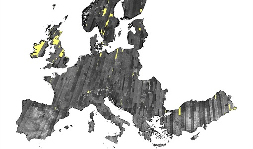
Image 2006 European coverage
The Image 2006 collection is a SPOT-4, SPOT-5 and ResourceSat-1 (also known as IRS-P6) cloud free coverage over 38 European countries in 2006 (from February 2005 to November 2007). The Level 1 data provided in this collection originate from the SPOT-4 HRVIR instrument (with 20 m spatial resolution), from SPOT-5 HRG (with 10 m spatial resolution resampled to 20 m) and IRS-P6 LISS III (with 23 m spatial resolution), each with four spectral bands. The swath is of about 60 km for the SPOT satellites and 140 km for the IRS-P6 satellite. In addition to the Level 1, the collection provides the same data geometrically corrected towards a European Map Projection with 25 m resolution. Spatial coverage: Check the spatial coverage of the collection on a map available on the Third Party Missions Dissemination Service.
Mission - Heritage Missions
ERS
The ERS programme was composed of two missions, ERS-1 and ERS-2, which together observed the Earth for 20 years, from 1991 to 2011.
Mission - Heritage Missions
IRS-1C and IRS-1D
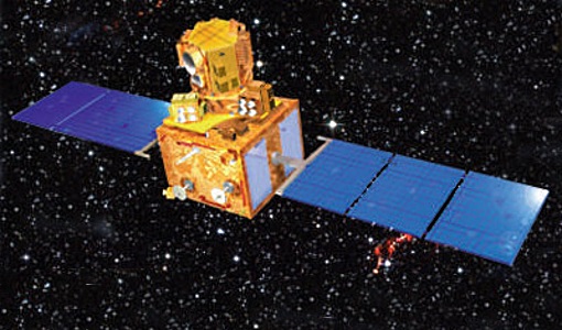
The Indian Remote Sensing satellites IRS-1C and IRS-1D were identical Earth-imaging satellites operated by the Indian Space Research Organisation.
Activity - Quality
SCIRoCCo
The SCIRoCCo project is an interdisciplinary cooperation of scatterometry experts aimed at promoting the continuing exploitation of ESA's unique 20 years' worth of ERS Scatterometer data.
Document - Proceedings
2004 Envisat and ERS Symposium
The 2004 Envisat and ERS Symposium was held in Salzburg - Austria from 6 to 10 September 2004. The 2004 Envisat and ERS Symposium provided a forum for investigators to present results of ongoing research project activities and assess the development of applications and services.
Document - Proceedings
ERS Thematic Workshop on Oil Pollution Monitoring in the Mediterranean
Proceedings of the Thematic Workshop on Oil Pollution in the Mediterranean, held on 25-26 March 1996 at ESA-ESRIN in Frascati, Italy.
Mission - Third Party Missions
IRS-R2 (ResourceSat-2)
IRS-R2 (ResourceSat-2) continues the remote sensing data services to global users provided by the ResourceSat-1 mission and also provides data with enhanced multispectral/ spatial coverage.
Mission - Heritage Missions
IRS-1D
IRS-1D was part of the IRS (Indian Remote Sensing) satellites, a large family of Earth observation satellites operated by ISRO.
Mission - Heritage Missions
IRS-1C
IRS-1C is part of the IRS (Indian Remote Sensing) satellites, a large family of Earth observation satellites operated by ISRO.
Document - Quality Report
ERS-2 AMI-SAR/AMI-Scatterometer Weekly Report 12 May 2002
ERS-2 AMI-SAR/AMI-Scatterometer Weekly Report
Document - Quality Report
ERS-2 AMI-SAR/AMI-Scatterometer Weekly Report 05 May 2002
ERS-2 AMI-SAR/AMI-Scatterometer Weekly Report
Document - Quality Report
ERS-2 AMI-SAR/AMI-Scatterometer Weekly Report 14 Apr 2002
ERS-2 AMI-SAR/AMI-Scatterometer Weekly Report
Document - Quality Report
ERS-2 AMI-SAR/AMI-Scatterometer Weekly Report 07 Apr 2002
ERS-2 AMI-SAR/AMI-Scatterometer Weekly Report
Document - Quality Report
ERS-2 AMI-SAR/AMI-Scatterometer Weekly Report 21 Apr 2002
ERS-2 AMI-SAR/AMI-Scatterometer Weekly Report
Document - Quality Report
ERS-2 AMI-SAR/AMI-Scatterometer Weekly Report 28 Apr 2002
ERS-2 AMI-SAR/AMI-Scatterometer Weekly Report


