- All Categories (38)
- Data (16)
- News (5)
- Missions (1)
- Events (8)
- Tools (2)
- Documents (6)
News - General News
ESA's improved Earth system data records: what is in store for the future?
Fundamental Data Records (FDRs) are instrumental in advancing our understanding of Earth systems and for addressing societal challenges effectively. These long-term records contain uncertainty-quantified, calibrated and geo-located multi-instrument/multi-platform satellite sensor data spanning several decades to support climate-related applications.
Document - Newsletter
Earth Online Newsletter - 08 March 2024
This issue of the Earth Online Newsletter covers a selection of the latest news and events from ESA.
News - Data Release news
FDR4ALT - ESA unveils new cutting-edge ERS/Envisat Altimeter and Microwave Radiometer Datasets
The European Space Agency (ESA) has developed a comprehensive suite of innovative Earth system data records as part of the Fundamental Data Records for Altimetry project - FDR4ALT.
Data - EO Sign In Authentication (Open)
Land Ice Thematic Data Product [ALT_TDP_LI]
This is the Land Ice Thematic Data Product (TDP) V1 resulting from the ESA FDR4ALT project and containing estimates of ice sheet surface elevation and associated uncertainties. The collection covers data for three different missions: ERS-1, ERS-2 and Envisat, and based on Level 1 data coming from previous reprocessing (ERS REAPER and the Envisat V3.0) but taking into account the improvements made at Level 0/Level 1 in the frame of FDR4ALT (ALT FDR). The Land Ice TDP focuses specifically on the ice sheets of Greenland and Antarctica, providing these data in different files. For many aspects, the Land Ice Level 2 and Level 2+ processing is very innovative: Improved relocation approach correcting for topographic effects within the beam footprint to identify the Point of Closest Approach Homogeneous timeseries of surface elevation measurements at regular along-track reference nodes. The FDR4ALT products are available in NetCDF format. Free standard tools for reading NetCDF data can be used. Information for expert altimetry users is also available in a dedicated NetCDF group within the products. Please consult the FDR4ALT Product User Guide before using the data. The FDR4ALT datasets represent the new reference data for the ERS/Envisat altimetry missions, superseding any previous mission data. Users are strongly encouraged to make use of these datasets for optimal results.
News - Success Stories
Decades of satellite data reveal the risks of climate tipping points
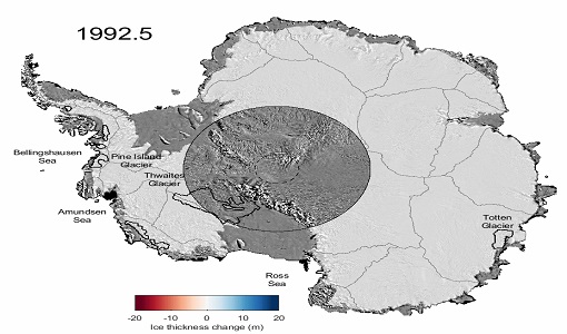
Decades-long time series that draw on ESA’s Earth observation archives are enabling scientists to uncover the threat of sudden and potentially irreversible changes to the icy parts of the planet.
News - Thematic area articles
Satellites reveal changes to Earth’s icy zones
ESA’s Earth observation activities are helping scientists investigate the influence of climate change on widespread ice-losses across the planet.
Event - Workshop
SEASAR 2006
ESA organised it's first SAR oceanography workshop, SEASAR 2006, entitled "Advances in SAR Oceanography from Envisat and ERS missions"
Event - Workshop
Fringe 2003 Workshop
The third ESA International Workshop on ERS SAR Interferometry and its first Workshop on ASAR interferometry: Advances in SAR interferometry from ERS and Envisat missions.
Event - Workshop
SEASAR 2008
The "Advances in SAR Oceanography from Envisat and ERS missions" was a thematic workshop on SAR remote sensing techniques for oceanography.
Tools - Apps
Heritage Missions app for iOS
Download the Heritage Missions application to discover what the missions were about, how it worked and what the elements of the space and ground segment that make these missions unique.
Data - Data Description
Envisat ASAR AP Co- and Cross-polar L0 [ASA_APC/APH/APV_0P]
The ASAR Alternating Polarization Mode Level 0 (Co-polar and Cross-polar H and V) products contain time-ordered Annotated Instrument Source Packets (AISPs) corresponding to one of the three possible polarisation combinations: HH & HV, VV & VH and HH & VV, respectively. The echo samples in the AISPs have been compressed to 4 bits/sample using FBAQ. This is a high-rate, narrow swath mode, so data is only acquired for partial orbit segments. There are two co-registered images per acquisition and may be from one of seven different image swaths. The Level 0 product was produced systematically for all data acquired within this mode. Data Size: 56-100 km across track x 100 km along track. There are three AP Mode Level 0 products: ASA_APH_0P: The Cross-polar H Level 0 product corresponds to the polarisation combination HH/HV. ASA_APV_0P: The Cross-polar V Level 0 product corresponds to the polarisation combination VV/VH. ASA_APC_0P: The Co-polar Level 0 product corresponds to the polarisation combination HH/VV= H and H received/V transmit and V received.
Tools - Other
Polar TEP
The Polar Thematic Exploitation Platform (TEP) enables access, processing, uploading, visualisation, manipulation and comparison of data over the polar regions.
Document - Proceedings
Fringe-2011-workshop-recommendations.pdf
This document contains the recommendations from the session summaries of the Fringe 2011 Workshop.
News - Infographics
Envisat - ESA's versatile Earth observation satellite
Learn more about ESA's Envisat mission - the largest Earth observation satellite ever built - in a new infographic.
Event - Workshop
Fringe 2011 Workshop
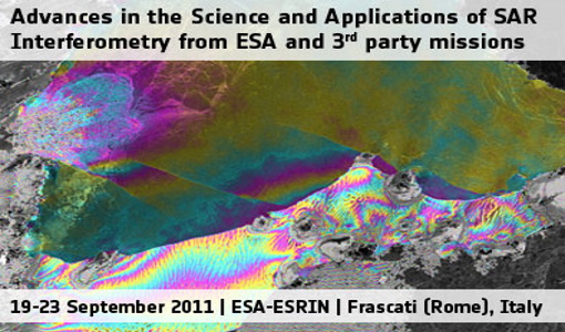
Fringe 2011 was the 8th International Workshop on "Advances in the Science and Applications of SAR Interferometry".
Data - Fast Registration with immediate access (Open)
Envisat RA-2 Geophysical Data Record - GDR [RA2_GDR__2P]
This is a RA-2 Geophysical Data Record (GDR) Full Mission Reprocessing (FMR) V3 product containing radar range and orbital altitude, wind speed, wave height, water vapour from the MWR and geophysical corrections. This FMR follows the first Envisat Altimetry reprocessing Version (V2.1) completed in 2012. The GDR and S-GDR data products were reprocessed for all cycles from 6 to 113 (May 2002 to April 2012) into a homogeneous standard in NetCDF format (close to Sentinel-3). For many aspects, the V3.0 reprocessed data are better than the previous dataset: In terms of available and valid data, the coverage is better, notably thanks to a better availability of MWR data at the beginning of the mission In terms of performance at cross-overs, the quality is improved: the annual signal and average of Mean SSH is decreased, as well as the standard deviation The new MWR characteristics were shown to improve largely the global quality of data. As well as the new tide model, the new MSS and the new orbit standard The Global and regional Mean Sea Level trend is very weakly impacted though the effort was put, this time, on the mesoscale restitution, rather than long term drift, as during V2.1 reprocessing. Please consult the Envisat RA-2/MWR Product Quality Readme file PDF before using the data.
Data - Fast Registration with immediate access (Open)
Envisat RA-2 Sensor and Geophysical Data Record - SGDR [RA2_MWS__2P]
This is a RA-2 Sensor and Geophysical Data Record (SGDR) Full Mission Reprocessing (FMR) V3 product. This FMR follows the first Envisat Altimetry reprocessing Version (V2.1) completed in 2012. The GDR and S-GDR data products were reprocessed for all cycles from 6 to 113 (May 2002 to April 2012) into a homogeneous standard in NetCDF format (close to Sentinel-3). The Sensor Data Record (SGDR) Product from RA-2/MWR includes the data in the GDR product (RA-2 geophysical data, MWR data) and also RA-2 averaged waveforms (18Hz) and RA-2 individual waveforms (1800Hz). This product is a continuation of ERS RA data. This data product has a coverage of 1 pass and pole to pole, a spatial sampling of about 390 m along track and a size of 31 to 40 MB, depending on presence of individual waveforms. The radiometric accuracy is 0.2 dB and auxiliary data include: Orbit state vectors (DORIS, FOS), RA2 and MWR characterisation data, Platform attitude, Gain calibration, USO frequency, ECMWF data, time relation, leap second, Ionospheric corrections, geoid, mean sea surface, slope data, and tide model (ocean, earth, loading, pole). Please consult the Envisat RA-2/MWR Product Quality Readme file before using the data.
Data - Fast Registration with immediate access (Open)
ERS-1/2 SCATTEROMETER Ocean Wind field and Sea Ice probability [ASPS20.H/ASPS20.N]
The ASPS Level 2 products contain, for each node: the radar backscattering sigma nought for the three beams of the instrument, the four aliased wind solutions (Rank 1-4 wind vector) and the de-aliased wind vector flag, the sea-ice probability and sea-ice flag, the YAW quality flag. The wind retrieval is performed with the CMOD5N geophysical model function derived by ECMWF to compute the neutral winds rather than 10 m winds. ASPS L2.0 High resolution products are provided with a spatial resolution of 25x25 km and a grid spacing of 12.5 km. ASPS L2.0 Nominal resolution products are provided with a spatial resolution of 50x50 km and a grid spacing of 25 km. One product covers one orbit from ascending node crossing. Please consult the Product Quality Readme file before using the ERS ASPS data.
Data - EO Sign In Authentication (Open)
ERS-1/2 SAR IM Single Look Complex L1 [SAR_IMS_1P]
The SAR SLC product is a single look complex acquired in Image Mode. It is a digital image, with slant range and phase preserved, generated from raw SAR data using up-to-date auxiliary parameters. The products are intended for use in SAR quality assessment, calibration and interferometric applications. A minimum number of corrections and interpolations are performed on the data. Absolute calibration parameters (when available) are provided in the product annotation. Product characteristics: Pixel size: 8 m (range - across track) x 4 m (azimuth - along track – varying slightly depending on acquisition Pulse Repetition Frequency) Scene area: 100 km (range) x at least 102.5 km (azimuth) Scene size: 5000 samples (range) x at least 30000 lines (azimuth) Pixel depth: 32 bits signed integer (16 bits I, 16 bits Q) Total product volume: 575 MB Projection: Slant range- Number of looks: 1.
Data - Data Service Request (Restrained)
ERS-1/2 SAR IM L0 [SAR_IM__0P]
This SAR Level 0 product is acquired in Image Mode. The products consist of the SAR telemetry data and are supplied as standard scenes. It also contains all the required auxiliary data necessary for data processing. The product serves two main purposes: For testing ERS SAR processors independently from the HDDR system For users interested in full SAR data processing. Product characteristics: Scene area: 100 km (range - across track) x full segment length (azimuth - along track) Scene size: 5616 samples (range) x full segment length (azimuth) Pixel depth: 10 bits signed integer (5 bits I, 5 bits Q) Projection: Slant range.


