- All Categories (42)
- Data (13)
- News (14)
- Missions (3)
- Events (1)
- Campaigns (1)
- Documents (10)
News - Spotlight on EO community
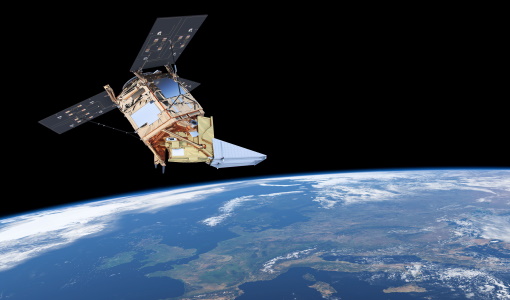
An overview of the EarthCARE mission
In this video, meet Björn Frommknecht, Mission Manager of ESA's upcoming EarthCARE satellite.
Data - Announcement of Opportunity (Restrained)

Announcement of Opportunity for NoR
ESA invites submissions for the Network of Resources (NoR) call, which aims to support research, development and pre-commercial users to innovate their working practices, moving from a data download paradigm towards a 'bring the user to the data' paradigm.
Data - External Data (Restrained)
Aura OMI complete NASA dataset
The OMI observations provide the following capabilities and features: A mapping of ozone columns at 13 km x 24 km and profiles at 13 km x 48 km A measurement of key air quality components: NO2, SO2, BrO, HCHO, and aerosol The ability to distinguish between aerosol types, such as smoke, dust and sulfates The ability to measure aerosol absorption capacity in terms of aerosol absorption optical depth or single scattering albedo A measurement of cloud pressure and coverage A mapping of the global distribution and trends in UV-B radiation. The OMI data are available in the following four levels: Level 0, Level 1B, Level 2, and Level 3. Level 0 products are raw sensor counts. Level 0 data are packaged into two-hour "chunks" of observations in the life of the spacecraft (and the OMI aboard it) irrespective of orbital boundaries. They contain orbital swath data. Level 1B processing takes Level 0 data and calibrates, geo-locates and packages the data into orbits. They contain orbital swath data. Level 2 products contain orbital swath data. Level 3 products contain global data that are composited over time (daily or monthly) or over space for small equal angle (latitude longitude) grids covering the whole globe.
Document - Product Handbook

AVHRR-Handbook.pdf
The AVHRR user handbook provides details about the content of the consolidated and harmonised data set archived at ESA facilities.
Mission - Copernicus Sentinels
Copernicus Sentinel-5P
The Copernicus Sentinel-5 Precursor mission is the first Copernicus mission dedicated to monitoring our atmosphere.
News - Events and Proceedings

Data preservation takes centre stage at Living Planet Symposium
Against the backdrop of the famed Rhine River, world-class scientists and Earth observation data-users are gathered this week in the historical city of Bonn, at the Living Planet Symposium (LPS).
News - Infographics

EarthCARE - ESA's cloud, aerosol and radiation explorer mission
Learn about ESA’s upcoming cloud, aerosol and radiation explorer mission – EarthCARE – in our latest infographic.
Event - Workshop

EarthCARE pre-launch science and validation workshop
The EarthCARE pre-launch Science and Validation Workshop will bring together the community to discuss the science of this upcoming cloud and aerosol mission, and offer the opportunity to discuss validation activities.
News - Events and Proceedings
EarthCARE pre-launch science workshop a success
Held between 13 and 17 November 2023, in ESA’s Earth Observation facility in Frascati, Italy, the ESA-JAXA pre-launch EarthCARE science and validation workshop brought together nearly 250 participants, representing a vibrant worldwide scientific community that is eagerly awaiting the mission’s launch.
Document - Product Document

EarthCARE-BBR-L1-PDD.pdf
This documents purpose is to describe the format and content of the L1 nominal products for the BBR processor (The EarthCARE Broadband Radiometer).
Document - Product Document
EarthCARE-CALVAL-AO.pdf
This document is an Announcement of Opportunity for EarthCARE Calibration and Validation.
Document - Product Cal/Val Plan/Report

EarthCARE-CALVAL-MainText.pdf
This document is the main EarthCARE Calibration and Validation call plan.
Document - Product Document
EarthCARE-CALVAL-Work-Agreement.pdf
This document is a form that describes the agreed project activity to be executed for EarthCARE Calibration and Validation.
Document - Product Document
EarthCARE-CDP.pdf
This document describes the protocol for the handling of correlative data for EarthCARE validation. It is the Correlative Data Protocol.
Document - Product Document
EarthCARE-ESA-product-list.pdf
This document presents the list of EarthCARE science data products recommended by the European and Canadian members of the EarthCARE Mission Advisory Group (MAG) to be developed and generated operationally by or under the supervision of ESA.
Document - Product Document
EarthCARE-Geophysical-Parameters.xlsx
This document is a form meant to be filled in to accompany EarthCARE data requests.
Document - Product Document
EarthCARE-instrument-descriptions.pdf
This document contains descriptions of the instruments on EarthCARE - ATLID (Atmospheric LiDAR), BBR (Broadband Radiometer), CPR (Cloud Profiling Radar), and the MSI (Multi Spectral Imager).
Document - Product Document
EarthCARE-Production-Model.pdf
This document presents the Production Model for EarthCARE science data products.
Mission - Heritage Missions

Envisat
Envisat was ESA's successor to ERS. Envisat carried ten instruments aboard for a wide range of Earth observing fields. The mission was operational from 2002 to 2012.
Data - EO Sign In Authentication (Open)
Envisat MERIS Full Resolution - Level 1 [MER_FRS_1P/ME_1_FRG]
The MERIS Level 1 Full Resolution (FR) product contains the Top of Atmosphere (TOA) upwelling spectral radiance measurements. The in-band reference irradiances for the 15 MERIS bands are computed by averaging the in-band solar irradiance of each pixel. The in-band solar irradiance of each pixel is computed by integrating the reference solar spectrum with the band-pass of each pixel. The MERIS FR Level 1 product has Sentinel 3-like format starting from the 4th reprocessing data released to users in July 2020. Each measurement and annotation data file is in NetCDF 4. The Level 1 product is composed of 22 data files: 15 files containing radiances at each band (one band per file), accompanied by the associated error estimates, and 7 annotation data files. The 15 sun spectral flux values provided in the instrument data file of the Level 1 products are the in-band reference irradiances adjusted for the Earth-sun distance at the time of measurement. The band-pass of each pixel is derived from on-ground and in-flight characterisation via an instrument model. The values "Band wavelength" and "Bandwidth" provided in the Manifest file of the Level 1b products are the averaged band-pass of each pixel over the instrument field of view. Auxiliary data are also listed in the Manifest file associated to each product. The Level 1 FR product covers the complete instrument swath. The product duration is not fixed and it can span up to the time interval of the input Level 0 (for a maximum of 20 minutes). Thus the estimated size of the Level 1 FR is dependent on the start/stop time of the acquired segment. During the Envisat mission, acquisition of MERIS Full Resolution data was subject to dedicated planning based on on-demand ordering and coverage of specific areas according to operational recommendations and considerations. See yearly and global density maps to get a better overview of the MERIS FR coverage.