- All Categories (25631)
- Data (60)
- News (164)
- Missions (9)
- Events (33)
- Tools (17)
- Activities (26)
- Campaigns (9)
- Documents (25313)
DATA
Discover and download the Earth observation data you need from the broad catalogue of missions the European Space Agency operate and support.
Data - EO Sign In Authentication (Open)

Fundamental Data Records for Radiometry [MWR_FDR___]
This dataset is a Fundamental Data Record (FDR) resulting from the ESA FDR4ALT project. The Fundamental Data Record for Radiometry V1 products contain intercalibrated Top of the Atmosphere brightness temperatures at 23.8 and 36.5 GHz. The collection covers data for the ERS-1, ERS-2 and Envisat missions, and is built upon a new processing of Level 0 data, incorporating numerous improvements in terms of algorithms, flagging procedures, and corrections. Compared to existing datasets, the Radiometry FDR demonstrates notable improvements in several aspects: New solutions for instrumental effects (ERS Reflector loss, Skyhorn, and Sidelobe corrections) Native sampling rate of 7Hz with enhanced coverage The FDR4ALT products are available in NetCDF format. Free standard tools for reading NetCDF data can be used. Information for expert altimetry users is also available in a dedicated NetCDF group within the products. Please consult the FDR4ALT Product User Guide before using the data. The FDR4ALT datasets represent the new reference data for the ERS/Envisat altimetry missions, superseding any previous mission data. Users are strongly encouraged to make use of these datasets for optimal results.
Data - EO Sign In Authentication (Open)

Fundamental Data Records for Altimetry [ALT_FDR___]
This dataset is a Fundamental Data Record (FDR) resulting from the ESA FDR4ALT project. The Fundamental Data Record for Altimetry V1 products contain Level 0 and Level 1 altimeter-related parameters including calibrated radar waveforms and supplementary instrumental parameters describing the altimeter operating status and configuration through the satellite lifetime. The data record consists of data for the ERS-1, ERS-2 and Envisat missions for the period ranging from 1991 to 2012, and bases on the Level 1 data obtained from previous ERS REAPER and ENVISAT V3.0 reprocessing efforts incorporating new algorithms, flags, and corrections to enhance the accuracy and reliability of the data. For many aspects, the Altimetry FDR product has improved compared to the existing individual mission datasets: New neural-network waveform classification, surface type classification, distance to shoreline and surface flag based on GSHHG Instrumental calibration information directly available in the product Improved Orbit solutions Correction of REAPER drawbacks (i.e., time jumps and negative waveforms) The FDR4ALT products are available in NetCDF format. Free standard tools for reading NetCDF data can be used. Information for expert altimetry users is also available in a dedicated NetCDF group within the products. Please consult the FDR4ALT Product User Guide before using the data. The FDR4ALT datasets represent the new reference data for the ERS/Envisat altimetry missions, superseding any previous mission data. Users are strongly encouraged to make use of these datasets for optimal results.
Data - EO Sign In Authentication (Open)
Sea Ice Thematic Data Product [ALT_TDP_SI]
This is the Sea Ice Thematic Data Product (TDP) V1 resulting from the ESA FDR4ALT project and containing the sea ice related geophysical parameters, along with associated uncertainties: snow depth, radar and sea-ice freeboard, sea ice thickness and concentration. The collection covers data for the ERS-1, ERS-2 and Envisat missions, and bases on Level 1 data coming from previous reprocessing (ERS REAPER and the Envisat V3.0) but taking into account the improvements made at Level 0/Level 1 in the frame of FDR4ALT (ALT FDR). The Sea Ice TDP provides data from the northern or southern hemisphere in two files corresponding to the Arctic and Antarctic regions respectively for the winter periods only, i.e., October to June for the Arctic, and May to November for the Antarctic. For many aspects, the Sea Ice TDP is very innovative: First time series of sea-ice thickness estimates for ERS Homogeneous calibration, allowing the first Arctic radar freeboard time series from ERS-1 (1991) to CryoSat-2 (2021) Uncertainties estimated along-track with a bottom-up approach based on dominant sources ERS pulse blurring error corrected using literature procedure [Peacock, 2004] The FDR4ALT products are available in NetCDF format. Free standard tools for reading NetCDF data can be used. Information for expert altimetry users is also available in a dedicated NetCDF group within the products. Please consult the FDR4ALT Product User Guide before using the data. The FDR4ALT datasets represent the new reference data for the ERS/Envisat altimetry missions, superseding any previous mission data. Users are strongly encouraged to make use of these datasets for optimal results.
Data - EO Sign In Authentication (Open)
Land Ice Thematic Data Product [ALT_TDP_LI]
This is the Land Ice Thematic Data Product (TDP) V1 resulting from the ESA FDR4ALT project and containing estimates of ice sheet surface elevation and associated uncertainties. The collection covers data for three different missions: ERS-1, ERS-2 and Envisat, and based on Level 1 data coming from previous reprocessing (ERS REAPER and the Envisat V3.0) but taking into account the improvements made at Level 0/Level 1 in the frame of FDR4ALT (ALT FDR). The Land Ice TDP focuses specifically on the ice sheets of Greenland and Antarctica, providing these data in different files. For many aspects, the Land Ice Level 2 and Level 2+ processing is very innovative: Improved relocation approach correcting for topographic effects within the beam footprint to identify the Point of Closest Approach Homogeneous timeseries of surface elevation measurements at regular along-track reference nodes. The FDR4ALT products are available in NetCDF format. Free standard tools for reading NetCDF data can be used. Information for expert altimetry users is also available in a dedicated NetCDF group within the products. Please consult the FDR4ALT Product User Guide before using the data. The FDR4ALT datasets represent the new reference data for the ERS/Envisat altimetry missions, superseding any previous mission data. Users are strongly encouraged to make use of these datasets for optimal results.
Data - EO Sign In Authentication (Open)
Inland Waters Thematic Data Product [ALT_TDP_IW]
This is the Inland Waters Thematic Data Product (TDP) V1 resulting from the ESA FDR4ALT project and containing improved Water Surface Height (WSH) data record from the ERS-1, ERS-2 and Envisat missions estimated using the ICE1 retracking range for its better performance on the hydro targets. The FDR4ALT products are available in NetCDF format. Free standard tools for reading NetCDF data can be used. Information for expert altimetry users is also available in a dedicated NetCDF group within the products. Please consult the FDR4ALT Product User Guide before using the data. The FDR4ALT datasets represent the new reference data for the ERS/Envisat altimetry missions, superseding any previous mission data. Users are strongly encouraged to make use of these datasets for optimal results.
Data - EO Sign In Authentication (Open)
Ocean and Coastal Topography Thematic Data Product [ALT_TDP_OC]
This is the Ocean and Coastal Topography Thematic Data Product (TDP) V1 resulting from the ESA FDR4ALT project and containing improved sea surface height anomaly data records both at 1 Hz and 20 Hz resolution to address climate and/or coastal areas studies. The collection covers data for the ERS-1, ERS-2 and Envisat missions. Note that a dedicated processing to coastal zones has been applied for coastal distances below 200 km. Compared to existing datasets, the Ocean and Coastal Topography TDP demonstrates notable improvements in several aspects: Up-to-date orbit and geophysical corrections applied Adaptive retracker for Envisat The FDR4ALT products are available in NetCDF format. Free standard tools for reading NetCDF data can be used. Information for expert altimetry users is also available in a dedicated NetCDF group within the products. Please consult the FDR4ALT Product User Guide before using the data. The FDR4ALT datasets represent the new reference data for the ERS/Envisat altimetry missions, superseding any previous mission data. Users are strongly encouraged to make use of these datasets for optimal results.
Data - EO Sign In Authentication (Open)
Ocean Waves Thematic Data Product [ALT_TDP_WA]
This is the Ocean Waves Thematic Data Product (TDP) V1 resulting from the ESA FDR4ALT project and containing Significant Wave Height estimates for the ERS-1, ERS-2 and Envisat missions. Compared to existing datasets, the Ocean Waves TDP demonstrates notable improvements in several aspects: Great improvements for Envisat due to noise reduction from Adaptive retracker and High-Frequency Adjustment (HFA) All variables are given at 5 Hz The FDR4ALT products are available in NetCDF format. Free standard tools for reading NetCDF data can be used. Information for expert altimetry users is also available in a dedicated NetCDF group within the products. Please consult the FDR4ALT Product User Guide before using the data. The FDR4ALT datasets represent the new reference data for the ERS/Envisat altimetry missions, superseding any previous mission data. Users are strongly encouraged to make use of these datasets for optimal results.
Data - EO Sign In Authentication (Open)
Atmospheric Thematic Data Product [MWR_TDPATM]
This is the Atmospheric Thematic Data Product (TDP) V1 resulting from the ESA FDR4ALT project and containing Total Column Water Vapour (TCWV), Cloud Liquid Water Path (LWP), Atmospheric Attenuation of the altimeter backscattering coefficient at Ku-band (AttKu), and Wet Tropospheric Correction (WTC), retrieved from observations of the Microwave Radiometer (MWR) instruments flown on-board the ERS-1, and ERS-2, and Envisat satellites. Compared to existing datasets, the Atmospheric TDP demonstrates notable improvements in several aspects: Improved temporal coverage, especially for ERS-2 Improved L0 -> 1 processing Two different corrections are provided based on a neural network retrieval or on a 1D-VAR approach The FDR4ALT products are available in NetCDF format. Free standard tools for reading NetCDF data can be used. Information for expert altimetry users is also available in a dedicated NetCDF group within the products. Please consult the FDR4ALT Product User Guide before using the data. The FDR4ALT datasets represent the new reference data for the ERS/Envisat altimetry missions, superseding any previous mission data. Users are strongly encouraged to make use of these datasets for optimal results.
Data - Sample Data (Open)

CryoSat Data Samples
Download CryoSat data samples from Baseline-B, C, and D products.
Data - Announcement of Opportunity (Restrained)

Announcement of Opportunity for S3VT (Sentinel-3 Validation Team)
In the framework of a Copernicus collaborative agreement ESA and EUMETSAT invite interested groups and individuals to support the Sentinel-3 Validation Team (S3VT).
Data - Campaigns (Open)
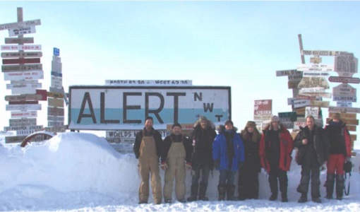
CryoVExGround 2011
The aims of the CryoVEx 2011 experiment, operating out of Alert base, was to study the snow and ice characteristics of Arctic sea ice and its snow cover during winter.
Data - Campaigns (Open)
CryoVExAnt 2014/2015
The aim of CryoVEx Ant 2014 to 2015 was to perform altimeter measurements at a designated validation site in the vicinity of the Schirmacher Oasis, near Kohnen and Neumayer as well as in the Pine Island Glacier drainage basin.
Data - Campaigns (Open)

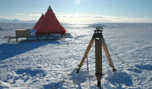
CryoVExAnt 2010/2011
The CryoVEx 2010/2011 Antartic campaign was carried out in Dronning Maud Land from 11 November 2010 to 20 February 2011.
Data - Campaigns (Open)
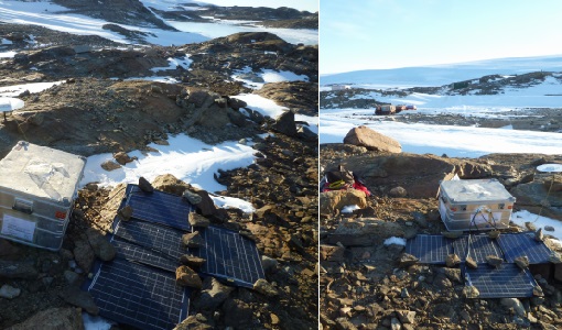
CryoVExAnt 2008/2009
The key objective of the CryoSat Validation Experiment Antarctica (CryoVExAnt) campaign is a better approximation of the error range of the elevation obtained from SAR-processed altimetric radar returns and its sensitivity to surface roughness.
Data - EO Sign In Authentication (Open)

VT GOCE Data
This collection contains the VT GOCE software and associated data set needed to run the software that is used for GOCE data visualisation.
Data - Open access (Open)
Swarm Core
Spherical harmonic model of the main (core) field and its temporal variation.
Data - Open access (Open)
Swarm Ionosphere/Magnetosphere
Spherical harmonic model of the large-scale magnetospheric field and its Earth-induced counterpart, spherical harmonic model of the daily geomagnetic variation at middle latitudes and low latitudes, Ionospheric bubble index, ionospheric total electron content, ionosphericfield-aligned currents, dayside ionospheric equatorial electric field, ionospheric plasma density and plasma irregularities.
Data - Open access (Open)
Swarm Level 2 daily
The Swarm Level 1b data products are the corrected and formatted output from each of the three Swarm satellites. By a complex assimilation of these individual satellite measurements into one set of products for the satellite constellation, the Swarm Level 2 Processor ensures a very significant improvement of the quality of the final scientific data products.
