- All Categories (14)
- News (5)
- Missions (1)
- Events (4)
- Campaigns (2)
- Documents (2)
Event - Workshop

VH-RODA 2024
The 2024 VH-RODA workshop provides an open forum (for the new space, commercial and institutional space sectors) for presenting and discussing the current status and future developments related to Earth Observation data quality, calibration and validation of space-borne very high-resolution SAR and Optical sensors and data products.
News - Infographics
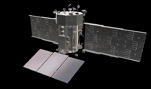
Twin satellites - TerraSAR-X and TanDEM-X
DLR's TerraSAR-X and TanDEM-X are twin satellites flying in close formation to acquire SAR data of unique geometric accuracy. Operating together, the missions deliver data that are used to generate Digital Elevation Models of Earth.
News - Data Release news
New BorealScat campaign dataset released
A new dataset has been released for the BorealScat campaign, which took place between 2017 and 2021 in Sweden.
News - Events and Proceedings

National missions in the spotlight at the Living Planet Symposium
In the framework of ESA’s Third Party Missions (TPM) programme, the agency offers access to the full data archives of almost 50 satellite missions, which are owned by organisations around the world.
Event - Workshop

VH-RODA 2022
The 2022 VH-RODA workshop will provide an open forum (for the new space, commercial and institutional space sectors) for presenting and discussing the current status and future developments related to Earth Observation data quality, calibration and validation of space-borne very high-resolution SAR and Optical sensors and data products.
Event - Workshop
VH-RODA 2023
The 2023 VH-RODA workshop provided an open forum (for the new space, commercial and institutional space sectors) for presenting and discussing the current status and future developments related to Earth Observation data quality, calibration and validation of space-borne very high-resolution SAR and Optical sensors and data products.
News - Success Stories
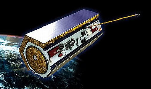
SAOCOM the Argentinean constellation with an Italian twist
Composed of two satellites launched in 2018 and 2019 respectively, the SAOCOM satellite mission, managed and operated by Argentina's Space Agency, CONAE, covers an array of applications that greatly benefit Earth observation and disaster monitoring.
News - Data Release news
New imaging modes added to PAZ collection
Two new imaging modes, Wide ScanSAR and Staring Spotlight, have been added to the PAZ offering and are now available to users for research and application development following submission of a project proposal subject to evaluation and acceptance by ESA and the data owner.
Mission - Third Party Missions

SAOCOM
The SAOCOM (SAtélite Argentino de Observación COn Microondas) satellite series represents Argentina's approved polarimetric L-band SAR constellation of two spacecraft. It's objective is to provide an effective Earth observation and disaster monitoring capability.
Document - Algorithms Theoretical Baseline Document

EarthCARE-CPR-L1B-ATBD.pdf
This document describes the theoretical basis of Level 1b algorithm, except for the spacecraft data processing, for the EarthCARE Cloud Profiling Radar (CPR).
Document - Product Document

EarthCARE-CPR-L1B-PDD.pdf
The purpose of this document is to specify the format and content of the L1 products for the EarthCARE CPR (Cloud Profiling Radar).
Event - Workshop
VH-RODA 2021 Workshop
The Very High-resolution Radar & Optical Data Assessment (VH-RODA) 2021 workshop was held online from 20–23 April 2021.
Campaign

TerraSARSIM
The objectives of the TerraSAR SIM project were to quantify the impact of the time intervals between SAR acquisitions at different wavelengths on agricultural applications.
Campaign
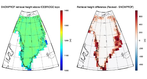
SnowSum
The SnowSum experiment is designed to support the development of future concepts to monitor the cryosphere.