- All Categories (949)
- Data (1)
- News (1)
- Missions (2)
- Tools (2)
- Documents (943)
Data - Announcement of Opportunity (Restrained)
Announcement of Opportunity for S3VT (Sentinel-3 Validation Team)
In the framework of a Copernicus collaborative agreement ESA and EUMETSAT invite interested groups and individuals to support the Sentinel-3 Validation Team (S3VT).
Tools - Apps
Heritage Missions app for Android
Download the Heritage Missions application to discover what the missions were about, how it worked and what the elements of the space and ground segment that make these missions unique.
Document - Technical Note
CryoSat-Characterisation-for-FBR-users-ARESYS-ESA.zip
This document contains the CryoSat system and SIRAL instrument characterization parameters that can be useful to CryoSat users to processBaselineCFBR data.The information provided in this document does not apply to FBR products from the previous Baselines.
Document - Technical Note
CryoSat-2-Guidelines-for-reverting-Waveform-Power-Sigma-Nought-in-SAR-mode.pdf
The scope of thisTechnical Note is tofeatureknow-howand recipes in ordertoextract the sigma nought information from CryoSat-2 data productsin SAR mode.
Mission - Copernicus Sentinels
Copernicus Sentinel-3
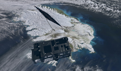
Copernicus Sentinel-3 is an European Earth Observation satellite mission developed to support Copernicus ocean, land, atmospheric, emergency, security and cryospheric applications.
Mission - Heritage Missions
Envisat
Envisat was ESA's successor to ERS. Envisat carried ten instruments aboard for a wide range of Earth observing fields. The mission was operational from 2002 to 2012.
Tools - Analysis
VtCryoSat
VtCryoSat is a tool for easily browsing and downloading CryoSat products through an interactive and graphical web interface.
News - Data Release news
Updated Precise Orbit data (POD) for the full ERS-1 and ERS-2 mission available
The Precise Orbit files (ERS.ORB.POD) for the entire ERS-1 and ERS-2 mission periods have been reprocessed with up-to-date standards.
Document - Product Document
CryoSat-Mission-and-Data-Document.pdf
The purpose of this document is to provide information about the CryoSat mission and its implementation.
Document - Product Cal/Val Plan/Report
CryoSat-Calibration-and-Validation-Concept.pdf
This document intends to provide a description of a calibration and validation approach that is understandable by wider scientific users of the CryoSat data.
Document - Product Cal/Val Plan/Report
CryoSat-In-Flight-Calibration-Approach.pdf
This document determines the in-flight calibration activities for CryoSat. These activities will (largely) be performed within the Commissioning Phase1 and this document is an input to the overall Commissioning Phase Plan, AD 1.
Document - Technical Note
CryoSat-Science-and-Mission-Requirements.pdf
This document describes the CryoSat mission. It aims to provide the scientist and the engineer with an explanation of the importance of the mission, and the basis for the design of the CryoSat satellite and instrument payload.
Document - Technical Note
CryoSat-Data-Processing-Concept.pdf
The purpose of this document is to provide information to groups or individuals with an interest in this activity that will aid the focussing and planning of their activity. It contains an outline of the schedule and approach to the development of pre-launch and post-launch baseline processing algorithms, together with an identification of new processing algorithms whose optimisations requires particular post-launch attention.
Document - Technical Note
CryoSat-2-L2-Design-Summary-Document.pdf
This document is the Design Summary Document [DSD] for the CryoSat 2 Level 2 IPF2 processing system, developed by University College London’s Mullard Space Science Laboratory. The code runs under the Linux operating system, specifically CentOS.
Document - Technical Note
CryoSat-2-New-Mean-Sea-Surface-for-the-L2-SAR-Chain.pdf
POM were asked to supply a new mean sea surface for use in sea ice freeboard retrieval in the second pass of the Baseline-C L2 SAR chain. The mean sea surface used in previous releases of the L2 SAR chain was constructed by UCL in 2004 for use with CryoSat-1.
Document - Technical Note
Known-Biases-in-CryoSat-Level-1b-products.pdf
The following known biases that affected CryoSat Level 1b products before Baseline C are hereafter considered: Datation biases, Range biases, Mispointing angle biases.
Document - Technical Note
CryoSat-Footprints-ESA-Aresys.pdf
In this paragraph, the beam-limited, the pulse-limited and the pulse-Doppler-limited footprints for CryoSat are discussed.
Document - Technical Note
CryoSat-Mission-and-Data-Description.pdf
The purpose of this document is to provide information about the CryoSat mission and its implementation. The level of detail is intended to be such that the potential users, and other scientists, will be in a position to understand the capabilities and limitations of the system as well as the nature of the information it will deliver.
Document - General Reference
The Nine Candidate Earth Explorer Missions - Topography Mission
This report for assessment addresses the Topography mission when it was selected with other nine Earth Explorer missions as a potential candidate for Phase A study.
Document - General Reference
The-Changing-Earth-New-Scientific-Challenges-for-ESAs-Living-Planet-Programme.pdf
This article is extracted from ESA Bulletin Nr. 129.


