- News & Events
- RADARSAT data on demand
- Laos flood
Laos flood
08 Oct 2020
Laos flood
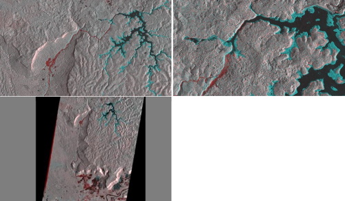
Acquired on 23 July 2018, these RADARSAT-2 Extra Fine and Wide Ultra Fine images show a change detection flood product in the Province of Attapeu, of the Laos Dam Collapse.
The Extra Fine (XF0W2) HH Polarisation scene was taken before the event on 10 July 2018, and the Wide Ultra Fine (U21W2) HH Polarisation scene was taken after the event, on 24 July 2018.
The different colours indicated in the image display drained and flooded areas after the event took place. The blue area indicates part of the reservoir that drained because of the dam collapse, while the red area indicates the area where flooding took place – mostly downstream villages. The area where the red and blue meet is where the Dam was located and the collapse took place.
Copyright: MDA Geospatial Services Inc. (2018)
