- WorldView-4
- Mission
- WorldView-4 Overview
WorldView-4 Overview
Mission Background
Worldview-4 (formerly GeoEye-2), served as a companion to WorldView-3, and was added by Maxar to its satellite constellation to offer multispectral high-resolution optical imagery.
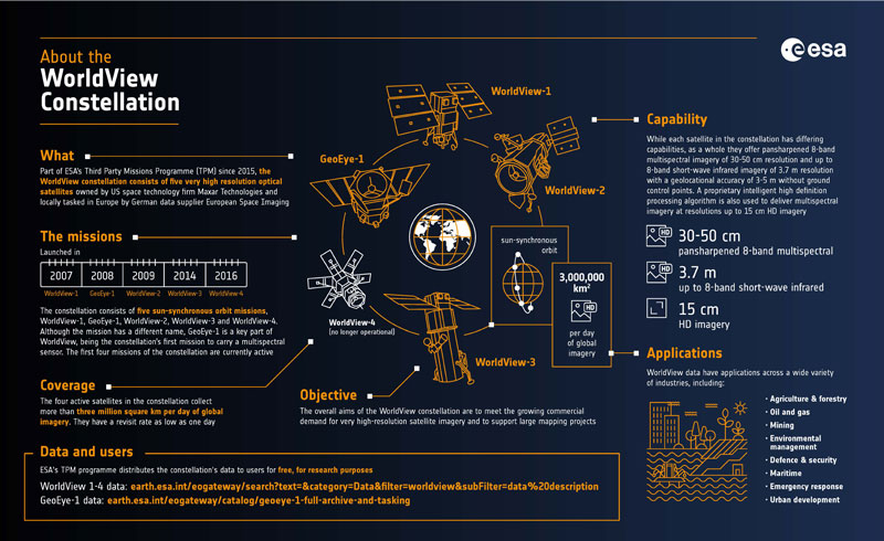
WorldView Infographic
Learn about Maxar's WorldView Constellation, which is part of ESA's Third Party Missions programme:
Satellite Design
WorldView-4 was a very high resolution imaging satellite that provided high resolution and colour imagery to commercial, government and international customers. It provided map-accurate images with a high-resolution camera - WV110 - provided by Harris Corporation. In addition to delivering critical geospatial situational awareness and global security information to intelligence analysts, militaries, and decision makers, access to imagery from WorldView-4 is also available to commercial users.
| Mass | 2087 kg |
| Dimensions | 5.3 m x 2.5 m |
| Design Lifetime | 7 years |
Mission Operations
WorldView-4 circled Earth in a 617 km, 98 degree Sun-synchronous orbit allowing an average revisit time of less than one day.
The architectural design of WorldView sees customers downloading data from their own ground stations. Amazon Web Services have set up a cloud service for customers to receive data from the Amazon ground station.
Related Links
Learn more about WorldView-4:
*The information provided is sourced and updated by external entities. For further details, please consult our Terms and Conditions page.