- Meteosat Second Generation
- Mission
- Meteosat Second Generation Ove...
Meteosat Second Generation Overview
Mission Background
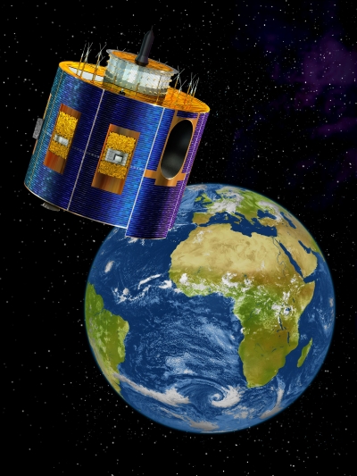
MSG (Meteosat Second Generation) consists of a series of four geostationary meteorological satellites, along with ground-based infrastructure, that will operate consecutively until 2020.
The launch dates of Meteosat were:
- MSG-1/Meteosat-8: 28 August 2002
- MSG-2/Meteosat-9: 21 December 2005
- MSG-3/Meteosat-10: 5 July 2012
- MSG-4: 15 July 2015
For almost 30 years ESA has been building Europe's orbital weather satellites: the Meteosat series of geostationary spacecraft, the first of which was launched in 1977. The success of the early Meteosats led to the creation of the European Organisation for the Exploitation of Meteorological Satellites (EUMETSAT) in 1986.
ESA was responsible for designing and developing the first MSG satellite, and for procuring the other three on behalf of EUMETSAT. Meanwhile EUMETSAT has responsibility for defining the payload based on user needs, procuring the ground segment and launchers, and operating the system.
By using the very latest, state of the art technology, the satellites monitor weather development and processes closely enough to allow accurate predictions of adverse weather over the next few hours anywhere over the satellite's footprint. Airports get an earlier warning of impending fog, local authorities will know when to grit the roads before a cold snap, construction companies will be able to plan ahead for wet weather and farmers plan harvests. The commercial implications, as well as the convenience, of accurate short-term weather forecasting, or 'nowcasting', are far reaching.
Now more than ever, we need to understand the processes driving the weather and climate on our planet. Short-lived extreme weather phenomena, such as hurricane and floods, seem to be becoming more frequent and severe. We suspect that human processes are at least partly responsible, but we're not sure how. We also suspect that these same processes are driving long-term climate change, but the evidence is still inconclusive. Our need for the tools to predict severe weather at short notice and to monitor long-term atmospheric change has never been greater.
Mission Operations
| Orbit Time | Repeat Cycle | Mass in Orbit | Imager Mass | Imager Ground Sampling Distance | Power Capability |
|---|---|---|---|---|---|
| 24 hour (geostationary) Orbit Height: 35,800 km | 15-mins (full disc) Rapid Scan 5-mins (Europe) | 1,200 kg | 260 kg | 1 km Ch 12 (HRV) 3 km Ch 1–11 (VIS, IR, WV) | 600 W average |
MSG transmits raw atmospheric data to the EUMETSAT control and processing centre in Darmstadt, Germany, via the primary ground station, for processing. The raw data will consist mainly of images generated by the camera (SEVIRI) and the Geostationary Earth Radiation Budget Experiment on board the satellite. Once processed, the data is sent back to the satellite for broadcasting to users. Furthermore, data collection platforms on ships, balloons, aircraft and ground–based platforms also send meteorological data such as local temperature, wind speed and humidity directly to users via the satellite.
The primary ground station sends the processed data to users via the satellite at a high and a low rate. High Rate Information Transmission (HRIT) contains the full volume of processed, compressed image data and Low Rate Information Transmission (LRIT) will contain a reduced set at lower resolution. In addition, the EUMETSAT Control and Processing Centre, with support from other satellite applications facilities throughout Europe, extracts information from the processed data and turns it into 'products' of particular use to meteorologists and climatologists, such as wind field diagrams, maps of upper tropospheric humidity and analyses of cloud shape and height. To receive data or 'products', users must register with EUMETSAT and equip themselves with an appropriate receiving station. The design of the communications package on board MSG is sophisticated enough to cope with the enormous volume of data and the multiple paths it needs to transfer information between ground facilities, satellite and users.
MSG also includes a transponder to relay SOS messages at 406 MHz to a central reception station in Europe, from which they will be sent to the appropriate rescue organisations. This system is run by the COSPAS-Sarsat organisation, which achieves global coverage by having several search and rescue transponders on geostationary and other satellites.