- Learn & Discover
- Space data support Earth’s ecosystems
- WorldView-3 images classify sa...
WorldView-3 images classify savannah land types
30 Jan 2024
Title: WorldView-3 images classify savannah land types
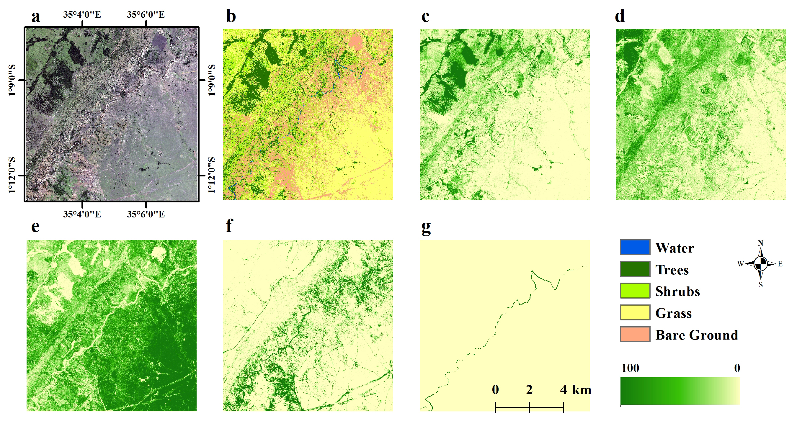
Description: The high resolution WorldView-3 data allowed high-accuracy mapping of the five elementary land cover types. One of the six WorldView-3 images (10 km × 10 km) is shown here: (a) True-colour composite image (1.2 m); (b) Corresponding supervised land cover classification map (1.2 m); and Estimated fractional cover (10 m) for (c) trees, (d) shrubs, (e) grass, (f) bare ground, and (g) water.
Copyright: ESA/Maxar.