- Learn & Discover
- How ESA uses space data to explore deep Earth
- InSAR helps map earthquakes
InSAR helps map earthquakes
18 May 2022
Title: InSAR helps map earthquakes
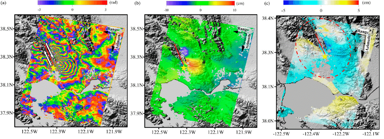
Description: (a) Coseismic interferogram derived from COSMO-SkyMed SAR images (acquisition date: 26 July 2014/27 August 2014), (b) LOS deformation field after phase unwrapping. Red line denotes the fault surface rupture trace, yellow star denotes the epicentre, and white arrows indicate the fault slip direction. (c) Difference between the COSMO-SkyMed and Sentinel-1A InSAR observations of Napa event, red dotted ellipse denotes the significantly deformed area.
Copyright: Ying-Hui, Yang et al (2017)