 Asset Publisher
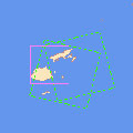
Satellite Planning for Flood in Fiji Islands, April 2012Envisat satellite planning for the flood in the Fiji Islands, April 2012. 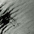
Satellite Planning for gas leak at Elgin Platform (North Sea), March 2012Envisat satellite planning and images of the gas leak at Elgin Platform in the North Sea, March 2012. 
Satellite Planning for Earthquake in Chile, March 2012Envisat satellite planning for the 7.1 magnitude earthquake that struck Chile in March 2012. 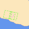
Satellite Planning for Earthquake in Mexico, March 2012Envisat satellite planning for the 7.4 magnitude earthquake that struck Mexico in March 2012. 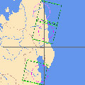
Satellite Planning for Flood and Ocean Storm in Madagascar, March 2012Envisat satellite planning for Cyclone Irina's impact on Madagascar in March 2012. 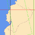
Satellite Planning for Floods in Ecuador, March 2012Envisat satellite planning for the floods and landslides in Ecuador during March 2012. 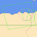
Satellite Planning for Flood in Algeria, February 2012Envisat satellite planning for the floods in Algeria during February 2012. 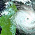
Satellite Planning for Tropical Cyclone Giovanna (Madagascar), February 2012Envisat satellite planning and images for Tropical Cyclone Giovanna's impact on Madagascar in February 2012. 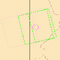
Satellite Planning for Flood in Peru, February 2012Envisat satellite planning for floods in Peru during February 2012. 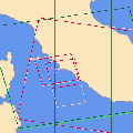
Satellite Planning for potential oil spill in Italy (Giglio Island), January 2012Envisat satellite planning for the Costa Concordia disaster on the coast of Giglio Island, Italy, in January 2012. 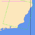
Satellite Planning for Floods in Brazil, January 2012Envisat satellite planning for floods in Brazil during January 2012. 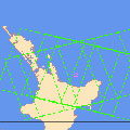
Satellite Planning for Oil Spill in New Zealand, January 2012Envisat satellite planning for oil spill in New Zealand, January 2012. 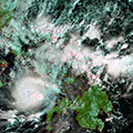
Satellite Planning for Flood in the Philippines, December 2011Envisat satellite planning and images for flooding in the Philippines during December 2011. 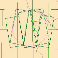
Satellite Planning for Earthquake in Turkey, October 2011Envisat satellite planning for the 7.2 magnitude earthquake that struck Turkey in October 2011. 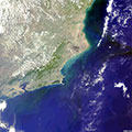
Satellite Planning for Oil Spill in Brazil, November 2011Envisat satellite planning and images for an oil spill in Brazil during November 2011. 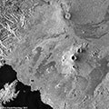
Satellite Planning for Volcano in Democratic Republic of Congo, November 2011Envisat satellite planning and images of Nyamulagira volcano, which erupted in November 2011 in the Democratic Republic of Congo. 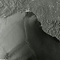
Satellite Planning for Flood in Italy, October 2011Envisat satellite planning and images of flooding in Genoa, Italy, during October and November 2011. 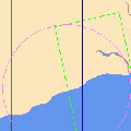
Satellite Planning for Flood in Ghana, October 2011Envisat satellite planning for floods in Ghana during October 2011. 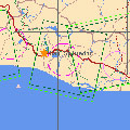
Satellite Planning for Flood in El Salvador, October 2011Envisat satellite planning for flooding in El Salvador, during October 2011. 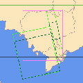
Satellite Planning for Flood in Cambodia, October 2011Envisat satellite planning for the flooding in Cambodia, during October 2011. |
||