|
Seville, Spain (1984-2004)
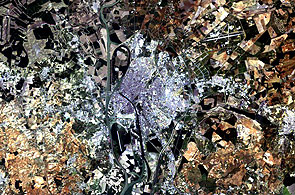
Twenty years separate these two Landsat thematic mapper images of the city of Seville, Spain. They clearly highlight the urbanisation that the city underwent during the 1980s by allowing a comparison between the 2004 image on the right and the 1984 image on the left. Rome, Roma in Italian and Latin, is the capital city of Italy and of its Latium region. It is located on the lower Tiber River, near the coasts of the Tyrrhenian Sea. During this period, the expansion of the city included the development of the Isla de la Cartuja, west of the centre of the city, which hosted the Universal Exposition in 1992 and whose buildings are still widely used today. One of these buildings is the 70,000-seater Cartuja Olympic stadium to the north of the island which is visible as a white, square structure. The 2004 image also shows the bridges that were constructed at the time of the Exposition in 1992. The Alamillo and the Quinto Centernario bridges join the Isla de la Cartuja to the city centre. The images also trace the urbanisation of the areas to the northeast, where urban development in the areas of Parque Alcosa, Torreblanca de los Caqos and Urbanizacion Montequintos can be seen creeping towards the airport of San Pablo and to the far west of the city, in the areas of Tomares, Bormujos and Castilleja de La Cuesta. The first Landsat-5 image was acquired on 19 April 1984 – This Landsat Thematic Mapper image shows Seville, Spain's fourth largest city, as it was in 1984. At that time it was home to some 670,000 people. The Santa Justa railway station is clearly visible at the centre of the city. The runways of the San Pablo Airport can be seen to the northeast. The Isla de la Cartuja, just west of the centre of the city, is surrounded by the east and west branches of the Guadalquivir River prior to the changes that took place as a result of the Universal Exposition of 1992. Here it is still an area mainly composed of parks and cultivated agricultural land. The six bridges that cross over the Guadalquivir are visible on the west branch of the river and five over the eastern branch. The second Landsat-5 image was acquired on 19 August 2004 – In 2004, the city of Seville is currently home to over 700,000 people. Urbanisation has given birth to suburbs in the northeast and west and new roads and bridges have been built to connect the outskirts to the city centre. The structures built for the Universal Exposition of 1992 are now visible on the Isla de la Cartuja, west of the city's centre. Most of these structures are still used today and one of these buildings is the 70,000 seater Estadio Olimpico de la Cartuja to the north of the island which is visible as a white, square structure. The newly-built, ultramodern Alamillo and Quinto Centenario bridges now join the Isla de la Cartuja to the city centre.
|
||||||||||||||||||||||


