- Tools
- SMOS Global Mapping Tool
SMOS Global Mapping Tool
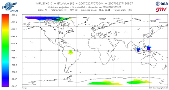
The SMOS Global Mapping Tool (GMT) is useful for plotting the SMOS data into a single global geographical map. The GMT is also able to visualise additional quantities derived from SMOS data (i.e. first Stokes parameter) and to filter data based on the quality flag available in the SMOS products.
The tool requires a Linux operating system and the installation of the IDL virtual machine or a licensed version of IDL (v8.7 or above).
This new version of SMOS GMT was compiled and tested using IDL 8.7 and we can't guarantee full support or compatibility on older IDL versions. In support of this, the Software User Manual also requires IDL 8.7 as a minimum requirement for this software to work.
You can simply call the GMT from the command line specifying a configuration file to be used as the only argument. By setting the appropriate values in this configuration file, you will be able to select the parameters to be plotted according to the product type. You will also be able to specify the projection, map centre, filters, format of the output files, etc.
Although just a single parameter will be visualised at a time (i.e. on one single geographic map), several parameters can be specified in the configuration file; in this case the tool will generate as many geographic maps as specified parameters. For that purpose, you would need to be acquainted with the various L1 and L2 SMOS products in order to define the appropriate configuration for the GMT.
The GMT configuration files themselves are based on a human-readable XML format, and thus they can be written or modified by hand through a regular text editor, or created by means of a specific XML tool.
Download
To update the GMT with the latest version of the SMOS product BinX schemas, please follow the instructions provided in Chapter 7 of the GMT Software User Manual.
- Download the latest version of the GMT Installer (V4.01)
- Download the latest version of the GMT libraries (V4.01)
- Download the GMT Software User Manual
- Download the latest version of the BinX SMOS product schema package
- Download the BinX schema package release note
- Download an example of the configuration file map: SMOS level 1C Brightness Temperature
- Download the GMT Interface Control Document to learn more about how the configuration files are created