- All Categories (17005)
- Data (1)
- News (45)
- Missions (35)
- Events (21)
- Activities (2)
- Campaigns (2)
- Documents (16899)
MISSIONS
Explore the European Space Agency's Earth Observation satellite missions. Learn all about ESA's dedicated Earth Explorers or collaborations with other agencies through the Third Party Missions programme.
Mission - Earth Explorers

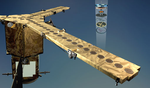
GOCE
Explorer (GOCE) mission mapped Earth's geoid very accurately, opening a window into Earth's interior structure as well as the currents
Mission - Heritage Missions
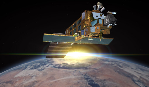
MOS-1/1B
MOS-1 and 1B, Japan’s first marine observation satellites, were designed to monitor ocean currents, sea surface temperature
Mission - Third Party Missions

ICEYE
Currently, the satellites operate in five modes called 'Strip Mode', 'Spot Mode', 'Scan Mode', 'Spot Extended Area (SLEA)
Mission - Heritage Missions

Seasat
The instrument had the objectives of the determination of sea surface profiles, currents, wind speeds and wave heights.
Mission - Earth Explorers
SMOS product availability
+ NIR + Long LO + FTT LO + Electrical Stability LO + NIR + Long + FTT LO + Short LO + Long + Short Current
Mission - Earth Explorers
Geographical Mode Mask
The current operational Geographical Mode Mask v5.0 The current version of the geographical mode mask v5.0 has been in operation
Mission - Earth Explorers
GOCE Objectives
Thanks to this current, the coastal waters of Europe are 4°C warmer than waters at equivalent latitudes in the north Pacific
Mission - Heritage Missions
Seasat Objectives
wealth of information on diverse ocean phenomena such as sea-surface winds and temperatures, surface and internal waves, currents
Mission - Heritage Missions
ASAR Processor Releases
August 2009 5.03L03 9 October 2009 5.04 17 September 2010 6.00 16 December 2011 6.02 30 April 2012 6.03 3 July 2015 (current
Mission - Earth Explorers

SMOS Objectives
SMOS Science The SMOS mission is a direct response to the current lack of global observations of soil moisture and ocean
Mission - Earth Explorers

Special Datasets Overview
CryoSat Antarctic Digital Elevation Model - Download the current CryoSat product Antarctic DEM.
Mission - Heritage Missions

RA (ERS)
the RA provided information on significant wave height; surface wind speed; sea surface elevation, which relates to ocean currents
Mission - Earth Explorers
EGG
This opened a window into Earth's interior structure, as well as the currents circulating within the depths of its oceans
Mission - Heritage Missions

ERS Radar Course 1
Therefore, microwaves easily penetrate clouds, and images can be acquired independently of the current weather conditions
Mission - Earth Explorers
SSTI ANTEX Data
data were generated from 154 days in 2009 GOCE SSTI-B PCVs data were generated from the available data in 2010-2012 The current
Mission - Earth Explorers

Products Information
here, these are intended for the purpose of becoming familiar with the format of the CryoSat Science Products from the current
Mission - Earth Explorers
Products Information
For an optimal exploitation of the current SMOS L2 data set V620 consult the read-me-first notes available for V620 soil
Mission - Heritage Missions
GOCE re-entry dataset
with further dynamical and environmental information such as on-board magnetometer measurements of Earth's magnetic field, currents
Mission - Earth Explorers
About CRYO2ICE
The measurements will also help map snow over the poles and advance our understanding of currents in polar oceans, with further
Mission - Earth Explorers
SMOS Overview
Mission Background The SMOS mission is a direct response to the current lack of global observations of soil moisture and