- All Categories (10810)
- News (12)
- Missions (8)
- Events (8)
- Activities (1)
- Documents (10781)
News - Success Stories
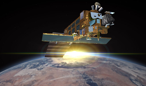
Trailblazing ERS-2 mission enables climate change applications
Varied elevations of Bachu in western China InSAR is currently one of the most accurate methods to generate digital elevation
News - Thematic area articles
Tracking the world’s forests from space
Deforestation in Brazil Scientist’s understanding of the health of the world’s forests is being further improved through current
Document - General Reference

The International Charter- Space and Major Disasters
The Charter is an important step forward in linking the needs of disaster and relief organisations with space technology solutions to help mitigate the effects of disaster on human life, property and the environment.
Document - General Reference
Taking-the-Measure-of-Earth-Fifteen-Years-of-Progress-in-Radar-Altimetry.pdf
This article is extracted from ESA Bulletin Nr. 128.
Document - General Reference
Spill-Science-and-Technology-Bulletin-Special-issue-on-ERS-oil-pollution-monitoring.pdf
This special issue of the Spill Science and Technology Bulletin provides a feature on the ERS SAR contribution to oil pollution monitoring in the Mediterranean.
Document - General Reference
spaceborne-radar-applications-in-geology-an-introduction.pdf
This document is intended for geologists who are interested in broadening their knowledge of interpretation of imaging radar data. It introduces imaging radar as it may be used by technicians and image interpreters. Interferometric SAR is briefly treated, with some basic and practical hints. An illustrated application study on land subsidence is included.
News - Thematic area articles
Space data support Earth’s ecosystems
Currently, it is not possible to measure photosynthetic activity from space, but the forthcoming FLuorescence EXplorer (FLEX
Event - Workshop

Space and the Arctic 2009 Workshop
possibilities for the future : Volker Liebig, Director of ESA EO Programme Observations of the Arctic - EUMETSAT's Contribution to Current
News - Infographics
Showcasing success stories from ESA's Heritage Missions
success stories showcased used data from ESA's ERS (European Remote Sensing) and Envisat satellites in combination with current
Event - Workshop

SEASAR 2012
Aouf 14:00 - 14:20 Towards consistent inversion of wind, waves and surface current from SAR Bertrand Chapron (IFREMER, France
Event - Workshop
SEASAR 2008
of the workshop were: Wave mode processing algorithms, product validation and assimilation Ocean Wind applications Ocean Current
Document - General Reference
Remote-Sensing-and-Humanitarian-Aid-A-life-saving-combination.pdf
This article was published in the ESA Bulletin Nr. 122 and describes how Earth Observation activities may answer to the requirements of humanitarian and aid workers.
Mission - Heritage Missions
Products Availability L2
7.03 Last update on 25 May 2016 - Issue 1.0 Year Total orbits Products available Percentage of availability L0 products currently
Mission - Heritage Missions
Products Availability L0
Last update on 29 March 2017 - Issue 1.3 Year Total orbits Products available Percentage of availability Products currently
Mission - Heritage Missions
Products Anomalies
The status of the MIPAS consolidated data sets currently available can be accessed here.
Mission - Heritage Missions

MIPAS Quality Control Reports
Maps are currently available only for a limited part of the mission.
Mission - Heritage Missions
MIPAS Processor Releases
day/night discrimination REPRO Phase F 5.06 migsp 2.7 mical 1.6 4L 1C 5B 4C 8.6 Bug fixes: - Wrong 'Number of sweeps in current
News - Success Stories

Long-term satellite data show wind farms can affect local air currents
Long-term measurements allow before and after comparison Data from the heritage Envisat satellite currently maintained accessible
Document - General Reference
In-action-around-the-world-the-International-Charter-Space-and-Major-Disasters.pdf
This is an article extracted from the ESA Bulletin Nr.143.
Document - General Reference
Hydrological-Processes-An-International-Journal-Special-issue-on-Remote-Sensing.pdf
This special issue of Hydrological Processes contains a selection of the most significant reports presented at the Flood Monitoring Workshop held at the ESA/ESRIN premises in Frascati, Italy on 26-27 June 1995. It is intended to provide the reader with an overall assessment of the capability of remote sensing to contribute to flood risk management, including the advantages and limitations, as well as critical areas, for further improvement.