- All Categories (1577)
- Data (27)
- News (43)
- Missions (4)
- Events (24)
- Tools (11)
- Activities (4)
- Campaigns (6)
- Documents (1458)
NEWS
Discover the latest news on the European Space Agency's Earth Observation activities. Learn all about new data availability and how ESA's missions are performing.
News - General News
 8 Apr 2024
ESA's improved Earth system data records: what is in store for the future?
Fundamental Data Records (FDRs) are instrumental in advancing our understanding of Earth systems and for addressing societal challenges effectively. These long-term records contain uncertainty-quantified, calibrated and geo-located multi-instrument/multi-platform satellite sensor data spanning several decades to support climate-related applications.
News - How to guides
27 Mar 2024HEDAVI Discover: a step-by-step guide
The Heritage Data Visualisation tool (HEDAVI) is a platform developed by the French Science Consulting for Earth Observation group, VisioTerra, which allows users to freely access over 40 years of ESA Earth Observation Heritage data, Third Party Missions and some Copernicus data.
News - Data Release news
 22 Mar 2024
ICEYE Dwell mode now available to users
ICEYE Dwell mode products are now available through ESA’s Third Party Missions programme.
News - Announcement of Opportunity updates
 18 Mar 2024
Announcement of Opportunity for SAOCOM – deadline extended
The submission deadline for the ESA/CONAE Announcement of Opportunity for SAOCOM mission data has been extended until 31 December 2024.
News - Success Stories
14 Mar 2024How scientists are unlocking the potential of SAOCOM
A team of scientists has drawn on SAOCOM data to measure the heights of forests in Argentina, marking the first time that tree canopies have been mapped using the two-satellite constellation.
News - Data Release news
8 Mar 2024FDR4ALT - ESA unveils new cutting-edge ERS/Envisat Altimeter and Microwave Radiometer Datasets
The European Space Agency (ESA) has developed a comprehensive suite of innovative Earth system data records as part of the Fundamental Data Records for Altimetry project - FDR4ALT.
News - Infographics
21 Feb 2024Showcasing the NovaSAR-1 radar satellite
Learn about the NovaSAR-1 mission in our new infographic.
News - Announcement of Opportunity updates
23 Jan 2024ESA encourages S-band applications with NovaSAR-1 Announcement of Opportunity
ESA is offering possibilities to develop new applications in the S-band microwave frequency range, with a new Announcement of Opportunity for NovaSAR-1 data, via ESA’s Third Party Mission programme.
News - Operational News
28 Nov 2023Change of access to FTP-S for ERS and Envisat Radar Altimeter data
As of 29 November 2023, access to the ERS-1/2 and Envisat Radar Altimeter data will be changed from simple FTP to FTP-S.
News - Success Stories
29 June 2023ESA missions help to reveal worldwide lake water loss trend
Climate change, human consumption and sedimentation are depleting more than half of the world’s biggest lakes of water, according to a ground-breaking analysis that drew on three decades of satellite data.
News - Spotlight on EO community
20 June 2023Introducing the Biomass and SMOS Mission Manager
In this video, Klaus Scipal describes his role as Mission Manager of Biomass and SMOS, and what he enjoys about his involvement with these dedicated science missions.
News - Thematic area articles
9 Dec 2022Global understanding of Earth's land surfaces greatly boosted by satellite data
ESA perform land surface monitoring with a range of instruments onboard satellites acquiring optical and radar data. Collections of data from these missions are freely available for research purposes.
News - How to guides
 5 Dec 2022
How to request level zero radar data from ERS and Envisat
To apply to use level zero (A)SAR radar data from ESA’s European Remote Sensing satellites (ERS-1 and ERS-2) and its Envisat mission for research purposes, you should prepare and submit an online form – called a Data Service Request – to put forward your proposed project to ESA for evaluation.
News - Success Stories
 10 Nov 2022
Long-term satellite data show wind farms can affect local air currents
Decades of satellite data have allowed for the first long-term study of the impact of offshore wind farms on downstream wind flow in coastal areas.
News - Success Stories
 25 Oct 2022
Studying forest biomass from space
Forestry expert Maurizio Santoro, senior researcher at Gamma Remote Sensing and one of the leaders of ESA projects related to the Climate Change Initiative (CCI), explains how the use of various data.
News - Infographics
 13 Oct 2022
The COSMO-SkyMed series - Two generations of SAR satellites
Learn about the COSMO-SkyMed (Constellation of small Satellites for the Mediterranean basin Observation) series in our latest infographic.
News - Success Stories
 6 Oct 2022
Decades of satellite data reveal the risks of climate tipping points
Decades-long time series that draw on ESA’s Earth observation archives are enabling scientists to uncover the threat of sudden and potentially irreversible changes to the icy parts of the planet.
News - Events and Proceedings
 28 Sept 2022
Very High Resolution data to take centre stage
In the last few years, European New Space providers have helped strengthen the offering of very high resolution remote sensing data products—a designated workshop this November aims to focus on the latest developments in this arena.
News - Spotlight on EO community
 22 Sept 2022
Meet a young researcher who studies the behaviour of volcanoes worldwide
Researcher Camila Novoa Lizama, of the University of Leeds, recently analysed how the use of Synthetic Aperture Radar (SAR) imagery over the Puyehue Cordón-Caulle Volcanic Complex, in Chile, acquired by ALOS-1, Envisat and the Copernicus Sentinel-1 satellites, helped her team to better comprehend the temporal and spatial behaviour of ground displacements before, during and after the volcano’s last eruption.
News - Data Release news
 8 Sept 2022
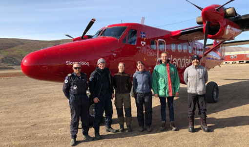
New CryoVEx campaign datasets released
Two new datasets have been released for the CryoVEx campaign, covering activities in Spring and Summer 2019.