- All Categories (90)
- Data (10)
- News (44)
- Missions (7)
- Events (3)
- Tools (9)
- Activities (2)
- Documents (15)
News - Spotlight on EO community
Spotlight on Third Party Mission provider: EUSI
European Space Imaging (EUSI) is one of ESA’s suppliers of commercial Very High Resolution (VHR) satellite imagery for scientific research in Earth Observation (EO).
News - How to guides
HEDAVI Discover: a step-by-step guide
The Heritage Data Visualisation tool (HEDAVI) is a platform developed by the French Science Consulting for Earth Observation group, VisioTerra, which allows users to freely access over 40 years of ESA Earth Observation Heritage data, Third Party Missions and some Copernicus data.
News - Infographics
Explore sample data products from Third Party Missions
ESA’s Third Party Missions programme consists of over 50 satellite missions from commercial and public organisations worldwide.
Data - Sample Data (Open)
WorldView-3 Sample Data
Download free WorldView-3 sample datasets to preview products available for this mission.
News - Data Release news
Sample data products from ESA’s Third Party Missions
Samples of data products from a range of Third Party Missions are now available to download, offering a preview of what these missions provide.
News - Thematic area articles
Space data support Earth’s ecosystems
ESA’s Earth observation (EO) missions are making a critical contribution to monitoring transformations in our planet’s ecosystems, helping track changes in the vegetation, soil, and ocean that affect these systems.
News - Thematic area articles
How to use space data to probe humankind’s ancient past
Data disseminated by ESA’s Third Party Missions (TPM) programme are enabling archaeological investigations that could help to unravel the mysteries of past societies and cultures.
News - Success Stories
Discover Earth like never before: the HEDAVI tool
The Heritage Data Visualisation tool, or HEDAVI, enables the analysis of global spatio-temporal dynamics of natural and artificial environments, covering over 40 years of ESA Earth Observation Heritage data, Third Party Missions and some Copernicus data.
News - Thematic area articles
Cloud-free collections key for land monitoring
Satellite imagery is a crucially important tool for monitoring the land, but cloud cover can often block parts of Earth’s surface from view, limiting subsequent analyses.
News - Thematic area articles
Tracking the world’s forests from space
As human activities continue to threaten the planet’s forests, data delivered by satellites are boosting global efforts to conserve these crucial natural resources.
News - Success Stories
Commercial and international data for fire monitoring
As climate change sparks a surge in the frequency and intensity of wildfires, satellite data disseminated through ESA’s Third Party Missions (TPM) programme are helping scientists to track and investigate these potentially damaging natural events.
News - Success Stories
TPM data help advance plastic litter detection from space
Several innovative ESA Discovery element projects exploring remote sensing of plastic marine litter lean on commercial satellite data disseminated via the Agency’s Third Party Mission programme.
News - Thematic area articles
How satellite data empower sustainable urban growth
Earth observation is a vital tool for facilitating the sustainable development of the world's cities, helping to ensure that urban centres keep spurring collaboration, innovation and opportunity as they continue to expand.
News - Thematic area articles
Remote sensing data underpin research on soil
Environmental data disseminated by ESA’s Earth observation programmes provide knowledge about the stresses on Earth’s soils – aiding many applications such as crop management, drought and flood forecasting, and ecosystem protection.
News - Thematic area articles
How scientists use space data to help advance the energy transition
Scientists are using remote sensing data disseminated by ESA to support the green transformation of world’s power generation infrastructure.
News - General News
International collaboration: Summarising ESA’s Third Party Missions
ESA’s Third Party Missions programme consists of more than 50 missions from around the world. Learn more about the Third Party Missions in this video.
News - Success Stories
Showcasing success stories from ESA's Third Party Missions
ESA’s Third Party Missions programme consists of more than 50 missions from around the world.
News - Thematic area articles
Global understanding of Earth's land surfaces greatly boosted by satellite data
ESA perform land surface monitoring with a range of instruments onboard satellites acquiring optical and radar data. Collections of data from these missions are freely available for research purposes.
News - Data Release news
New collections available: Cloud Free Landsat-5 TM and Landsat-7 ETM+ European and Mediterranean Countries
Two new data collections, Landsat-5 TM Cloud Free and Landsat-7 ETM Cloud Free collections, are available through the ESA Third Party Missions programme.
Data - EO Sign In Authentication (Open)
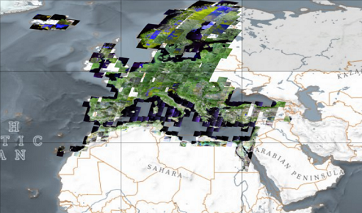
Landsat 5 TM European and Mediterranean Countries Cloud Free Collection
This dataset contains the cloud-free products from Landsat 5 Thematic Mapper collection acquired over Europe, North Africa and the Middle East; for each scene only one product is selected, with the minimal cloud coverage. The acquired Landsat TM scene covers approximately 183 x 172.8 km. A standard full scene is nominally centred on the intersection between a path and row (the actual image centre can vary by up to 100 m). The data are system corrected.
