- All Categories (1944)
- Data (8)
- News (43)
- Missions (2)
- Events (8)
- Tools (2)
- Activities (1)
- Documents (1880)
News - General News

ESA's improved Earth system data records: what is in store for the future?
Fundamental Data Records (FDRs) are instrumental in advancing our understanding of Earth systems and for addressing societal challenges effectively. These long-term records contain uncertainty-quantified, calibrated and geo-located multi-instrument/multi-platform satellite sensor data spanning several decades to support climate-related applications.
News - Operational News
Transition from FTP to FTPS for SMOS, Aeolus and Campaign data dissemination systems
As of 15 April 2024 access to the SMOS, Aeolus and Campaign data will be changed from simple FTP to FTPS.
Document - Newsletter

Earth Online Newsletter - 08 March 2024
This issue of the Earth Online Newsletter covers a selection of the latest news and events from ESA.
News - Data Release news
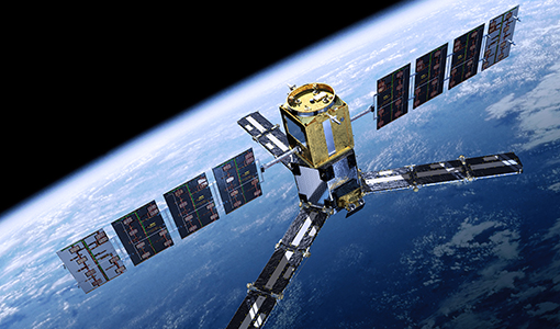
FDR4ALT - ESA unveils new cutting-edge ERS/Envisat Altimeter and Microwave Radiometer Datasets
The European Space Agency (ESA) has developed a comprehensive suite of innovative Earth system data records as part of the Fundamental Data Records for Altimetry project - FDR4ALT.
Data - EO Sign In Authentication (Open)
Land Ice Thematic Data Product [ALT_TDP_LI]
This is the Land Ice Thematic Data Product (TDP) V1 resulting from the ESA FDR4ALT project and containing estimates of ice sheet surface elevation and associated uncertainties. The collection covers data for three different missions: ERS-1, ERS-2 and Envisat, and based on Level 1 data coming from previous reprocessing (ERS REAPER and the Envisat V3.0) but taking into account the improvements made at Level 0/Level 1 in the frame of FDR4ALT (ALT FDR). The Land Ice TDP focuses specifically on the ice sheets of Greenland and Antarctica, providing these data in different files. For many aspects, the Land Ice Level 2 and Level 2+ processing is very innovative: Improved relocation approach correcting for topographic effects within the beam footprint to identify the Point of Closest Approach Homogeneous timeseries of surface elevation measurements at regular along-track reference nodes. The FDR4ALT products are available in NetCDF format. Free standard tools for reading NetCDF data can be used. Information for expert altimetry users is also available in a dedicated NetCDF group within the products. Please consult the FDR4ALT Product User Guide before using the data. The FDR4ALT datasets represent the new reference data for the ERS/Envisat altimetry missions, superseding any previous mission data. Users are strongly encouraged to make use of these datasets for optimal results.
Data - EO Sign In Authentication (Open)
Inland Waters Thematic Data Product [ALT_TDP_IW]
This is the Inland Waters Thematic Data Product (TDP) V1 resulting from the ESA FDR4ALT project and containing improved Water Surface Height (WSH) data record from the ERS-1, ERS-2 and Envisat missions estimated using the ICE1 retracking range for its better performance on the hydro targets. The FDR4ALT products are available in NetCDF format. Free standard tools for reading NetCDF data can be used. Information for expert altimetry users is also available in a dedicated NetCDF group within the products. Please consult the FDR4ALT Product User Guide before using the data. The FDR4ALT datasets represent the new reference data for the ERS/Envisat altimetry missions, superseding any previous mission data. Users are strongly encouraged to make use of these datasets for optimal results.
Document - Newsletter

Earth Online Newsletter - 23 February 2024
This issue of the Earth Online Newsletter covers a selection of the latest news and events from ESA.
News - Data Release news

New reanalysis dataset impacts SMOS Level 3 and 4 sea ice thickness
On 24 January 2024 the JRA55 reanalysis dataset was terminated and updated with the Japanese Reanalysis for Three Quarters of a Century.
News - Events and Proceedings
Highlighting the value of SMOS data in space weather applications
Data from ESA’s SMOS mission are driving many space weather applications, ranging from air navigation, characterisation of solar flares, space weather modelling and ionospheric electron content mapping.
News - General News
Ensuring soil moisture data quality with reference measurements
ESA is taking steps to verify the accuracy of soil moisture estimation with the Fiducial Reference Measurements for Soil Moisture (FRM4SM) project and a new version of the Quality Assurance for Soil Moisture (QA4SM) service.
Event - Workshop

2nd SMOS for Space Weather Workshop
The Second Workshop on SMOS for Space Weather will take place on 27 October 2023, hosted by the Space Weather Group of the University of Alcala, Alcalá de Henares (Madrid, Spain).
News - Events and Proceedings
2nd SMOS for Space Weather Workshop
The 2nd Workshop on SMOS for Space Weather will take place on 27th October 2023, hosted by the Space Weather Group of the University of Alcala, Alcalá de Henares (Madrid, Spain).
News - Success Stories
Synergy of space data helps modernise irrigation systems
The growing demands on agriculture, coupled with the climate crisis, are pressurising Earth’s valuable freshwater resources and making assessment of water practices ever more important.
News - General News
SMOS Tools updates
Updates for two SMOS tools have been released, offering new features and improvements.
News - Spotlight on EO community

An overview of the SMOS mission
In this video, Klaus Scipal - Biomass and SMOS Mission Manager - talks about ESA's Soil Moisture and Ocean Salinity mission.
News - Success Stories
ESA missions help to reveal worldwide lake water loss trend
Climate change, human consumption and sedimentation are depleting more than half of the world’s biggest lakes of water, according to a ground-breaking analysis that drew on three decades of satellite data.
News - Spotlight on EO community
Introducing the Biomass and SMOS Mission Manager
In this video, Klaus Scipal describes his role as Mission Manager of Biomass and SMOS, and what he enjoys about his involvement with these dedicated science missions.
News - Success Stories
SMOS data reveal ecosystems' resistance to drought
Climate change is rapidly altering the world’s ecosystems, causing extreme weather conditions, such as droughts, to become increasingly frequent. Understanding the factors that contribute to ecosystem resilience to extreme events is vital to develop more effective strategies for climate adaptation and mitigation.
News - Infographics
Key facts about SMOS Level-1 and Level-2 science data
Learn about data products from the SMOS mission in our latest infographic.
News - General News
Overachieving SMOS mission primed for continued success
ESA’s Soil Moisture and Ocean Salinity mission (SMOS) was the second Earth Explorer launched in 2009. Over 13 years on, having already vastly exceeded its predicted lifetime and initial objectives, the mission has been further extended until at least the end of 2025.
