- All Categories (98)
- Data (5)
- News (29)
- Missions (3)
- Events (9)
- Tools (11)
- Activities (2)
- Campaigns (2)
- Documents (37)
Document - Proceedings

EO-Summer-School-4-The-Earth-Observation-Programme-at-ESA.pdf
This presentation from ESA's EO Summer School 4 describes 2008 the Earth Observation Programme at ESA
Document - Proceedings
EO-Summer-School-5-ESA-Satellite-Missions-for-Climate-Observations.pdf
This presentation from ESA's EO Summer School 5 describes ESA Satellite Missions for Climate Observations
Document - Conference Presentation - Poster

04_OCT2013_ESA-EO_programmes.pdf
ESA EO missions and their exploitation for science and applications ESA
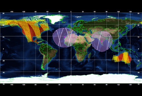
Document - Product Document

Urban-Atlas-Data-Coverage-WorldView-2.pdf
14EUSI-1961 Urban Atlas Data Coverage with WorldView-2 Data
Document - Technical Note

Long-Term-Database-lidar-measurements
This report describes the establishment of a long-term aerosol and cloud database from ground-based lidar network measurements taken in the frame of EARLINET and the CALIPSO satellite.
Document - Conference Presentation - Poster
EO-Summer-School-5-Poster-EarthCARE-The-Earth-Cloud-Aerosol-and-Radiation-Explorer-Mission.pdf
This poster from ESA's EO Summer School 5 is about EarthCARE: the earth cloud, aerosol and radiation explorer mission
Event - Workshop

Volcanic Ash Monitoring - ESA/EUMETSAT Workshop
On 14 April 2010 the Icelandic volcano Eyjafjalla erupted and had been ejecting immense plumes of ash and sulphur into the atmosphere. The workshop was held in response to the emergency.
Mission - Third Party Missions

WorldView-2
WorldView-2 is an environment-monitoring satellite from Maxar which presents images as the human eye can perceive them, creating a more realistic 'true colour' view of the world.
Mission - Earth Explorers
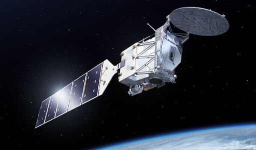
EarthCARE
EarthCARE will examine the role clouds and aerosols play in trapping infrared radiation emitted from Earth's surface.
News - Success Stories

ESA's Earth Explorers surpassing expectations
In this video, learn how each Earth Explorer mission is contributing to Earth science, and changing the way we look at our beloved planet.
Event - Conference

Living Planet Symposium 2019
ESA's Living Planet Symposia are amongst the biggest Earth observation conferences in the world. Scientists present their latest findings on Earth's environment and climate.
Tools - Visualisation
ESOV Software Tools (ESOV NG)
ESOV tool provides the means to visualise instrument swaths of all ESA EO Satellites, assist in understanding where and when satellite measurements are made and ground contact is possible.
Tools - Processing

EO CFI Software
Earth Observation CFI Software is a collection of multiplatform precompiled C libraries for timing, coordinate conversions, orbit propagation, satellite pointing calculations, and target visibility calculations.
Tools - Visualisation
SAMI
SAMI (Satellite Mission Editor & Player) is a freely available software application for visualisation of high-resolution 3D and 2D scenarios of ESA Earth Observation satellites.
Tools - Visualisation

S2G Data Viewer
S2G Data Viewer is an extensible application that allows you to inspect the contents of CCSDS-compliant telemetry data exchanged between a satellite and its ground segments on the space-to-ground link.
Tools - Analysis

SNAP
SNAP is a common architecture for all Sentinel Toolboxes. It is ideal for Earth observation processing and analysis.
Campaign
CLARE
CLARE 2000: Cloud Lidar and Radar Experiments were to provide an extended data base and develop new analysis methods.
Mission - Third Party Missions

WorldView Series
The WorldView constellation are environment-monitoring satellites that have been supplying imagery since 2007.
Tools - Analysis

Sentinel-2 Toolbox
The Toolbox consists of a rich set of visualisation, analysis and processing tools for the exploitation of optical high-resolution products including the Sentinel-2 MSI sensor.