- All Categories (14)
- Data (2)
- Missions (2)
- Tools (5)
- Documents (5)
Tools - Catalogues

FedEO
FedEO is a data catalogue that provides a unique entry point to a number of scientific catalogues and services for, but not limited to, European and Canadian missions.
Tools - Catalogues

ESA PDGS DataCube
ESA's DataCube is a data catalogue that enables multi-temporal and pixel-based access to a subset of data available from ESA
Tools - Catalogues

EO CAT
EO CAT is a data catalogue, offering a Next Generation Earth Observation system designed to manage end-user Earth Observation services.
Data - Fast Registration with approval (Restrained)
IKONOS ESA archive
ESA maintains an archive of IKONOS Geo Ortho Kit data previously requested through the TPM scheme and acquired between 2000 and 2008, over Europe, North Africa and the Middle East. The imagery products gathered from IKONOS are categorised according to positional accuracy, which is determined by the reliability of an object in the image to be within the specified accuracy of the actual location of the object on the ground. Within each IKONOS-derived product, location error is defined by a circular error at 90% confidence (CE90), which means that locations of objects are represented on the image within the stated accuracy 90% of the time. There are six levels of IKONOS imagery products, determined by the level of positional accuracy: Geo, Standard Ortho, Reference, Pro, Precision and PrecisionPlus. The product provided by ESA to Category-1 users is the Geo Ortho Kit, consisting of IKONOS Black-and-White images with radiometric and geometric corrections (1-metre pixels, CE90=15 metres) bundled with IKONOS multispectral images with absolute radiometry (4-metre pixels, CE90=50 metres). IKONOS collects 1m and 4m Geo Ortho Kit imagery (nominally at nadir 0.82m for panchromatic image, 3.28m for multispectral mode) at an elevation angle between 60 and 90 degrees. To increase the positional accuracy of the final orthorectified imagery, customers should select imagery with IKONOS elevation angle between 72 and 90 degrees. The Geo Ortho Kit is tailored for sophisticated users such as photogrammetrists who want to control the orthorectification process. Geo Ortho Kit images include the camera geometry obtained at the time of image collection. Applying Geo Ortho Kit imagery, customers can produce their own highly accurate orthorectified products by using commercial off the shelf software, digital elevation models (DEMs) and optional ground control. Spatial coverage: Check the spatial coverage of the collection on a map available on the Third Party Missions Dissemination Service.
Data - EO Sign In Authentication (Open)
JERS-1 OPS (Optical Sensor) Very Near Infrared Radiometer (VNIR) System Corrected Products level 1
The JERS-1 Optical System (OPS) is composed of a Very Near Infrared Radiometer (VNIR) and a Short Wave Infrared Radiometer (SWIR). The instrument has 8 observable spectral bands from visible to short wave infrared. Data acquired by ESA ground stations The JERS-1 OPS products are available in GeoTIFF format. These products are available only for the VNIR sensor. All four bands are corrected. The correction consists in a vertical and horizontal destriping, the radiometry values are expanded from the range [0.63] to the range [0.255]. No geometrical correction is applied on level 1. The pixel size of approximately 18 x 24.2 metres for raw data is newly dimensioned to 18 x 18 metres for System Corrected data using a cubic convolution algorithm. Disclaimer: Cloud coverage for JERS OPS products has not been computed using an algorithm. The cloud cover assignment was performed manually by operators at the acquisition stations. Due to missing attitude information, the Nadir looking band (band 3) and the corresponding forward looking band (band 4) are not well coregistered, resulting in some accuracy limitations. The quality control was not performed systematically for each frame. A subset of the entire JERS Optical dataset was selected and manually checked. As a result of this, users may occasionally encounter issues with some of the individual products. Spatial coverage: Check the spatial coverage of the collection on a map available on the Third Party Missions Dissemination Service.
Tools - Analysis

Sentinel-1 Toolbox
The Toolbox consists of: processing tools, data product readers and writers and a display and analysis application to support the archive of SAR data from ESA and 3rd party missions.
Tools - Processing

PolSARpro
PolSARpro is a toolbox for the scientific exploitation of polarimetric SAR data and a tool for high-level education in radar polarimetry.
Mission - Heritage Missions

JERS-1
The overall objectives of JERS-1 (Japanese Earth Resources Satellite) were the generation of global data sets with SAR and OPS sensors aimed at surveying resources, establishing an integrated Earth observation system
Mission - Heritage Missions
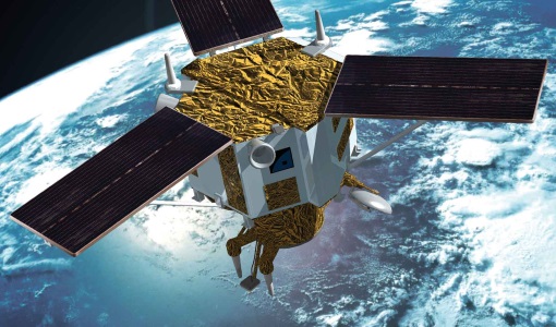
IKONOS-2
At the time of its launch, IKONOS-2 brought imagery rivalling that of military satellites to the commercial market.
Document - Product Specifications

JERS-1-Optical-System-OPS-Format-Description.pdf
This document describes the JERS-1 Optical System data format as delivered by the European Space Agency.
Document - Proceedings

Advances-in-Atmospheric-Science-and-Applications.pdf
Proceedings in Advances in Atmospheric Science and Applications held in 18-22 June 2012 in Bruges, Belgium.
Document - Technical Note

JERS-1-TPML-mission-instrument-characteristics.pdf
This documents contains an over of the JERS-1 mission and instrument characteristics. In particular, it provides details about the mission history and background, and the correction algorithm applied.
Document - User Guide

Third Party Missions, Cat-1 Data Availability
This brochure gives a quick overview on the availability of the Third Party Missions IRS-P3, JERS-1, NIMBUS, Proba, Landsat, KOMPSAT-1, SCISAT-1, Terra/Aqua, NOAA, QSCAT, OrbView, SPOT-1,-2,-3,-4, ALOS.