- News
- New SMOS sea surface wind spee...
New SMOS sea surface wind speed products now available
17 Apr 2020
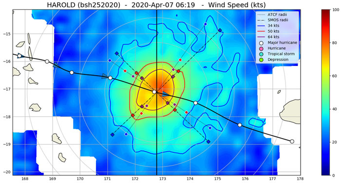
The European Space Agency (ESA), the Institut Français pour la Recherche et l'Exploitation de la MER (IFREMER) and the French company OceanDataLab are pleased to announce a new operational service called "SMOS Wind Data Service" which provides, in near real time (NRT), surface wind speed over the ocean derived from the brightness temperature measurements of the Soil Moisture and Ocean Salinity (SMOS) satellite mission.
The SMOS NRT wind products can be accessed now at IFREMER and will be available on the ESA SMOS dissemination service from June 2020.

The SMOS Wind Data Service produces three types of products:
- SMOS Near Real Time Level 2 swath wind speed (SMOS L2WS NRT) products - These are SMOS retrieved surface wind speed gridded maps with a spatial sampling of 1/4°x 1/4° and are available within 4 to 6 hours from sensing.
- SMOS Wind Radii Fixes (SMOS WRF) products - These are generated in the so-called "Fix (F-deck)" ATCF format and are available within 4 to 6 hours from sensing.
- SMOS Level 3 daily wind speed (SMOS L3WS) products - These are daily composite maps (separated into ascending and descending passes) of the collected SMOS L2 swath wind products (SMOS L2WS NRT).
Download the documentation for the SMOS Wind Data Service products. The Algorithm Theoretical Basis Document, the Product Description Document and the read-me-first note are available.