- Learn & Discover
- Askos campaign validates Aeolu...
Askos campaign validates Aeolus data
15 Oct 2021
From July to September 2021, the European Space Agency (ESA) organised the Joint Aeolus Tropical Atlantic Campaign (JATAC) in Cape Verde, with the main aim of providing quality-assured reference measurements for the validation of Aeolus products and to collect information for ESA’s upcoming EarthCARE mission and future satellite concepts, such as the Earth Explorer 11 Wivern candidate mission. JATAC also supported a range of scientific objectives, such as investigations into the Saharan Air Layer, African Easterly waves and jets and convection in the Intertropical Convergence Zone.
The ground-based component of the JATAC campaign, ASKOS, was designed, deployed and implemented by the National Observatory of Athens (NOA) in close collaboration with the Leibniz Institute for Tropospheric Research (TROPOS) and the Romanian National Institute for Research and Development for Optoelectronics (INOE).
Its name is closely connected to Aeolus, the Greek god of the winds: ASKOS is the Greek word for the god’s legendary bag that contained all the storm-winds.
Based in Mindelo, on the Island of São Vicente in Cape Verde, the ASKOS campaign collected high quality ground-based wind, aerosol and cloud observations, using advanced instrumentation to provide reference values for Aeolus validation and calibration efforts.
Highly-advanced lidars for measurements of unprecedented accuracy
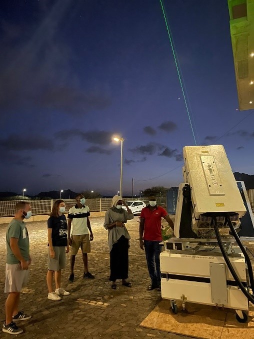
The main ground-based remote sensing instruments consisted of three sophisticated lidar systems: the EVE lidar, a combined linear/circular polarisation system that mimics Aeolus measurements from the ground, the multi-wavelength Polly-XT lidar and a Doppler wind lidar.
The ground-based instrumentation was complimented by measurements from an AERONET sun-photometer, a cloud radar, a microwave radiometer and a disdrometer. These instruments constitute an aerosol and cloud remote sensing facility of the Aerosol, Clouds and Trace Gases Research Infrastructure (ACTRIS).

The campaign was also supported by operational modelling simulations for meteorological and atmospheric composition forecasting. Copernicus CAMS provided aerosol forecast support for the campaign, while the Sand and Dust Storm Warning Advisory and Assessment System (SDS-WAS) of the World Meteorological Organisation (WMO) was used for desert dust forecasts. NOA itself provided Weather Research and Forecasting (WRF) aerosol and cloud forecasts tailored to the ASKOS campaign.
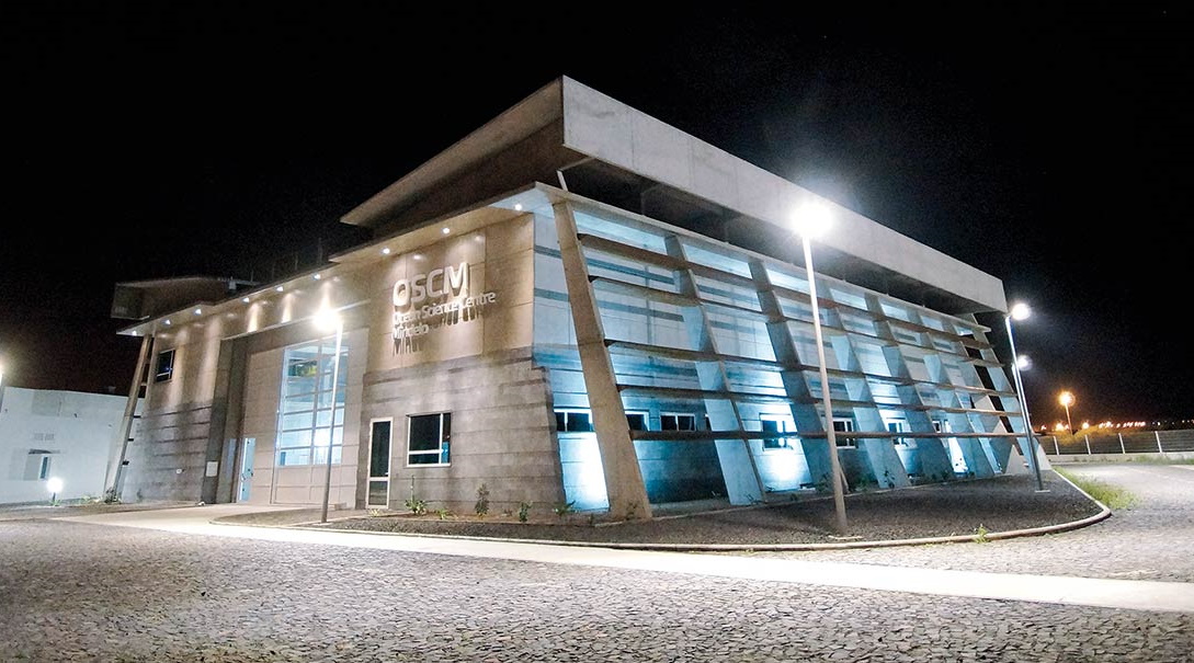
ASKOS was hosted in the Ocean Science Centre Mindelo (OSCM), a joint facility of the GEOMAR Helmholtz Centre for Ocean Research Kiel, Germany, and the Instituto do Mar (IMar) in Mindelo, Cabo Verde.
OSCM has been operating in Mindelo since 2017, providing a multifunctional basis for long-term ocean observation and field research in the tropical Northeast Atlantic region, and creating opportunities to strengthen capacities and academic education in West Africa. For the EVE lidar operation, ASKOS was also supported by students of the Atlantic Technical University (UTA) of Cabo Verde.
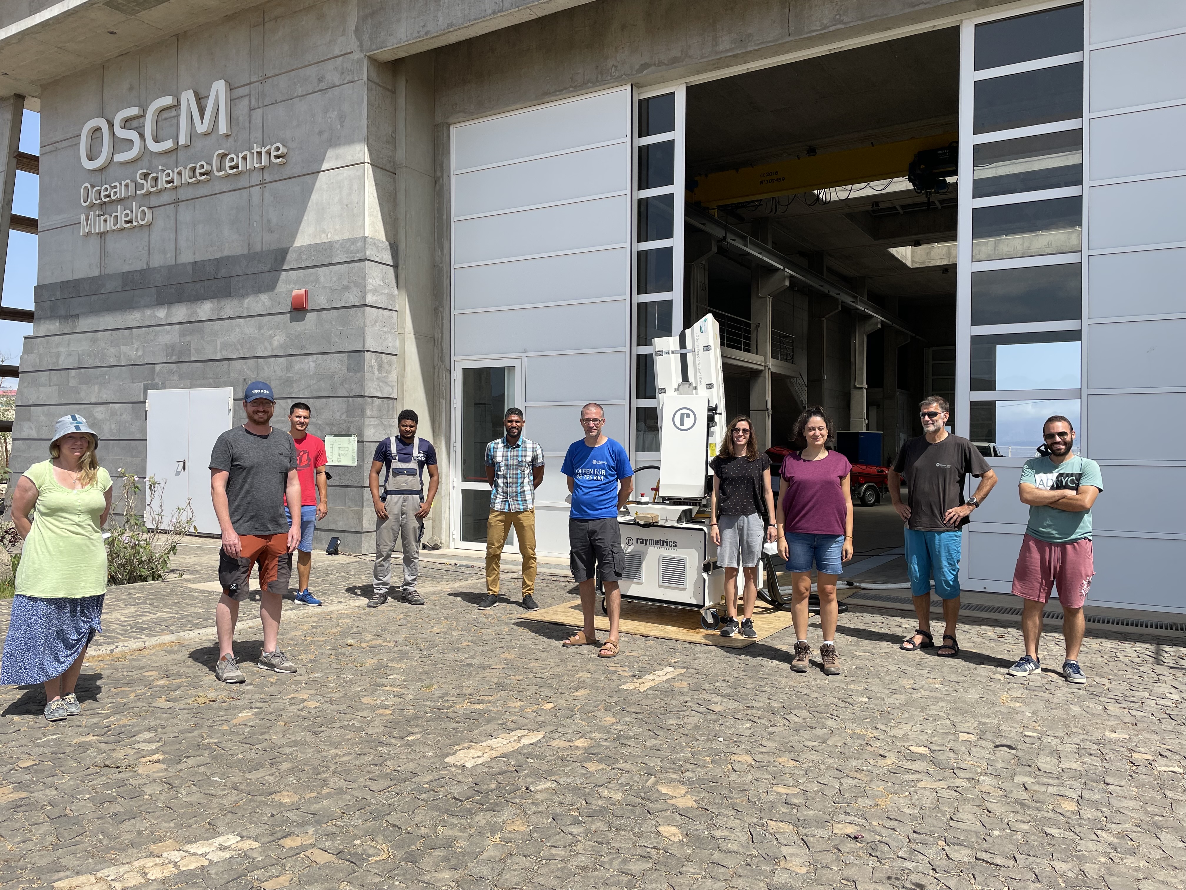
ASKOS and UNG on-site team on 11/09/2021. From right to left: Dr. Nikos Siomos, Matevz Lenarcic, Dr. Eleni Marinou, Peristera Paschou, Dr. Grisa Mocnik, Elizandro Rodrigues, Eder Silva, Razvan Pirloaga, Dr. Ronny Engelmann, Dr. Annett Skupin. Credits: NOA-ReACT.
Credits: NOA-ReACT.
Collocated data for improved Aeolus Cal/Val results
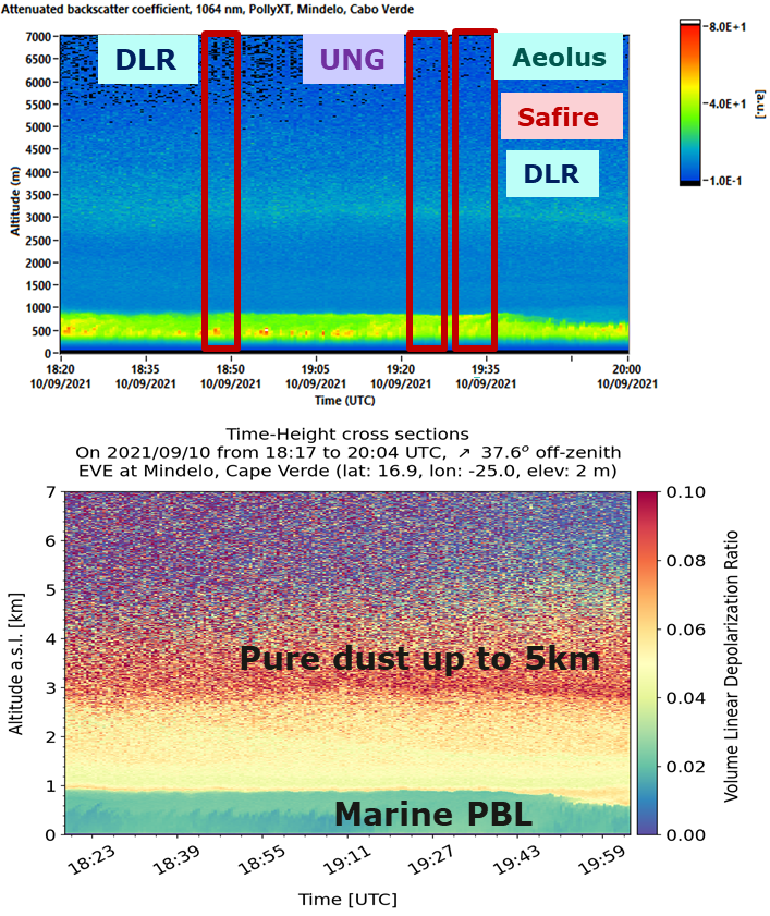
ASKOS gathered collocated profiles with Aeolus, complimenting other airborne and in-situ platforms of the JATAC campaign. On 10 and 17 September 2021, the Aeolus overpass over OSCM coincided with measurements from all JATAC teams. The featured image shows the aerosol conditions above the ASKOS site during the 10 September operations. Dust was present above the site in altitudes between 1 and 5 km. Local advection was observed in the first 500 m and non-depolarising aerosols (mainly sea salt) was dominant in the first km.
The ASKOS measurements delivered essential data for the validation of Aeolus optical properties products in the tropics, with a particular focus on Saharan dust. It also provided important information to improve the characterisation and calibration of the satellite’s ALADIN instrument, as well as for the quantitative validation of the Aeolus instrument and optical properties’ data in terms of systematic and random errors.