- News & Events
- How to guide for submitting Pr...
How to guide for submitting Project Proposals
13 May 2022
This detailed guide will show step-by-step how to submit a project proposal, in order to request access to restrained datasets, usually on-demand Third Party Mission products, distributed by ESA.
View a quick guide to Project Proposal submission in our infographic.
Initiating the project proposal directly from Earth Online
If you already know which ESA Third Party Missions (TPMs) for which you wish to request datasets then you may start at Step 2 below.
Alternatively, you may start your search for datasets by browsing the TPMs on the Earth Online portal. Here you may browse via missions, data, thematic area or simply the banner search bar.
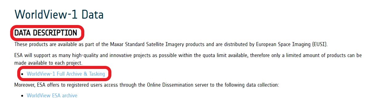
Once you have chosen a particular TPM, and the available data products are not sufficient for your needs, you should scroll to the bottom of the page to the Data Description section and then click the Full Archive & Tasking button.
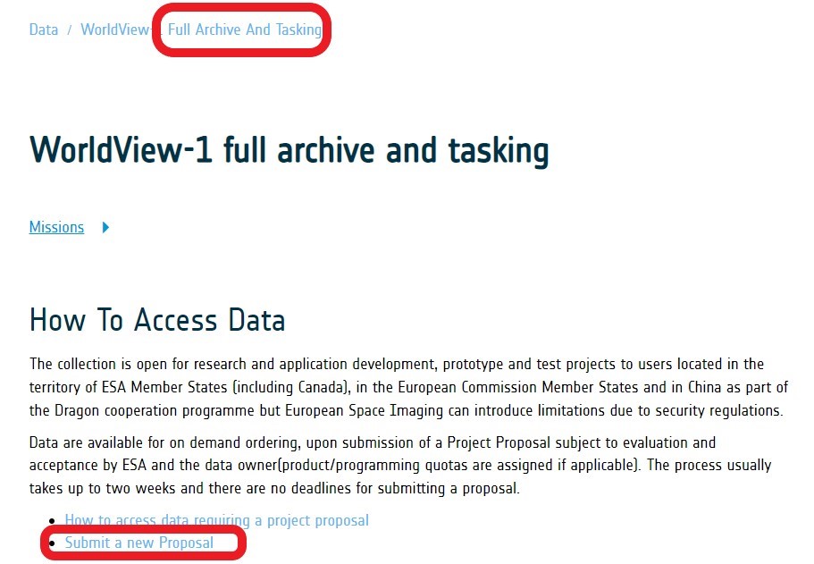
In the following page, you can begin the process to create a new project proposal by clicking the "Submit a new Proposal" button. The below step-by-step process to complete the Project Proposal form may then be followed, with the exception that the chosen mission collection will already be populated on the form. You may still add further collections to the form.
Step 1: Starting the Project Proposal process
Earth Observation sign in.
In order to submit a Project Proposal an active EO Sign In account is required. If you have not already registered, create an account now: How can I create an EO Sign In account.
Step 2: Create a Project Proposal
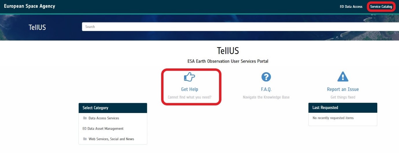
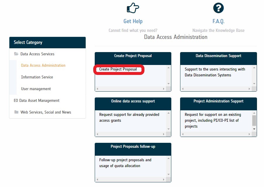
Once you have signed into TellUS, you should open the Service Catalogue page on the TellUS home page top banner.
The Select Category tab will open on the left-hand-side and you should select Data Access Administration and then "Create Project Proposal".
Step 3: Complete the Project Proposal form
This online form is used to create a project proposal.
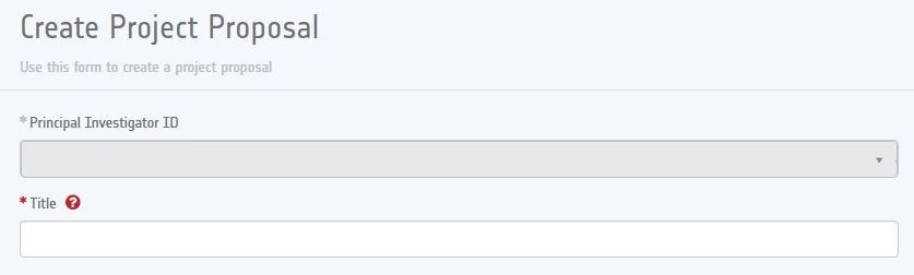
The user's name registered in TellUS will automatically be used as the Principal Investigator (PI) on this form. You should enter the title of the project here (max 256 characters).
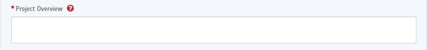
Then you provide an overview of the project, which is a concise summary of max 4000 characters, describing the objective, method and deliverables of the project. Availability of funding to run the project must also be specified.
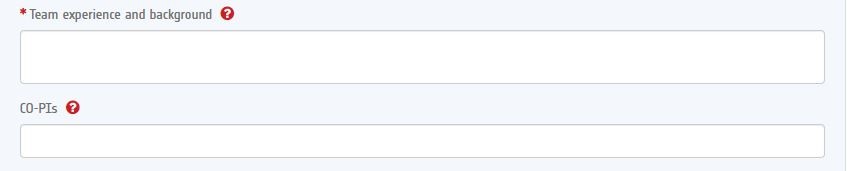
You should provide details of the team composition, the Institutions involved and the overall team experience (max 4000 characters), including the experience of both the Project Leader and the co-investigators.
While the email of the PI is already registered, now you should list the emails of all co-investigators in the clearly indicated comma separated format. Only those team members listed here will be officially allowed to access the requested dataset(s).
Any person having a personal EO Sign In account and satisfying the geographical restrictions for the requested dataset(s) may be listed as a co-investigator in the project proposal. The geographical restrictions, when applicable, refer to the PI country of residence as defined by the EO Sign In user account and can be found in the "How to access this data" section or the Terms of Applicability document, available in the "Resources" section of the applicable Earth Online data description page.
You should specify the contact email of the co-investigator as used at the time of EO Sign In registration. Nominated co-investigators will receive an email and can opt out of the proposal. After acceptance of the proposal, co-investigators are informed by the PI about the available quota and procedures.
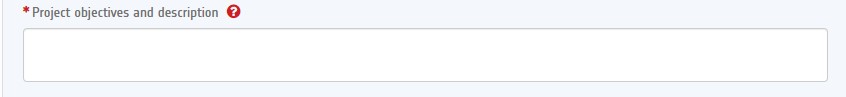
The project objectives and description are the main part of the proposal used for its evaluation and should not exceed 16,000 characters. It should include as a minimum the following information:
- Technical and scientific approach and methods proposed to meet the proposal's objectives, and the success criteria of the project.
- Anticipated results, deliverables of the investigation, and schedule for availability of such results and deliverables (including final results).
- Work Plan of the investigation, including a description of the key milestones, the planned use of data, models and facilities and a schedule of the project phases.
- Justification for the number and type of requested data products. If relevant, the innovative character of the proposal can be described, indicating the related domains
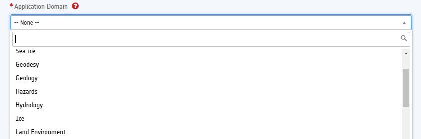
The Application Domain for the proposal shall be selected from the predefined list in the drop-down menu. The details of each of these applicable themes are given here:
| Guidelines for the submission of Project Proposals | Sub-Theme |
|---|---|
| Atmosphere |
|
| CAL/VAL |
|
| Coastal zones monitoring |
|
| Geodesy |
|
| Geology |
|
| Hazards |
|
| Hydrology |
|
| Ice |
|
| Land environment |
|
| Methods |
|
| Oceanography |
|
| Renewable resources |
|
| Sea-ice |
|
| Topographic mapping |
|
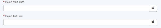
You should clearly specify the schedule of the Project with start/end dates chosen from the drop-down menus. Please note the start date cannot be in the past.
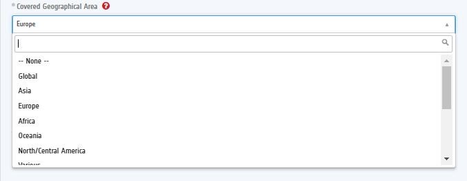
You should choose the geographical area of interest from a predefined list of regions and continents.
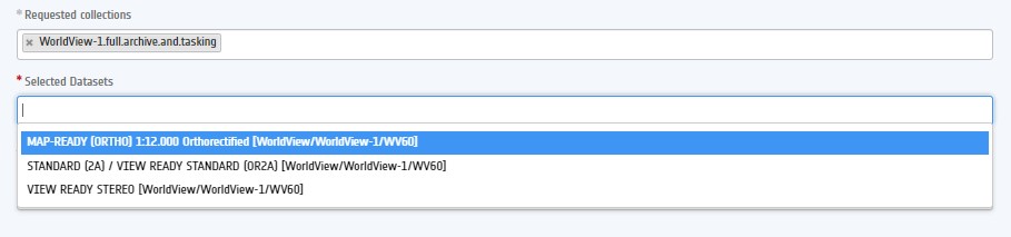
You may choose one or multiple data collections. Requesting data from different missions is highly recommended. In this case, if you have started the project proposal request directly from Earth Online, the first requested collection will be automatically populated.
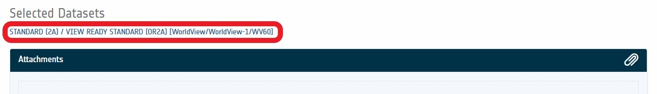
Once a collection has been chosen, the available dataset, i.e. a specific types of product within the collection, become available in the drop-down menu "Selected Datasets". Here you should select exactly which datasets are required. There are no limits to the number of datasets requested.
Finally, you may complete the form by providing additional information up to a limit of 6,000 characters. This field shall be filled-in with technical information (geolocation constraints, acquisition dates, polarization in case radar data are requested and any other needs) about the requested Third Party Mission Products or Announcement of Opportunities products.
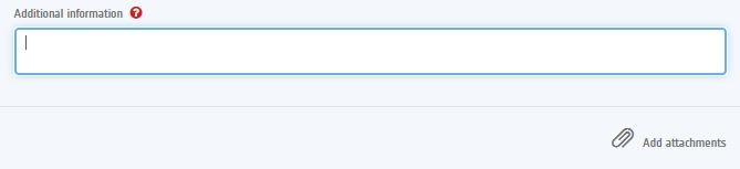
You may also add attachments by clicking the "Add attachment" button, such as a recently published peer-reviewed paper, to enhance the proposal.
Step 4: Saving and editing the Project Proposal
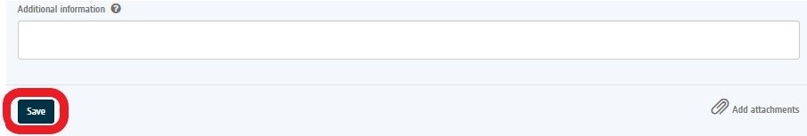
You may now choose to save a draft Project Proposal. Details of the initiated proposal are subsequently emailed to the registered email address, including an easy access link to continue to edit and submit the proposal at a later date.
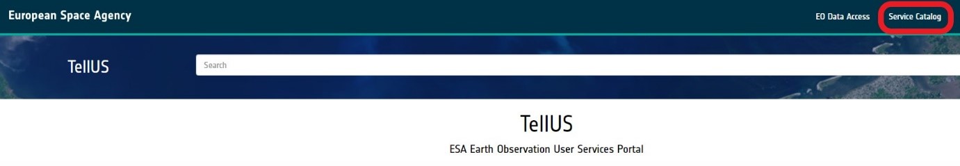
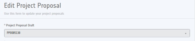
The Project Proposal draft may be edited further by clicking the link provided by email, or by accessing the TellUS system and EO Data Access page from the TellUS home page top banner:
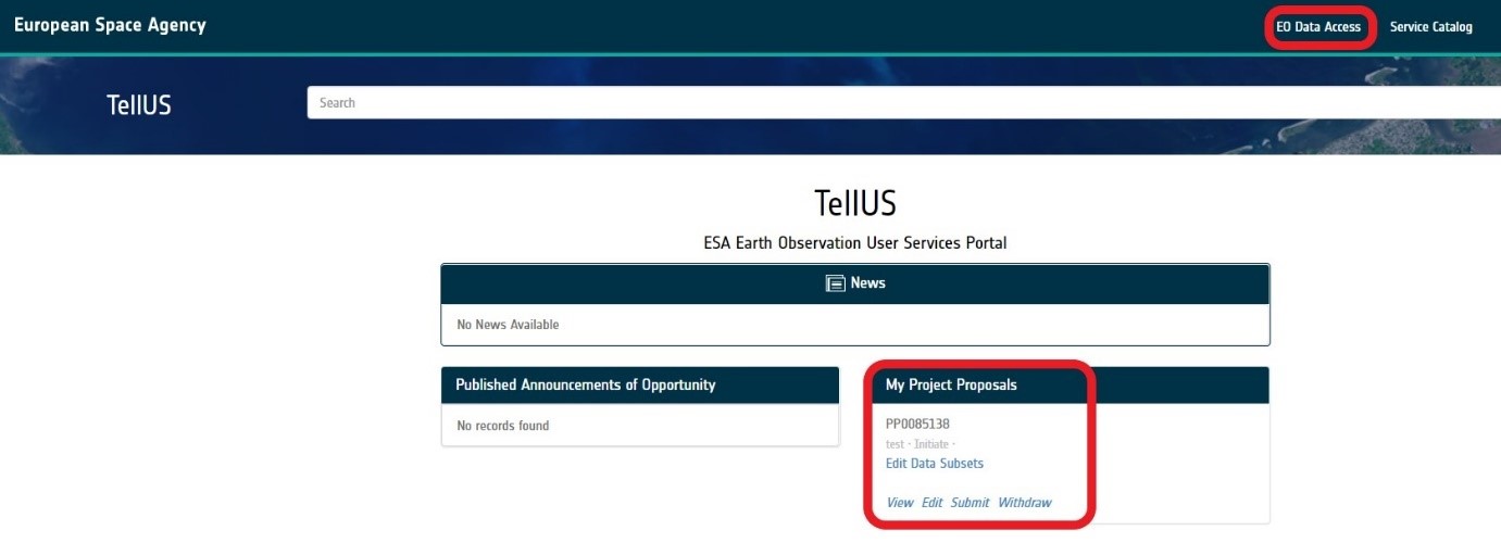
The proposal will be in "initiate" status until you submit it.
Step 5: Complete the Submitted Dataset Form(s)
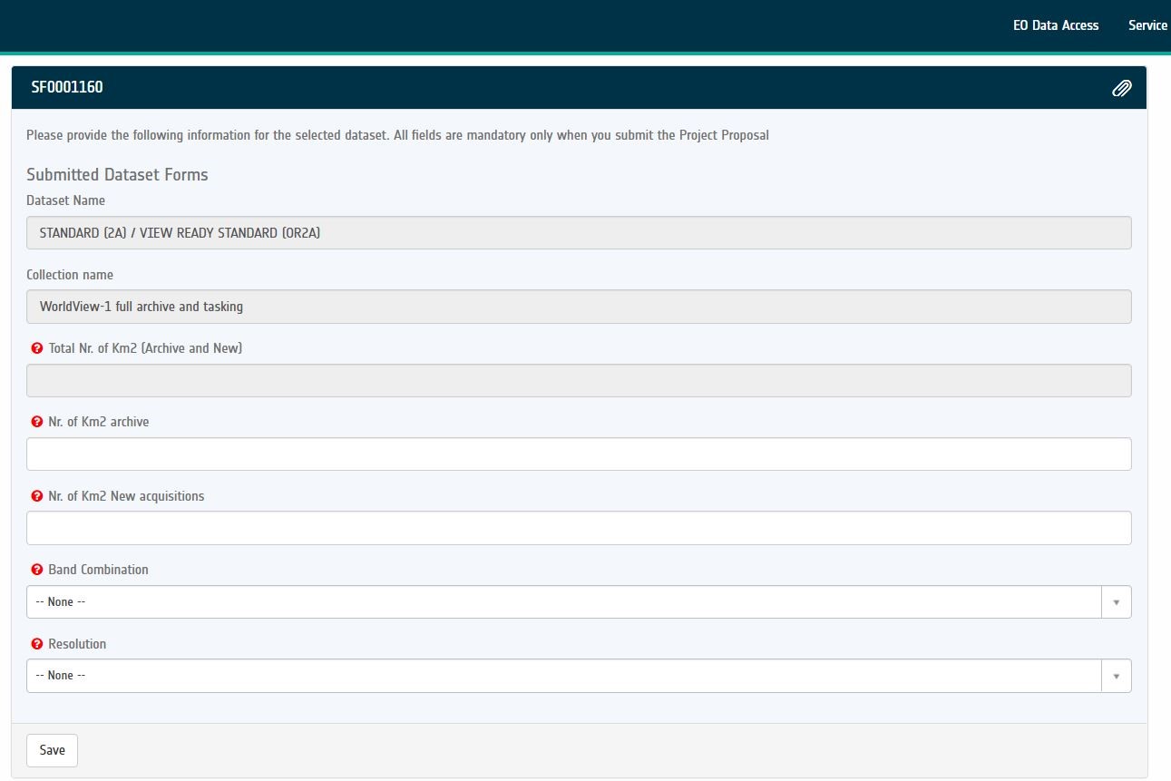
Before the proposal can be submitted, for each dataset chosen, you must provide additional information via an individual Submitted Dataset Form. A Submitted Dataset Form must be completed and attached for each chosen data subset.
There are two ways to open the form for a specific dataset. At the bottom of the Project Proposal form you may click the link that pops up under the title "Selected Dataset Form".
Alternatively, you may access the required forms directly from the TellUS main page:

The information requirements of each Submitted Dataset Form vary depending on the chosen data subset. Examples of the sort of information usually requested are the area in square kilometres, number of products (both archive and new tasking), area or time of interest, resolution or band combination.
Step 6: Submit the Project Proposal
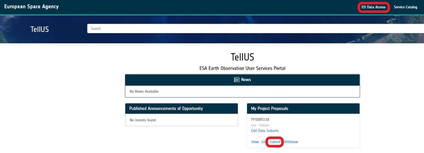
Your draft proposal is available via the EO Data Access button on the TellUS home page top banner. If the proposal is complete, the last step is to submit the proposal.
You can see the submit button under the My Project Proposals section. After submission, an email is sent to the PI confirming the new status of the Project Proposal.
Step 7: Project proposal evaluation
Once the project proposal is submitted, the evaluation process begins. During this period, modifications cannot be made to the Project Proposal. The evaluation is carried out by a committee composed of individuals appointed by ESA and may take up to six weeks.
You will receive an email providing confirmation of the submission.
There are three possible outcomes of this evaluation:
- The proposal may be rejected.
- The proposal may be accepted, after which you are informed about the procedure to access data via a "start-up" email.
- ESA may neither reject nor accept the proposal, but instead notify you by email and ask for a modification of the proposal in order to meet ESA and/or data provider requests. Project proposal modifications are enabled again; Edits may then be made to the proposal, and it can eventually be resubmitted.
The proposal will be in "initiate" status until you submit it.

Step 8: Submit results for success storys
When the project is closed, the PI shall submit a final report.
When your final results are published, please remember to contact the Earth Online editorial team so they can turn your experience of using Third Party Mission data into a 'success story'.
Please email the team at: contentmatters4earthonline@ejr-quartz.com.
FAQ and EO Help
If there are any further queries on the process to submit a Project Proposal see the FAQ page or contact EO Help via the TellUS home page and the Service Catalogue button on the top banner.