

Featured
About GOSAT-2
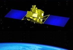
GOSAT-2 (Greenhouse gases Observing Satellite-2), which is also known as "IBUKI-2", is a JAXA satellite dedicated to the observation of greenhouse gases.
The satellite expands upon the capabilities of its predecessor, and carries enhanced versions of the two mission instruments aboard the GOSAT satellite, TANSO-FTS-2 (Thermal And Near infrared Sensor for carbon Observation-Fourier Transform Spectrometer-2) and TANSO-CAI-2 (Cloud and Aerosol Imager-2).
| Launch Date | 29 October 2018 |
| Orbit altitude | 613 km |
| Orbit type | Sun-synchronous |
| Repeat Cycle | 6 days |
GOSAT-2 is part of ESA's Third Party Missions Programme, in which ESA has an agreement with JAXA to distribute data products from the missions.
GOSAT-2 Objectives
GOSAT-2 monitors greenhouse gases, revisiting each point of observation every three days. Like its predecessor, it will observe levels of carbon dioxide, methane, ozone and water vapor in the atmosphere. However, it will also monitor carbon monoxide and nitrogen dioxide levels.
GOSAT-2 Instruments
Thermal And Near infrared Sensor for carbon Observation - Fourier Transform Spectrometer-2 (TANSO-FTS-2)
TANSO-FTS-2 is the same as the Fourier Transform spectrometer on the first GOSAT satellite, with improved characteristics: five bands (instead of four) with the spectral range of each band optimised based on the results of the utilisation of GOSAT data, two bands for the TIR, bands other than the TIR are divided into two polarizations (P and S), and band 3 has been extended to observe carbon monoxide.
The Instant Field of View (IFOV) is 15.8 mrad, which is the same as GOSAT, but the footprint size is smaller - from 10.5 km to 9.7 km - due to the lower altitude of GOSAT-2. The pointing angle in the along-track direction is larger - from ±20 degrees to ±40 degrees - to extend the sun glint observation area and make it possible to select the observation points freely within the capabilities of the pointing mirror moving speed. The scan duration is fixed to four seconds. FTS-2 has 16 steps of the gain to take advantage of the dynamic range corresponding to very different radiance. FTS-2 has the function to avoid clouds in a scene by using an intelligent pointing mechanism.
| Items | TANSO-FTS-2 | TANSO-FTS |
| Measurement Gases | CO2,CH4,O3,H2O,CO | CO2,CH4,O3,H2O |
| Field of View (FOV) | 15.8 mrad (9.7 kmf) | 15.8 mrad (10.5 kmf) |
| Spectral Ranges (µm)(cm-1) | band 1: 0.75-0.77 (12,950-13,250) band 2: 1.56-1.69 (5,900-6,400) band 3: 1.92-2.33 (4,200-5,200) band 4: 5.5-8.4 (1,188-1,800) band 5: 8.4-14.3 (700-1,188) | band 1: 0.75-0.77 (12,900-13,200) band 2: 1.56-1.72 (5,800-6,400) band 3: 1.92-2.08 (4,800-5,200) band 4: 5.5-14.3 (700-1,800) |
| SNR (@standard radiance) | band 1: >400 (P@13,050cm-1) band 2: >300 (P@6,200cm-1) band 3: >300 (P@5,000cm-1) >300 (P+S@4,250cm-1) band 4: >300 (@1,300cm-1) band 5: >300 (@700cm-1) | band 1: >300 band 2: >300 band 3: >300 band 4: >300 |
| Effective Aperture size | F73 mm | F64 mm |
| Gain steps | 16 | 2 |
| Avoidance of cloud | Intelligent pointing | ------- |
Thermal And Near infrared Sensor for carbon Observation - Cloud and Aerosol Imager-2 (TANSO-CAI-2)
TANSO-CAI-2 is a push-broom type imaging radiometer using linear array sensor and band pass filter and is the same as the instrument carried aboard the first GOSAT satellite. The line of sight of CAI-2 is tilted ±20 degrees in the along track direction (on GOSAT the line of sight points in the nadir direction); CAI-2 consists of five lens systems and each lens system has two FOVs of forward and backward viewing.
Three new observation bands were added to CAI-2 in addition to the four observation bands of CAI; and three bands are available to observe in forward and backward viewings.
| Items | TANSO-CAI-2 | TANSO-CAI | ||
| Spectral Ranges (nm) | Forward Viewing (+20°) band 1: 333-353 band 2: 433-453 band 3: 664-684 band 4: 859-879 band 5: 1585-1675 | Backward Viewing (-20°) band 6: 370-390 band 7: 540-560 band 8: 664-684 band 9: 859-879 band 10: 1585-1675 | Nadir Viewing band 1: 370-390 band 2: 664-684 band 3: 860-880 band 4: 1555-1645 | |
| Spatial Resolution (@nadir) | except band 5, 10 460 m (700 mrad) | band 5, 10 920 m (1,400 mrad) | band 1-3 500 m (750 mrad) | band 4 1,500 m (2,250 mrad) |
| Swath/FOV | 903 km / 67.6° (worldwide, to be observed at least twice per recurrent cycle) | band 1-3 1,002 km / 72° | band 4 786 km / 60° | |
| SNR (@spectral-radiance/albedo) (W/m2/sr/µm) | band 1: >200 (45/0.158) band 2: >200 (79/0.144) band 3: >200 (46/0.106) band 4: >200 (30/0.112) band 5: >200 (7/0.101) | band 6: >200 (48/0.152) band 7: >200 (65/0.125) band 8: >200 (46/0.106) band 9: >200 (30/0.112) band 10: >200 (7/0.101) | band 1: >200 (47/0.149) band 2: >200 (45/0.104) band 3: >200 (29/0.108) band 4: >200 (7/0.101) | |
GOSAT-2 Data
DATA DESCRIPTION
ESA offers registered users free access through the dedicated FTP server to the following GOSAT-2 data collection: