- Campaigns
- KaSAR
KaSAR
Overview
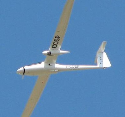
instrument onboard a Stemme motor glider
What was the purpose of KaSAR?
To support feasibility studies for a spaceborne high-resolution single-satellite interferometric SAR system operating in Ka-band and the associated technology roadmap, a better knowledge of Ka-band backscatter levels of natural targets as a function of incidence angles was required.
The KaSAR-2012 campaign was proposed to provide feedback to ESA on:
- Radiometry of Ka-band over natural medium reflectivity surfaces (i.e. bare soil, forest, grass/agriculture fields) as a function of incidence angle from 20° to 50°.
- Dynamic range of Ka-band signal (Radar Cross-sections) over targets of very high (anthropogenic bright targets), medium (bare soil, vegetation) and low (flat inner waters or runways) reflectivity
- Signature variability as a function of time-varying environmental conditions over selected land (wet and dry) and water (smooth and rough) surfaces
- Variability and information content of Ka-band at different polarisations
- Ka-band signature over hard targets (boats, vehicles) and infrastructure targets (pipelines, power lines, train tracks, etc.) for sizes, shapes and structural target characterisation
What was the outcome of KaSAR?
In the KaSAR project, it explored the backscattering behaviour of a large variety of targets with incidence angle.
The project had two main parts. In the first part, the team analysed the RAMSES archive data acquired in 2008 at HH and VV polarisation. In the second part, the team acquired, processed, calibrated and analysed VV Ka Band images from the DRIVE-BUSARD system. The simultaneous in-flight picture acquisition performed by the DRIVE-BUSARD has proven its interest for ground reporting.
Download the KaSAR final report
| Data Coverage (Year) | 2012 |
| Geographic Site | Southern France |
| Field of Application | Ka-Band SAR over natural (land, water) and anthropogenic targets |
| Data Size | More than 1.9 GB |
Digital Object Identifier: https://doi.org/10.5270/esa-sbw5o24 - KaSAR: "Technical Assistance for the Deployment of Airborne-Based Ka-band SAR and Geophysical Measurements during the KaSAR 2012 Campaign"
Data
The campaign data is available online via FTPS upon submission of a data access request. An active EO Sign In account is required to submit the request.
The data can be downloaded via an FTP client (e.g., FileZilla or WinSCP) using the option "Implicit FTP over TLS".
For further information about the EO Sign In Service you can visit TellUs
Should you need support please contact EOHelp