- Campaigns
- INDREX-2
INDREX-2
Overview
What was the purpose of INDREX-2?
The objective of INDREX-II: Indonesian Radar Experiment Campaign over Tropical Forest in L- and P-band was to:
- build up a data base for the investigation and validation of bio-/geophysical parameters obtained from L- and P-band polarimetric SAR interferometry (Pol-InSAR) acquired over tropical forests
- to secure with this data set feedback to the European Agency regarding the optimal SAR sensor configuration and algorithms for biomass retrieval and monitoring in tropical areas.
What was the outcome of INDREX-2?
INDREX-II was a successful campaign in terms of experiment planning, radar data and ground measurement acquisition and radar data quality. All suggested experiments could be performed as described in the Experimental Plan submitted to ESA. The planned time schedule could be kept and no major technical problem occur during the INDREX-II campaign.
Download the INDREX-II Final Report
| Data Coverage (Year) | 2004 |
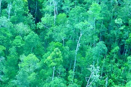
| Geographic Site | Kalimantan (Borneo), Indonesia |
| Field of Application | X-, C-, L- and P-Band SAR over Tropical Forest |
| Data Size | More than 50 GB |
Digital Object Identifier: https://doi.org/10.5270/esa-iwr5ohr INDREX-2: "Indonesian Airborne Radar Experiment Campaign over Tropical Forest in L- and P-band "
Data
The campaign data is available online via FTPS upon submission of a data access request. An active EO Sign In account is required to submit the request.
The data can be downloaded via an FTP client (e.g., FileZilla or WinSCP) using the option "Implicit FTP over TLS".
For further information about the EO Sign In Service you can visit TellUs
Should you need support please contact EOHelp