- Campaigns
- Drift4SKIM
Drift4SKIM
Overview
What was the purpose of Drift4SKIM?
As part of the detailed design and feasibility studies of the Sea Surface Kinematics Multiscale (SKIM) 9th Earth Explorer program candidate mission, ESA initiated the Drift4SKIM field campaign, with the aim to evaluate the feasibility of measuring the insitu Total Surface Current Velocity (TSCV) using pulse-pair Doppler radars.
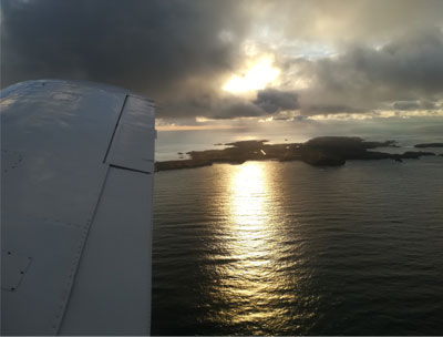
The campaign took place from 20 to 27 November, 2018, in the Iroise Sea, west of the French Atlantic coast, chosen for its wave climate and its strong tidal regime, and featured both airborne and in-situ data collection components.
Airborne data collection consisted of Ku- and Ka-band pulse-pair Doppler measurements performed using the KuROS and KaRADOC radars from an ATR-42 aircraft, and optical (visible and TIR) observations of the sea surface performed from a PA-23 aircraft. Both aircraft were operated by the French research aircraft facilities, SAFIRE. In-situ operations consisted of the deployment of two moored buoys providing observations of wind, waves and surface current shear, and the deployment of a large number (~130) of drifting buoys measuring currents at different depths (0.4, 1, 2, 5 and 15 m). The deployments were performed from French research vessel Thalia, and two rigid inflatable boats operated by a local company.
What was the outcome of Drift4SKIM?
The Drift4SKIM campaign can be considered extremely successful:
- It allowed the collection of a large set of airborne Doppler radar observations of the sea surface, both at Ku- and Ka-band, in two different acquisition geometries, relevant to several current or proposed satellite mission contexts, in a variety of conditions, together with a comprehensive set of ancillary measurements, documenting sea state and the structure of the sea surface, both from in-situ and optical remote sensing perspectives, eulerian and lagrangian currents over a large range of depths, and to some extent the meteorological conditions prevailing during the experiment. This dataset will be used for many years as a source of insight into the imaging mechanisms relevant to low-incidence Doppler microwave observations of the sea surface.
- A first analysis of the data, performed in the very tight timeframe of the preparation of the SKIM Report for EE9 Mission Selection, has provided the basis for the validation of the Remote Sensing Spatial Simulator (R3S), a new electromagnetic simulation tool developed as part of the SKIM Phase A studies.
Download the Drift4SKIM Final Report
| Data Coverage (Year) | 2018 |
| Release Date | September 2022 |
| Geographic Site | Iroise Sea, west of the French Atlantic coast |
| Mission Instrument | KuROS and KaRADOC |
| Field of Application | Radar (Ku & Ka-band), optical, drifters |
| Data Size | 1.9 TB |
Digital Object Identifier: European Space Agency, 2018, Drift4SKIM, https://doi.org/10.5270/ESA-12ed7a3
Data
The campaign data is available online via FTPS upon submission of a data access request. An active EO Sign In account is required to submit the request.
The data can be downloaded via an FTP client (e.g., FileZilla or WinSCP) using the option "Implicit FTP over TLS".
For further information about the EO Sign In Service you can visit TellUs
Should you need support please contact EOHelp