- Campaigns
- CoSMOS 2006
CoSMOS 2006
Overview
What was the purpose of CoSMOS 2006?
The Campaign for Validating the Operation of SMOS (coSMOS) was designed to acquire SMOS-like data so that the algorithms were fine-tuned and properly validated before the launch of SMOS mission in 2007.
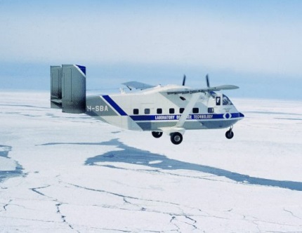
The European Space Agency conducted an airborne campaign to map sea surface salinity named "CoSMOS-OS" that took place in April 2006 over the Norway Sea off the coast of Stavenger.
The main objectives were:
- Improving the parameterizations of the dependencies between sea surface emissivity at L-band and surface roughness, and perform validation of currently used forward models in the SMOS Level 2 prototype processor,
- Estimating the contamination of measured brightness temperatures by rough sea surface scattering of solar and galactic radiation towards the radiometer, and,
- Clarifying possible physical causes for unexplained azimuthal oscillation of measured L-band brightness temperatures over the ocean (often referred to as "wiggles" in the SMOS community).
What was the outcome of CoSMOS 2006?
The following was successively conducted:
- An analysis of multi source-auxilliary data for Synergetic analysis of the CoSMOS campaign data and an in depth geophysical description of the campaign environment,
- the development of a complete aircraft L-band data Processor called TRAP and mimiking the L2PP built up. The TRAP code can be used for future (or past) aircraft data (re-)analysis.
- the development of data post-calibration methodologies. These developments are model free and only concept-based methods, using first and second Stokes parameters properties.
- An analysis to combine the data and form a validation dataset, that we used to study the data detail properties as function of incidence angle and wind speed.
- An analysis to provide the specific validation of the Level-2 roughness correction models with the validation CoSMOS dataset
- An analysis to provide the specific validation of the Level-1 and 2 sunglint correction models,
- developments to study the galactic glints phenomena and the validity of the Level-2 correction models,
- an analysis of the overall azimuthal signatures and particularly wind direction dependencies, and, finally
- developments of processing to attempt SSS retrievals across the Norvegian Coastal Current front.
The results obtained emphasize the strong interest of having both a Nadir and aft-looking antenna. Indeed, one of the major result of this campaign was to provide to the community a complete and to our opinion, good quality, data set for validation of the Level 2 PP forward models, prior the launch. The CoSMOS data set is to our knowledge unique for ocean brightness temperature measurements at L-band.
Download the CoSMOS 2006 Final Report
| Data Coverage (Year) | 2006 |
| Geographic Site | North Sea (Norway) |
| Field of Application | Sea Surface Salinity with L-band radiometer, Sea Surface Roughness with GNSS reflection |
| Data Size | 7.4 |
Digital Object Identifier: https://doi.org/10.5270/esa-xe06wq9 - CoSMOS 2006: "Scientific Data Analysis Report."
Data
The campaign data is available online via FTPS upon submission of a data access request. An active EO Sign In account is required to submit the request.
The data can be downloaded via an FTP client (e.g., FileZilla or WinSCP) using the option "Implicit FTP over TLS".
For further information about the EO Sign In Service you can visit TellUs.
Should you need support please contact EOHelp.